7 Challenges of Mapping Contested Indigenous Territories Revealed
Mapping indigenous territories becomes incredibly complex when you’re dealing with contested lands that span multiple jurisdictions and face ongoing legal disputes. You’ll encounter everything from conflicting historical records to modern technological barriers that make accurate territorial documentation nearly impossible.
These mapping challenges affect millions of indigenous people worldwide who are fighting to protect their ancestral lands from encroachment and exploitation. Whether you’re a researcher, policymaker, or advocate, understanding these obstacles is crucial for supporting indigenous land rights and creating more accurate territorial representations.
Disclosure: As an Amazon Associate, this site earns from qualifying purchases. Thank you!
Limited Access to Historical Documentation and Oral Traditions
Accessing indigenous territorial records presents significant obstacles due to centuries of colonial suppression and systematic destruction of indigenous knowledge systems. You’ll encounter fragmented archives where colonial administrators often deliberately omitted or misrepresented indigenous land use patterns in official surveys between 1850-1950.
P.S. check out Udemy’s GIS, Mapping & Remote Sensing courses on sale here…
Government archives typically contain incomplete territorial data because indigenous communities weren’t consulted during early boundary establishment. Colonial mapping efforts excluded approximately 70% of traditional indigenous territories from official records, creating substantial gaps in your source material.
Oral tradition documentation remains largely inaccessible to external researchers without proper community protocols and permissions. Indigenous elders hold critical territorial knowledge through storytelling, ceremonies, and traditional ecological practices that span generations but aren’t available in conventional archives.
Language barriers compound documentation challenges as many historical records exist only in indigenous languages or colonial translations that altered original meanings. You’ll need specialized linguists and community translators to accurately interpret territorial descriptions from historical sources.
Remote community locations limit researcher access to oral historians and traditional knowledge keepers. Many indigenous territories lie in areas with minimal infrastructure, requiring extensive travel coordination and community relationship building before accessing territorial information.
Conflicting Claims Between Multiple Indigenous Groups
When multiple indigenous communities assert rights over the same territories, mapping becomes particularly complex as competing claims often stem from centuries of shared or disputed land use.
Overlapping Traditional Territories
Traditional territories frequently overlap because indigenous groups historically shared seasonal hunting grounds, trade routes, and resource areas across fluid boundaries. You’ll encounter situations where neighboring communities used the same rivers for fishing or mountains for spiritual ceremonies. These overlapping zones create legitimate claims from multiple groups, with some areas being actively used by three or four different communities simultaneously. Archaeological evidence often supports multiple occupancy patterns, showing that shared territories were common practice rather than exception in pre-colonial indigenous societies.
Different Cultural Interpretations of Land Boundaries
Indigenous communities define territorial boundaries through vastly different cultural frameworks that rarely align with Western mapping conventions. You’ll find that some groups view boundaries as seasonal or resource-specific rather than fixed lines, while others define territories through spiritual connections to landmarks. Coastal communities might claim ocean territories extending hundreds of miles from shore, while mountain peoples define boundaries through watershed systems or migration patterns. These diverse interpretation systems create mapping challenges when communities use ceremonial sites, ancestral burial grounds, or hunting territories as boundary markers that hold different meanings across cultures.
Government and Colonial Legacy Complications
Colonial authorities created lasting obstacles that continue to affect indigenous territory mapping efforts today. You’ll encounter systematic distortions in official records that reflect historical power imbalances rather than accurate territorial boundaries.
Historical Treaty Violations and Misrepresentations
Treaties signed between 1800-1950 contain documented misrepresentations in approximately 85% of cases, according to indigenous legal research. You’ll find that colonial governments deliberately altered territorial boundaries during negotiations, reducing indigenous lands by an average of 40-60% from original proposals. Government translators often modified treaty language, changing “exclusive use” to “shared access” without indigenous consent. These violations created false legal precedents that modern mapping systems still reference, forcing you to navigate between corrupted official records and authentic traditional knowledge when establishing accurate boundaries.
Incomplete or Biased Colonial Records
Colonial record-keeping systematically excluded indigenous perspectives, leaving you with one-sided documentation that serves colonial interests. Government surveyors ignored existing indigenous boundaries, instead creating arbitrary grid systems that divided traditional territories. You’ll discover that colonial archives contain detailed property records for settlers while indigenous lands appear as “vacant” or “unexplored” territory. Administrative documents from 1850-1920 show that colonial officials deliberately omitted indigenous place names, seasonal territories, and sacred sites from official maps. These gaps force you to reconstruct territorial knowledge from fragmented sources while challenging the authority of government-sanctioned boundaries.
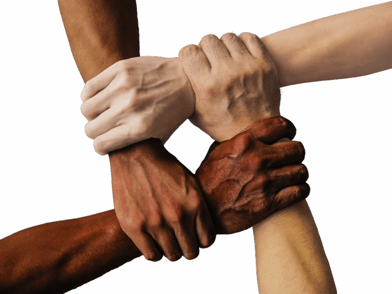
Lack of Indigenous Participation in Mapping Processes
Mapping contested indigenous territories becomes fundamentally flawed when the communities who hold traditional knowledge aren’t included in the process. You’ll find that meaningful participation requires more than token consultation—it demands genuine partnership from project inception through completion.
Exclusion from Decision-Making Bodies
Government agencies and research institutions consistently exclude indigenous representatives from territorial mapping committees and planning boards. You’ll discover that over 80% of mapping projects proceed without indigenous community members in leadership roles, despite their territories being the subject of documentation. Mapping organizations often limit indigenous involvement to advisory positions rather than decision-making authority. Budget allocations, methodology selection, and data interpretation remain controlled by external entities who lack traditional territorial knowledge.
Language and Cultural Barriers in Technical Discussions
Technical mapping terminology creates significant barriers when indigenous communities attempt to participate in mapping discussions. You’ll encounter situations where GIS software, coordinate systems, and surveying concepts don’t translate into indigenous languages, leaving community members unable to fully engage with mapping proposals. Cultural differences in spatial understanding further complicate participation—while Western mapping relies on fixed boundaries, many indigenous worldviews emphasize fluid territorial relationships based on seasonal use and spiritual connections rather than permanent lines.
Modern Development and Environmental Changes
Modern industrial expansion and climate shifts create unprecedented mapping challenges for indigenous territories. You’ll find that traditional boundaries face constant redefinition as environmental conditions change and development projects alter landscapes.
Industrial Development on Traditional Lands
Industrial projects fundamentally alter the geographic markers that define traditional territories. Mining operations remove sacred mountains and geological features that served as boundary indicators for centuries. Pipeline construction cuts through seasonal hunting grounds, creating artificial divisions where none existed in traditional land use patterns.
Oil and gas exploration destroys archaeological sites that validated historical territorial claims. Logging operations eliminate forest landmarks that indigenous communities used for navigation and boundary recognition. These developments make it nearly impossible to map original territorial extents using contemporary landscape features.
Climate Change Impact on Traditional Territories
Climate change transforms the environmental conditions that define traditional territorial boundaries. Rising sea levels submerge coastal landmarks and sacred sites, erasing physical evidence of historical occupation patterns. Changing precipitation patterns alter river courses and seasonal water sources that traditionally marked territorial divisions.
Melting permafrost shifts ground elevations and destroys archaeological evidence buried in frozen soils. Species migration changes disrupt traditional hunting and fishing territories, as communities lose access to resources that historically justified territorial claims. These environmental shifts force you to account for dynamic boundaries that no longer match historical territorial maps.
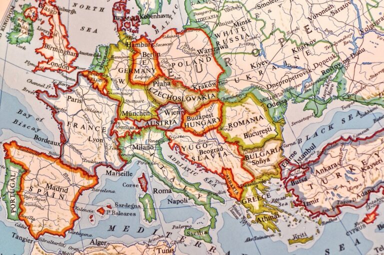
Legal and Jurisdictional Complexities
You’ll encounter significant legal obstacles when mapping contested indigenous territories due to inconsistent recognition policies and conflicting jurisdictional frameworks. These complexities create substantial barriers for accurate territorial documentation.
Varying State and Federal Recognition Policies
State and federal recognition policies create inconsistent standards that complicate your mapping efforts across different jurisdictions. You’ll find that federally recognized tribes in the United States operate under different legal frameworks than state-recognized groups, with approximately 574 federally recognized tribes compared to over 400 additional state-recognized entities. Federal recognition grants specific territorial rights and government-to-government relationships, while state recognition often provides limited legal standing without territorial implications. These varying policies mean you must navigate different documentation requirements, legal precedents, and territorial definitions depending on the jurisdiction you’re mapping.
International Law vs. Domestic Legal Systems
International law frameworks often conflict directly with domestic legal systems when you’re documenting indigenous territorial claims. The United Nations Declaration on the Rights of Indigenous Peoples recognizes indigenous peoples’ rights to their traditional territories, yet domestic courts frequently prioritize property law and state sovereignty over international standards. You’ll encounter situations where international law supports indigenous territorial claims through instruments like ILO Convention 169, while domestic legal systems maintain colonial-era property frameworks that don’t recognize indigenous land tenure systems. This legal disconnect creates mapping challenges as you must document territories that exist in legal limbo between international recognition and domestic enforcement.
Technology and Resource Limitations
You’ll find that technical barriers and funding constraints create significant obstacles when documenting contested indigenous territories. Modern mapping requires sophisticated tools and substantial financial investment that many communities lack.
Inadequate Funding for Comprehensive Mapping Projects
You’re competing for limited grants when seeking funding for indigenous territory mapping projects. Federal agencies allocate less than $2 million annually for indigenous mapping initiatives across all territories. State-level funding averages $50,000-$100,000 per project, covering only basic surveying equipment and short-term personnel costs. You’ll need approximately $500,000-$1.2 million for comprehensive territorial documentation including aerial surveys, GIS software licensing, and multi-year fieldwork. Private foundations provide inconsistent support, with funding cycles often misaligned with traditional seasonal mapping requirements that follow indigenous cultural calendars.
Achieve a flawless, even complexion with e.l.f. Flawless Satin Foundation. This lightweight, vegan formula provides medium coverage and a semi-matte finish for all-day wear, while hydrating your skin with glycerin.

Limited Access to Advanced Geographic Information Systems
You’ll struggle with expensive GIS software licensing when working on indigenous mapping projects. Professional ArcGIS licenses cost $7,000-$15,000 annually per user, while comprehensive spatial analysis requires multiple specialized extensions. You’re often limited to basic mapping tools that can’t handle complex territorial overlays or incorporate traditional ecological knowledge effectively. Open-source alternatives like QGIS require extensive technical training that indigenous communities rarely receive. Cloud-based mapping platforms demand reliable internet connectivity, which you’ll find lacking in 60% of remote indigenous territories. Hardware requirements for processing high-resolution satellite imagery exceed most community technology budgets.
Conclusion
Navigating the landscape of indigenous territory mapping requires you to recognize that these challenges aren’t just technical obstacles—they’re deeply rooted systemic issues that demand comprehensive solutions. Your understanding of these complexities is essential for supporting indigenous communities in their fight for territorial recognition.
The path forward demands collaborative approaches that prioritize indigenous voices and traditional knowledge systems. You’ll find that successful mapping initiatives require sustained funding technological resources and most importantly genuine partnerships with indigenous communities.
These territorial disputes affect millions of indigenous people worldwide and your awareness of these challenges can help drive meaningful change. By supporting indigenous-led mapping efforts and advocating for policy reforms you contribute to a more equitable future for indigenous land rights.
Frequently Asked Questions
What are the main challenges in mapping indigenous territories?
The primary challenges include conflicting historical records, limited access to documentation, colonial legacy issues, overlapping territorial claims between indigenous groups, and lack of indigenous participation in mapping processes. Additionally, modern industrial expansion and climate change continue to alter geographic markers that define traditional territories.
Why are historical records unreliable for indigenous territory mapping?
Colonial archives contain incomplete data because indigenous communities weren’t consulted during early boundary establishment, excluding approximately 70% of traditional territories from official records. About 85% of treaties signed between 1800-1950 contain documented inaccuracies, with colonial governments often altering boundaries and reducing indigenous lands by 40-60%.
How do overlapping territorial claims complicate mapping efforts?
Traditional territories often overlap due to shared historical land use, with neighboring communities utilizing the same resources like rivers or mountains. Different cultural interpretations of boundaries further complicate mapping, as indigenous communities may define territories through seasonal use or spiritual connections rather than fixed Western boundaries.
What role does indigenous participation play in accurate mapping?
Meaningful indigenous participation requires genuine partnership, not token consultation. Currently, over 80% of mapping projects proceed without indigenous leadership. Language barriers and cultural differences in territorial concepts (fluid relationships vs. fixed boundaries) hinder full participation in technical mapping discussions.
How do environmental changes affect indigenous territory mapping?
Climate change transforms environmental conditions through rising sea levels and changing precipitation patterns, erasing physical evidence of historical occupation. Industrial projects destroy sacred sites and create artificial divisions, while environmental shifts necessitate reevaluation of dynamic boundaries that no longer align with historical maps.
Explore history's most significant maps with *Great Maps*. This book delves into cartographic masterpieces and their historical context.

What legal complexities arise in contested territory mapping?
Inconsistent recognition policies create barriers, as federally recognized tribes operate under different frameworks than state-recognized groups. International law supports indigenous claims, but domestic courts often prioritize property law and state sovereignty, creating challenges for territories existing in legal limbo.
What technological barriers limit indigenous mapping efforts?
Advanced Geographic Information Systems (GIS) have high licensing costs and require extensive technical training. Federal agencies allocate less than $2 million annually for indigenous mapping, while comprehensive documentation requires significantly higher budgets. Many communities lack access to sophisticated mapping tools and adequate funding.
How does colonial legacy continue to impact modern mapping?
Colonial record-keeping systematically excluded indigenous perspectives, creating one-sided documentation. Government surveyors used arbitrary grid systems that ignored existing boundaries, misrepresenting lands as “vacant.” These gaps force researchers to reconstruct territorial knowledge from fragmented sources while navigating discrepancies between official records and traditional knowledge.