5 Best Geospatial Analysis Techniques for Artistic Maps
The big picture: Traditional cartography meets cutting-edge data science as creative professionals discover powerful new ways to transform geographic information into stunning visual narratives.
Why it matters: You’re no longer limited to basic pin-and-dot maps when geospatial analysis tools can reveal hidden patterns in everything from population flows to environmental changes. These techniques turn raw location data into compelling artistic statements that inform and inspire audiences.
What’s ahead: Five practical geospatial analysis approaches will elevate your cartographic projects from simple reference tools to memorable visual experiences that tell deeper stories about place and space.
Disclosure: As an Amazon Associate, this site earns from qualifying purchases. Thank you!
P.S. check out Udemy’s GIS, Mapping & Remote Sensing courses on sale here…
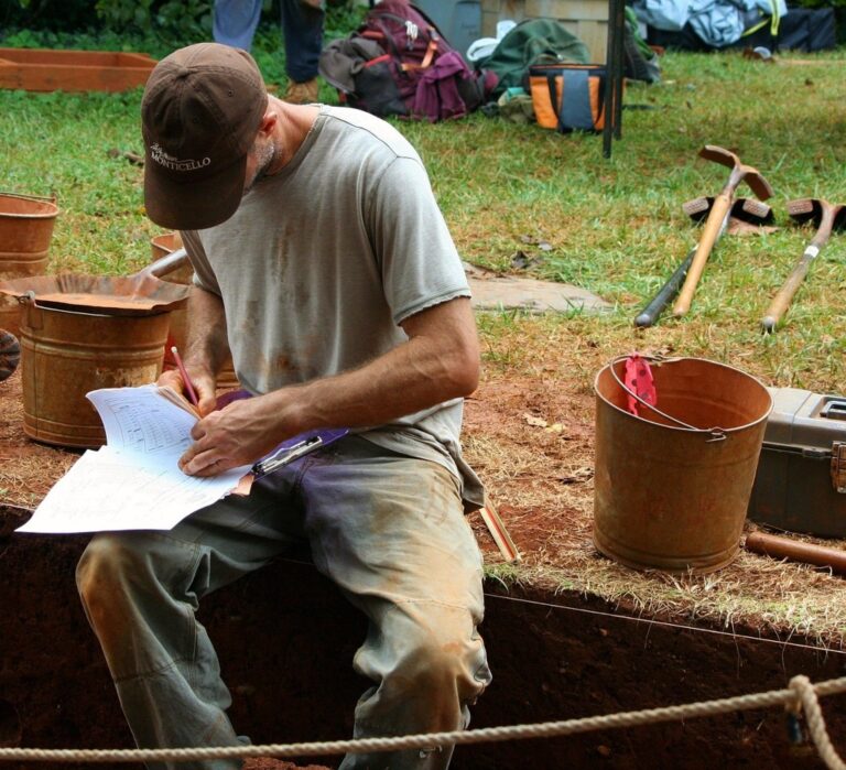
Elevation Modeling for Sculptural Terrain Visualization
Elevation data transforms flat geographic information into three-dimensional artistic expressions that reveal landscape character. You’ll discover how digital elevation models create compelling visual narratives that capture terrain’s sculptural qualities.
Creating 3D Relief Maps Using Digital Elevation Models
Explore the United States with this 3D raised relief map. Feel the terrain and understand topography through its tactile, vacuum-formed design.

Generate relief maps by processing USGS 30-meter DEM data through QGIS or ArcGIS Pro’s 3D Analyst tools. You’ll extract elevation values and convert them into mesh surfaces that highlight ridges, valleys, and peaks with dramatic visual impact.
Configure vertical exaggeration between 2x to 5x to enhance subtle topographic features without distorting geographic accuracy. This technique makes rolling hills appear more pronounced while maintaining spatial relationships essential for artistic interpretation.
Incorporating Contour Lines as Artistic Elements
Style contour intervals at 10-meter increments for detailed terrain representation, using varying line weights to create visual hierarchy. You’ll emphasize major elevation breaks with bold strokes while rendering intermediate contours as delicate background elements.
Apply organic line treatments by smoothing contour vertices and adjusting stroke patterns to mimic hand-drawn cartographic traditions. This approach transforms technical elevation data into flowing artistic compositions that maintain topographic accuracy.
Combining Hillshade Techniques With Creative Color Palettes
Calculate hillshade layers using 315-degree azimuth and 45-degree altitude settings to simulate natural northwest lighting conditions. You’ll blend multiple hillshade variants with different sun angles to eliminate harsh shadows and create balanced illumination.
Layer hypsometric tinting with custom color ramps that reflect landscape character—earth tones for arid regions or cool blues for alpine environments. This combination creates depth perception while supporting your map’s artistic narrative through strategic color psychology.
Population Density Mapping Through Abstract Data Visualization
Population density visualization moves beyond traditional choropleth maps when you apply artistic data transformation techniques to census information.
Transforming Census Data Into Flowing Organic Forms
You’ll create compelling narratives by converting raw population counts into organic flow patterns using kernel density estimation in QGIS or ArcGIS Pro. Transform block-level census data into smooth contours that mimic natural formations like river deltas or cloud patterns. Apply Gaussian smoothing algorithms with 500-meter bandwidths to generate fluid boundaries between high and low density areas. These organic forms reveal population gradients as living landscapes rather than rigid administrative boundaries.
Using Dot Density Methods for Pointillistic Effects
Dot density mapping transforms demographic data into impressionistic artwork by representing each person or household as individual points across geographic space. You’ll generate thousands of randomly placed dots within census boundaries using ArcGIS’s dot density symbology or QGIS’s random points algorithm. Vary dot sizes between 0.5-2 points to create visual texture while maintaining statistical accuracy. This pointillistic approach reveals clustering patterns that traditional choropleths miss while creating gallery-worthy population portraits.
Creating Heat Maps With Artistic Color Gradients
Heat mapping techniques produce stunning population visualizations when you replace standard red-yellow color schemes with custom artistic palettes. Design gradient transitions using complementary colors like deep purple to bright cyan or forest green to golden yellow through ColorBrewer or Adobe Color tools. Apply Gaussian blur filters with 1-kilometer radii to create smooth color transitions that emphasize population concentrations. These artistic heat maps transform sterile demographic data into emotionally resonant visual experiences.
Network Analysis for Creating Flowing Connection Art
Network analysis transforms infrastructure data into dynamic visual narratives that reveal hidden connectivity patterns across geographic spaces. You’ll discover how transportation systems, social connections, and natural networks become compelling artistic elements when viewed through geospatial analysis.
Visualizing Transportation Networks as Artistic Pathways
Transform your transportation data into flowing artistic pathways using network centrality analysis tools like NetworkX or ArcGIS Network Analyst. Analyze betweenness centrality to identify key transit corridors and apply gradient line weights that create organic flow patterns. Export your processed network data as SVG files for post-processing in design software, where you can apply artistic treatments like brush strokes or watercolor effects while maintaining geographic accuracy and proportional relationships.
Create vibrant watercolor art with this portable set. It includes 40 colors (metallic & fluorescent), a brush pen, watercolor paper, and more, all in a stylish tin box.

Mapping Social Media Connections Through Geographic Space
Create compelling connection art by analyzing geotagged social media data through spatial network analysis in R or Python. Extract location-based interaction patterns from platforms like Twitter or Instagram using their APIs, then apply force-directed layout algorithms to visualize relationship strengths. Use tools like Gephi to generate network layouts that you can overlay onto geographic base maps, creating abstract representations of digital communities anchored to real-world locations.
Designing River and Road Networks as Abstract Line Art
Convert hydrographic and transportation networks into abstract line art using graph theory principles in QGIS or PostGIS. Apply Strahler stream ordering to river networks and road hierarchy classifications to create variable line weights that emphasize network importance. Use geometric network analysis to identify confluence points and intersections, then apply artistic smoothing algorithms like Bezier curves to transform angular vector data into flowing, organic pathways that maintain topological relationships.
Temporal Geographic Analysis for Dynamic Storytelling Maps
Temporal analysis transforms static cartographic projects into compelling narratives that reveal how places evolve over time. You’ll discover how chronological data patterns create powerful visual stories that engage viewers through dynamic geographic storytelling.
Tracking Historical Changes Through Animated Cartography
Historical mapping projects benefit from time-series analysis that reveals transformation patterns across decades or centuries. You can process historical census data through QGIS TimeManager or ArcGIS Pro’s temporal visualization tools to create smooth transitions between time periods. Archive digitization workflows help convert historical maps into georeferenced datasets, while interpolation techniques fill temporal gaps between documented periods. Consider using OpenStreetMap’s historical data extraction tools combined with custom Python scripts to generate compelling animated sequences that showcase urban expansion, demographic shifts, or environmental changes with artistic timing controls.
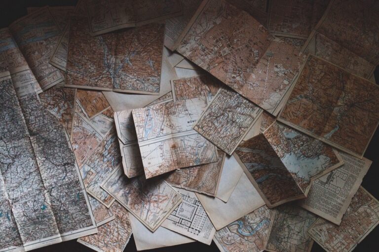
Explore history's most significant maps with *Great Maps*. This book delves into cartographic masterpieces and their historical context.

Creating Time-Lapse Visualizations of Urban Development
Urban development tracking requires satellite imagery analysis combined with change detection algorithms to identify growth patterns. You’ll achieve optimal results using Landsat or Sentinel-2 time series data processed through Google Earth Engine or ENVI software for automated classification workflows. Building footprint extraction from historical aerial photography creates vector datasets suitable for artistic treatment in Adobe After Effects or Blender’s geographic visualization tools. Apply artistic rendering techniques like particle systems or organic growth animations to transform raw development data into visually engaging narratives that highlight sprawl patterns, infrastructure expansion, or neighborhood transformation cycles.
Mapping Seasonal Changes With Artistic Seasonal Palettes
Seasonal mapping projects utilize phenology data and climate records to create cyclical visualizations that capture natural rhythm patterns. You can process MODIS vegetation indices or temperature datasets through R’s temporal analysis packages to identify seasonal transition points with statistical precision. Color palette automation using tools like ColorBrewer or custom Python libraries ensures consistent artistic treatment across temporal sequences. Consider incorporating artistic techniques like watercolor effects or impressionistic rendering styles that complement natural seasonal transitions, while maintaining data accuracy through careful temporal interpolation and quality control procedures for authentic seasonal storytelling.
Buffer Zone Analysis for Creating Artistic Proximity Patterns
Buffer zone analysis transforms traditional spatial relationships into compelling visual narratives that reveal hidden patterns around geographic features. You’ll discover how proximity calculations can generate organic artistic elements that enhance your cartographic storytelling.
Designing Concentric Circles Around Points of Interest
Create dynamic visual hierarchies by generating multiple buffer distances around cultural landmarks, transit hubs, or natural features. Use ArcGIS Pro’s Multiple Ring Buffer tool to establish 500m, 1km, and 2km zones around museums or parks. Apply gradient transparency levels from 80% at the center to 20% at outer rings, creating depth perception. Vary circle stroke weights from 3pt to 1pt as distance increases, emphasizing proximity relationships through visual weight.
Using Voronoi Diagrams for Geometric Art Patterns
Transform point datasets into tessellated artwork using Voronoi polygon generation tools in QGIS or PostGIS. Input coffee shops, schools, or historic sites to create natural territorial boundaries that reveal service areas and influence zones. Apply artistic color palettes based on attribute data—population density, elevation, or land use categories. Use organic edge treatments and subtle drop shadows to soften geometric boundaries, creating mosaic-like visualizations that maintain analytical accuracy while achieving aesthetic appeal.
Creating Organic Boundary Visualizations Through Buffer Zones
Generate flowing territorial boundaries by applying variable buffer distances based on attribute values like population density or elevation changes. Use the Buffer Geoprocessing tool with field-based distance calculations to create organic shapes around rivers, coastlines, or urban areas. Apply Gaussian blur effects and gradient fills to simulate natural phenomena like watershed influence or urban heat islands. Combine multiple buffer layers with blend modes to create complex overlay patterns that reveal spatial relationships.
Conclusion
These five geospatial analysis techniques offer powerful pathways for transforming raw geographic data into compelling artistic narratives. You’ll discover that elevation modeling sculpts landscapes into dimensional masterpieces while population density analysis reveals hidden demographic stories through organic visualizations.
Network analysis breathes life into connectivity patterns and temporal analysis captures the poetry of change over time. Buffer zone techniques create visual hierarchies that expose spatial relationships in entirely new ways.
Your cartographic projects will evolve from simple reference tools into emotionally resonant artworks that engage viewers on multiple levels. The key lies in experimenting with these methods and finding unique combinations that serve your creative vision while maintaining geographic integrity.
Start with one technique that resonates with your current project and gradually incorporate others as you build confidence with geospatial tools.
Frequently Asked Questions
What is the main focus of combining traditional cartography with modern data science?
The main focus is to transform basic geographic maps into visually engaging narratives that reveal hidden patterns in data. Creative professionals use advanced geospatial analysis tools to uncover deeper stories about locations, population changes, and environmental data, moving beyond simple mapping to create impactful visual experiences.
How does elevation modeling enhance terrain visualization?
Elevation modeling uses digital elevation models (DEM) from sources like USGS to create three-dimensional landscape representations. Through tools like QGIS or ArcGIS Pro, mapmakers apply vertical exaggeration techniques and incorporate artistic contour lines with varying weights to enhance topographic features while maintaining geographic accuracy.
What are the innovative methods for population density mapping discussed?
The article covers kernel density estimation to create organic flow patterns, dot density mapping for impressionistic artwork, and heat maps with custom color gradients. These techniques transform raw census data into emotionally resonant visual experiences that reveal clustering patterns traditional choropleth maps might miss.
How does network analysis create dynamic visual narratives in cartography?
Network analysis transforms transportation systems, social connections, and natural networks into artistic elements. It uses centrality analysis tools to visualize pathways with gradient line weights, maps social media connections through geotagged data, and converts river/road networks into abstract line art using graph theory principles.
What is temporal geographic analysis and how does it enhance mapping projects?
Temporal geographic analysis transforms static maps into dynamic storytelling tools that show how places evolve over time. It uses time-series analysis for historical mapping, tracks urban development through satellite imagery, and creates seasonal visualizations using phenology data and climate records.
How does buffer zone analysis reveal spatial relationships in cartography?
Buffer zone analysis creates visual hierarchies through concentric circles around points of interest, uses Voronoi diagrams for tessellated artwork, and generates flowing territorial boundaries with variable distances. These techniques reveal complex spatial relationships through artistic overlays and gradient effects that simulate natural phenomena.