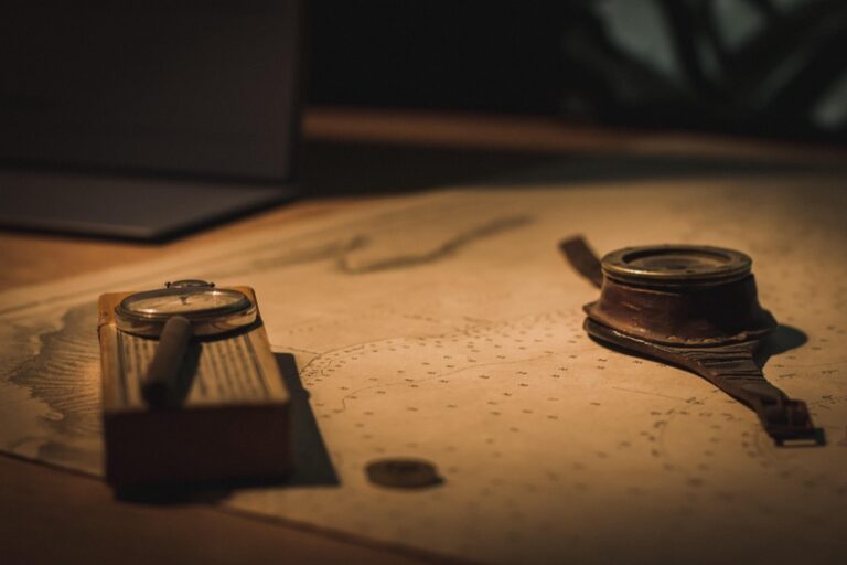
7 Methods for Historical Map Interpretation That Reveal Hidden Stories
Why it matters: Historical maps unlock secrets about past civilizations and reveal how societies viewed their world centuries ago.
The big picture: You’ll discover seven proven methods that historians and researchers use to decode these cartographic treasures â from analyzing symbols and scale to understanding the political context behind each map’s creation.
What’s next: These interpretation techniques will transform how you read historical maps and help you uncover hidden stories about trade routes, territorial disputes, and cultural exchanges that shaped our modern world.
Disclosure: As an Amazon Associate, this site earns from qualifying purchases. Thank you!
P.S. check out Udemy’s GIS, Mapping & Remote Sensing courses on sale here…
Understanding Map Symbols and Legends From Different Time Periods
Cartographic symbols evolved dramatically across centuries, reflecting the technological capabilities and cultural priorities of their creators. You’ll need to develop familiarity with these changing conventions to accurately interpret historical maps.
Decoding Cartographic Conventions of the Era
Renaissance maps (15th-16th centuries) typically feature ornate compass roses, sea monsters indicating unexplored waters, and religious symbols marking Christian territories. Medieval cartography employs T-O maps with Jerusalem at center, while 18th-century military maps introduce standardized topographic symbols like hachures for elevation. Victorian-era surveys establish precise measurement standards you’ll recognize in modern mapping. Each period’s conventions reflect contemporary knowledge limitations and cultural worldviews that shaped geographic representation.
Identifying Period-Specific Iconography and Markings
Colonial maps display crown symbols marking territorial claims, trade route indicators, and indigenous settlement markers often depicted as simple circles. 19th-century railroad maps feature locomotive symbols, telegraph lines as dotted patterns, and station house icons. Maritime charts from different eras show lighthouse symbols evolving from simple towers to detailed beacon representations. Boundary surveys use specific surveyor marks, metes and bounds descriptions, and township grid systems that vary by colonial origin and surveying methodology.
Analyzing Scale and Projection Techniques Used by Historical Cartographers
Understanding the mathematical foundations of historical maps reveals crucial insights about their accuracy and intended use. Scale and projection choices directly influenced how cartographers represented distances, areas, and geographic relationships.
Measuring Distances and Proportional Relationships
Determine the map’s stated scale by locating scale bars, verbal descriptions, or representative fractions printed on the original document. Historical maps often include multiple scales – graphical bars for different measurement units like miles, leagues, or local distance measurements. Calculate actual distances by measuring features with dividers or rulers, then comparing these measurements against the scale indicators. Verify proportional accuracy by checking known geographic relationships between cities, coastlines, or mountain ranges. Many pre-1800 maps show significant scale variations across different regions due to compilation from multiple sources with varying accuracy levels.
Recognizing Distortions in Early Projection Methods
Identify projection types by examining how meridians and parallels intersect – parallel lines indicate cylindrical projections, while converging meridians suggest conic or azimuthal methods. Assess shape distortions by comparing coastline curvatures and landmass proportions to modern references, noting that Mercator projections exaggerate polar regions while preserving local angles. Evaluate area relationships between continents, islands, and seas to detect projection-induced size distortions common in historical world maps. Recognize regional projection preferences – Mediterranean maps often used conic projections, while oceanic charts favored cylindrical methods for navigation purposes.
Get durable, tear-resistant posters made in the USA. Each 18" x 29" poster features high-quality 3 MIL lamination for lasting protection.

Examining the Political and Social Context Behind Map Creation
Understanding who commissioned a map and why they needed it reveals crucial insights about historical power structures and societal priorities.
Identifying the Map’s Intended Audience and Purpose
Determine the map’s primary audience by examining its visual complexity and informational depth. Military maps feature detailed terrain elevation and strategic positions for commanders, while merchant maps emphasize trade routes and port facilities for commercial navigation. Religious maps highlight pilgrimage sites and sacred locations for spiritual travelers. Educational maps simplify geographic features with clear labels for academic instruction. You’ll find that maps created for different audiences contain vastly different information priorities and levels of technical detail.
Understanding Colonial and Imperial Influences on Cartography
Recognize how colonial powers shaped cartographic representation through territorial claims and resource documentation. European colonial maps often exaggerated the size of controlled territories while minimizing indigenous settlements and traditional boundaries. Imperial cartographers emphasized mineral deposits, agricultural potential, and strategic military positions to support expansion efforts. You’ll notice that colonial maps frequently rename geographic features using European languages and ignore existing native nomenclature, reflecting the political dominance and cultural erasure inherent in imperial mapping projects.
Cross-Referencing Historical Maps With Contemporary Sources
Cross-referencing validates your historical map interpretations by comparing cartographic evidence with multiple source types from the same era. This method reveals discrepancies and confirms accurate geographic representations.
Comparing Multiple Maps From the Same Time Period
Examine cartographic variations by studying 3-4 maps created within a 5-10 year timeframe of your primary source. Look for consistent geographic features like rivers, mountains, and settlements that appear across different cartographers’ work. Note discrepancies in territorial boundaries, place names, or topographic details that might indicate political changes, surveying errors, or different information sources. Compare maps produced by different nations or organizations to identify bias in territorial claims or resource documentation. Document shared elements that appear in 75% or more of contemporary maps to establish geographic consensus.
Validating Information Through Historical Documents and Records
Cross-check map details against written records like government surveys, military reports, trade documents, and travelers’ accounts from the same period. Verify place names, territorial boundaries, and population centers using census data, land grants, and administrative records. Compare mapped trade routes with shipping manifests, merchant records, and customs documents to confirm commercial pathways. Use diplomatic correspondence and treaties to validate territorial claims shown on political maps. Archaeological evidence and historical descriptions of settlements help confirm the accuracy of urban representations and population distributions depicted by cartographers.
Studying Topographical Features and Geographic Accuracy
Topographical analysis reveals how accurately historical cartographers represented the physical landscape and natural boundaries. You’ll uncover significant insights about surveying capabilities and geographic knowledge of different eras.
Assessing Landscape Representation and Natural Boundaries
Mountain ranges appear as stylized illustrations in medieval maps but show increasing detail through Renaissance and modern periods. You’ll notice how elevation representations evolved from decorative hills to contour-based systems in 18th-century military surveys.
River systems provide excellent accuracy benchmarks since waterways remain relatively stable over centuries. Compare historical river courses with modern satellite imagery to identify meanders, tributaries, and seasonal variations that cartographers documented or overlooked.
Coastal boundaries reveal surveying precision through detailed shoreline features, harbor depths, and tidal information that maritime charts required for safe navigation.
Evaluating Surveying Methods and Measurement Precision
Triangulation networks became standard in 18th-century European surveys, creating geometric frameworks you can verify through mathematical analysis. Look for survey markers, baseline measurements, and angular calculations that indicate systematic mapping approaches.
Compass bearings show magnetic declination adjustments that cartographers applied to correct for regional variations. You’ll find these corrections documented in map legends or surveyor notes from the colonial period.
Distance measurements reflect the tools available – chain measurements for land surveys, dead reckoning for maritime charts, and astronomical observations for longitude calculations that improved dramatically after Harrison’s chronometer innovations.
Investigating Cultural Bias and Cartographic Propaganda
Historical maps often served as tools of political persuasion rather than neutral geographic records. Understanding these biases reveals how cartographers shaped public perception and justified territorial claims.
Recognizing Selective Information Inclusion and Omission
Examine what mapmakers chose to highlight or exclude from their representations. Colonial maps frequently emphasized European settlements while omitting indigenous villages and sacred sites. Trade route maps exaggerated the importance of certain ports while minimizing competitor locations. Military maps included strategic fortifications but excluded civilian infrastructure that might aid enemies. Religious maps prominently featured Christian sites while downplaying Islamic or pagan locations. You’ll notice resource maps highlighting valuable minerals in claimed territories while ignoring similar deposits in disputed areas.
Understanding How Maps Reflected Power Dynamics
Analyze how cartographic choices reinforced existing authority structures and political relationships. Imperial maps positioned the mother country at the center while relegating colonies to peripheral positions. Boundary representations favored the commissioning power’s territorial claims through bold lines and prominent labeling. City maps reflected social hierarchies by depicting wealthy districts in greater detail than working-class neighborhoods. Administrative maps emphasized government buildings and official institutions while minimizing commercial or cultural centers. You’ll find that propaganda maps used visual techniques like enlarged territories and strategic color choices to project strength and legitimacy.
Utilizing Digital Tools and Technology for Enhanced Analysis
Modern digital tools revolutionize historical map interpretation by enabling sophisticated analysis techniques that weren’t possible with traditional methods. You’ll discover how geographic information systems and online archives unlock new layers of understanding in historical cartographic documents.
Employing GIS Software for Layered Interpretation
GIS platforms like ArcGIS Pro and QGIS transform historical map analysis by allowing you to overlay multiple map layers from different time periods. You can georeferenced historical maps against modern satellite imagery to identify landscape changes and measure territorial shifts with precision. These tools enable distance calculations between historical settlements and modern reference points. You’ll create temporal animations showing boundary changes over decades or centuries. Vector analysis tools help you trace trade routes and migration patterns across multiple historical maps simultaneously.
Accessing Online Archives and Digital Collections
Digital repositories like the Library of Congress Geography and Map Division provide instant access to thousands of high-resolution historical maps from your workspace. You can search the David Rumsey Map Collection’s 150,000+ maps using keywords, dates, and geographic regions for comparative analysis. The British Library’s digitized maps offer detailed colonial and imperial cartographic records with zoom capabilities revealing minute details. You’ll download maps in TIFF format for GIS integration while accessing metadata about cartographers, publication dates, and commissioning authorities for contextual interpretation.
Conclusion
Mastering these seven interpretation methods transforms how you’ll read historical maps and unlocks the rich stories they contain. You’ll discover that every cartographic choice – from symbol placement to projection selection – reveals deliberate decisions that reflect the mapmaker’s world.
Your analytical skills will sharpen as you combine traditional techniques with modern digital tools. This comprehensive approach allows you to validate findings across multiple sources and uncover patterns that might otherwise remain hidden.
Historical maps become powerful windows into past societies when you apply these systematic methods. You’ll gain deeper insights into how geography shaped human civilization and continue to influence our modern world through the lens of cartographic history.
Frequently Asked Questions
What are the most important elements to analyze when interpreting historical maps?
Focus on symbols, scale, and political context. Examine cartographic symbols and conventions specific to the time period, understand the mathematical foundations including scale and projection techniques, and consider who commissioned the map and why. These elements reveal the mapmaker’s worldview and the map’s intended purpose.
How do cartographic symbols differ across historical periods?
Cartographic symbols evolved significantly over time. Renaissance maps featured ornate compass roses, medieval maps used T-O designs centered on Jerusalem, 18th-century military maps introduced standardized topographic symbols, and Victorian-era surveys established precise measurement standards. Understanding these changes is crucial for accurate interpretation.
Why is understanding map projection important for historical analysis?
Map projections affect how distances and geographic relationships are represented. Early projection methods contained inherent distortions that influenced how viewers perceived the world. Recognizing different projection types helps identify these distortions and understand how they shaped historical perspectives on geography and territorial relationships.
How does political context influence historical map creation?
Maps often reflected the political agendas of their commissioners. Colonial powers shaped representations through territorial claims and resource documentation. Understanding who created a map and their motivations reveals insights into historical power structures, societal priorities, and how maps served as tools of political persuasion.
What role do modern digital tools play in analyzing historical maps?
Digital tools revolutionize historical map interpretation through GIS technology and online archives. These enable sophisticated analysis by overlaying multiple map layers, georeferencing historical maps against modern imagery, and creating temporal animations of boundary changes. Digital repositories provide instant access to high-resolution maps for enhanced comparative analysis.
How can cross-referencing help validate historical map interpretations?
Cross-referencing involves comparing multiple maps from the same period and validating details through historical documents. This method helps confirm geographic representations, identifies inconsistencies, and provides broader context. Contemporary sources like travel accounts and official records can verify or challenge the accuracy of mapped information.
What should I look for when studying topographical features on historical maps?
Examine how cartographers represented physical landscapes and evaluate their surveying methods and measurement precision. Look for advancements in triangulation networks and distance measurement tools. Understanding the technological capabilities of different eras helps assess the accuracy and reliability of topographical information presented on historical maps.