6 Best Map Experiences for Digital Storytelling
Maps aren’t just navigation tools anymore—they’re powerful storytelling platforms that can transport your audience into entirely new worlds. Whether you’re building a business application, educational resource, or entertainment experience, today’s mapping technologies offer unprecedented opportunities to create engaging, interactive environments that captivate users and keep them coming back.
The bottom line: Modern map experiences go far beyond simple point-to-point directions, incorporating everything from real-time data visualization to gamified exploration that transforms how people interact with geographic information.
Disclosure: As an Amazon Associate, this site earns from qualifying purchases. Thank you!
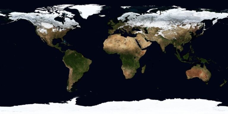
Create Interactive Storytelling Through Map Layers
Map layers transform static geographic data into compelling narratives that unfold as users explore your cartographic story.
P.S. check out Udemy’s GIS, Mapping & Remote Sensing courses on sale here…
Incorporate Historical Timeline Overlays
Timeline overlays reveal how landscapes evolved across decades or centuries through sequential data visualization. You’ll create temporal depth by stacking historical aerial imagery, property boundaries, or infrastructure development using tools like ArcGIS Online’s time-enabled layers. Configure slider controls that let users scrub through time periods, watching cities expand or coastlines shift. This technique works exceptionally well for urban planning presentations, environmental change documentation, and heritage site interpretation where chronological context enhances spatial understanding.
Add Character Journey Pathways
Character pathways guide users through predetermined routes that highlight specific locations with narrative significance. You’ll design these using GPS tracking data, historical travel records, or fictional story arcs plotted as polyline features with custom symbology. Tools like Mapbox Studio allow you to animate these pathways with directional arrows, color gradients, or pulsing effects that draw attention to movement patterns. Consider adding elevation profiles for hiking narratives or speed variations for transportation stories to create more engaging user experiences.
Track vehicles and assets with the LandAirSea 54 GPS Tracker. Get real-time location alerts and historical playback using the SilverCloud app, with a long-lasting battery and discreet magnetic mount.

Include Narrative Pop-Up Windows
Pop-up windows deliver contextual information precisely when users interact with specific map features or locations. You’ll configure these through attribute tables linked to point, line, or polygon data using HTML formatting for rich media integration. Include photographs, audio clips, video content, or detailed text descriptions that support your story’s themes. Modern web mapping platforms like Leaflet and OpenLayers support custom pop-up styling with CSS, allowing you to maintain visual consistency while presenting layered information that doesn’t overwhelm the base map design.
Design Multi-Sensory Map Elements
Creating truly immersive map experiences requires engaging multiple senses simultaneously. You’ll transform traditional visual-only mapping into rich environments that capture users’ attention through sound, sight, and touch.
Integrate Audio Soundscapes and Narration
Layer ambient soundscapes that match your map’s geographic context to create atmospheric depth. Forest areas benefit from bird calls and rustling leaves, while urban zones need traffic hums and pedestrian chatter. Record location-specific audio narration using professional voice talent to guide users through key waypoints. Synchronize audio triggers with map zoom levels and user interactions using JavaScript libraries like Howler.js or Web Audio API for seamless playback control.
Add Visual Effects and Animations
Implement animated data transitions using CSS transforms and SVG animations to show temporal changes in your mapped data. Create particle effects for weather patterns, population flows, or traffic movements using libraries like Three.js or P5.js. Design progressive disclosure animations that reveal map layers sequentially as users explore different zoom levels. Apply subtle hover effects and micro-interactions on clickable elements to provide immediate visual feedback and enhance user engagement.
Include Tactile Feedback Features
Enable haptic feedback on mobile devices using the Vibration API to provide physical responses when users interact with important map features. Design pressure-sensitive interactions for touch devices that respond differently based on touch intensity and duration. Create responsive touch gestures beyond standard pinch-and-zoom, including custom swipe patterns for layer switching and long-press actions for contextual menus. Implement tactile sound effects that simulate physical interactions like button clicks or page turns when users navigate between map sections.
Implement Real-Time Data Integration
Real-time data transforms static maps into dynamic visualization platforms that respond to current conditions. You’ll create more engaging experiences when your maps reflect live information streams.
Connect Live Weather and Environmental Data
Weather APIs provide immediate atmospheric conditions that enhance location-based storytelling. You can integrate OpenWeatherMap or National Weather Service feeds to display temperature overlays, precipitation patterns, and wind direction vectors directly on your map interface.
Environmental sensors offer air quality indices, UV radiation levels, and pollen counts that affect outdoor activities. These data streams help users make informed decisions about their geographic interactions while adding contextual depth to your mapping experience.
Measure temperature, humidity, pressure, and VOC gases with the BME680 environmental sensor. It supports I2C and SPI communication and is compatible with 3.3V/5V systems, including Raspberry Pi, Arduino, and ESP32.

Display Dynamic Population and Traffic Information
Traffic APIs from Google Maps Platform and HERE Technologies deliver real-time congestion data for route optimization features. You’ll enhance user engagement by showing current travel times, accident locations, and road closures that directly impact navigation decisions.
Population density feeds from cellular network data providers reveal crowd concentrations at events, transportation hubs, and commercial districts. This information creates compelling visualizations for urban planning applications and helps users avoid overcrowded areas during peak times.
Show Current Events and News Updates
News APIs aggregate location-tagged stories that provide immediate context for geographic areas. You can integrate feeds from Reuters, Associated Press, or social media platforms to display relevant headlines when users explore specific regions on your map.
Emergency alert systems offer critical safety information including natural disasters, public safety incidents, and infrastructure failures. These real-time notifications transform your map into a comprehensive situational awareness tool that keeps users informed about developing conditions in their area of interest.
Build Gamification Features Into Your Maps
Transform your mapping platform into an engaging interactive experience by incorporating game mechanics that motivate users to explore deeper and return frequently.
Create Quest-Based Exploration Challenges
Design location-specific missions that guide users through predetermined routes while revealing hidden geographic insights. You’ll structure these challenges with clear objectives like “Visit 5 historic landmarks within downtown” or “Discover 3 ecological zones in the park system.”
Set progressive difficulty levels that unlock advanced exploration areas once users complete basic quests. Include contextual clues and riddles that reference local geography, historical events, or cultural landmarks to educate while entertaining. Track completion rates through GPS verification points and offer bonus objectives for thorough exploration.
Add Achievement Badges and Progress Tracking
Implement digital badges that recognize specific mapping accomplishments like “First Explorer” for initial area discovery or “Data Collector” for contributing user-generated content. You’ll create categories spanning distance traveled, locations visited, and community contributions.
Display progress bars showing completion percentages for different exploration categories within your map interface. Include milestone celebrations at 25%, 50%, and 100% completion rates with special recognition features. Store achievement data in user profiles to maintain long-term engagement and encourage repeated platform usage.
Design Competitive Leaderboards
Establish ranking systems that compare user exploration metrics across daily, weekly, and monthly timeframes. You’ll track multiple performance indicators including total distance covered, unique locations discovered, and community interaction scores.
Create regional leaderboards that encourage local competition while maintaining global rankings for broader engagement. Include team-based challenges where groups collaborate to achieve collective mapping goals. Reset competitive periods regularly to give new participants opportunities to climb rankings and maintain active participation levels.
Utilize Augmented Reality Map Overlays
AR mapping transforms your geographic data into three-dimensional experiences that users can interact with through their mobile devices. Modern AR frameworks allow cartographers to overlay digital information directly onto real-world environments.
Develop AR Location-Based Information
Position contextual data points at specific GPS coordinates to create location-triggered content experiences. Implement geofencing APIs like ARCore or ARKit to detect when users approach designated areas and automatically display relevant information overlays. Configure distance-based visibility parameters to ensure data appears at optimal viewing ranges, typically within 10-50 meters of target locations. Include historical photographs, demographic statistics, or environmental measurements that activate when users point their devices at specific landmarks or geographic features.
Create Virtual Object Placement
Anchor digital assets to real-world surfaces using plane detection algorithms that identify horizontal and vertical surfaces in the camera feed. Utilize SLAM (Simultaneous Localization and Mapping) technology to maintain object persistence across user sessions, ensuring virtual elements remain in consistent positions. Deploy 3D models, interactive buttons, or information panels that users can manipulate through touch gestures. Scale virtual objects appropriately for different viewing distances and implement occlusion handling so digital elements appear naturally integrated with physical environments.
Enable Camera Integration for Enhanced Viewing
Integrate live camera feeds with real-time mapping data to create hybrid visualization experiences that combine physical and digital geographic information. Implement computer vision algorithms that recognize landmarks, street signs, or natural features to trigger contextual map overlays. Configure automatic focus and exposure adjustments to maintain clear visibility of both real-world elements and digital overlays under varying lighting conditions. Add screenshot and video recording capabilities so users can capture and share their AR mapping discoveries with integrated social media APIs.
Incorporate User-Generated Content and Social Features
Building on the immersive foundations you’ve established, integrating community-driven elements transforms your mapping platform into a collaborative ecosystem where users become active contributors rather than passive observers.
Achieve a flawless, even complexion with e.l.f. Flawless Satin Foundation. This lightweight, vegan formula provides medium coverage and a semi-matte finish for all-day wear, while hydrating your skin with glycerin.

Allow Community Map Contributions
Enable crowdsourced data validation through community editing tools that let users update location information, business hours, and accessibility features. Implement approval workflows with experienced moderators to maintain data accuracy while encouraging participation. Create contributor recognition systems with user profiles showcasing mapping achievements and expertise levels. Establish clear guidelines for submission quality standards including photo requirements, description formats, and verification protocols to ensure your community contributions enhance rather than compromise map reliability.
Enable Photo and Review Sharing
Integrate location-tagged photo galleries that automatically georeference user-submitted images to specific map coordinates using EXIF data extraction. Build review systems with star ratings, detailed comments, and helpful voting mechanisms that surface the most valuable insights. Create photo moderation tools using automated content filtering combined with community reporting features. Implement social sharing capabilities that let users cross-post their map discoveries to external platforms while maintaining attribution links back to your mapping environment.
Create Collaborative Mapping Projects
Launch community mapping initiatives focused on documenting local landmarks, historical sites, or environmental changes through coordinated data collection efforts. Establish project templates with standardized data fields, collection protocols, and progress tracking dashboards that teams can customize for specific geographic areas. Create assignment systems where project leaders can distribute mapping tasks to volunteers based on their location and expertise. Implement real-time collaboration features including shared editing sessions, comment threads, and version control systems that prevent data conflicts during simultaneous contributions.
Conclusion
The future of mapping lies in your ability to transform static geographic data into dynamic interactive experiences. By combining storytelling elements with cutting-edge technology you’re creating platforms that engage users on multiple sensory levels while delivering practical value.
These immersive approaches aren’t just trends—they’re fundamental shifts in how people expect to interact with geographic information. When you integrate real-time data gamification and community features you’re building more than maps; you’re crafting digital environments that foster exploration and connection.
Your success depends on thoughtfully balancing technical innovation with user needs. Focus on creating experiences that feel natural and intuitive while leveraging the full potential of modern mapping technologies to keep users engaged and coming back for more.
Frequently Asked Questions
What are interactive maps and how do they differ from traditional maps?
Interactive maps are dynamic digital platforms that go beyond basic navigation, incorporating real-time data, multimedia content, and user engagement features. Unlike static traditional maps, they offer storytelling capabilities, gamification elements, and multi-sensory experiences that transform geographic information into compelling narratives and immersive environments.
How can maps be used for storytelling purposes?
Maps can tell stories through historical timeline overlays, character journey pathways, and narrative pop-up windows with rich media content. These features showcase landscape evolution over time, guide users through significant locations using GPS data and animations, and provide contextual information that creates immersive storytelling experiences.
What are multi-sensory map elements?
Multi-sensory map elements include audio soundscapes, professional narration, visual effects, animations, and tactile feedback features on mobile devices. These components transform traditional visual-only mapping into rich environments that engage users through sound, sight, and touch, creating more immersive and memorable experiences.
How does real-time data integration enhance mapping platforms?
Real-time data integration incorporates weather APIs, environmental sensors, traffic data, population density feeds, and news APIs to create dynamic visualization platforms. This transforms maps into comprehensive situational awareness tools that respond to current conditions and provide users with immediate, relevant information about their surroundings.
What gamification features can be added to maps?
Gamification features include quest-based exploration challenges, achievement badges, progress tracking, competitive leaderboards, and team-based challenges. These elements guide users through predetermined routes, reveal hidden geographic insights, recognize accomplishments, and foster local and global competition to encourage repeated platform usage.
How does augmented reality enhance mapping experiences?
AR transforms geographic data into three-dimensional experiences through location-based information overlays, geofencing APIs, virtual object placement, and live camera feed integration. Users can interact with contextual data points positioned at specific GPS coordinates, creating hybrid visualization experiences that blend digital content with real-world environments.
What role does user-generated content play in modern mapping?
User-generated content transforms mapping platforms into collaborative ecosystems through crowdsourced data validation, location-tagged photo galleries, review systems, and community mapping initiatives. This empowers users as active contributors, enriching the mapping experience while maintaining data accuracy through moderation and real-time collaboration features.
What technologies enable advanced mapping features?
Advanced mapping features rely on GPS technology, SLAM algorithms, computer vision, plane detection systems, weather and traffic APIs, environmental sensors, and geofencing capabilities. These technologies work together to create dynamic, responsive mapping platforms that provide real-time information and immersive user experiences.