5 Cutting-Edge Surveying Technologies Explained
In the ever-evolving world of cartography, modern surveying technologies are nothing short of revolutionary. From the skies to the streets, these advancements are changing how we map and understand our world.
Surveying has evolved immensely from chain and compass days. Today’s surveyors wield high-tech tools for unparalleled precision and efficiency. Say goodbye to rough sketches; modern surveys are digital and data-rich, thanks to advancements that make old methods seem outdated.
Real-time data processing and visualization have revolutionized project planning, expanding surveying possibilities from small plots to vast landscapes and urban areas. It’s a brave new world for surveyors, ripe with possibilities for those embracing new technologies.
Disclosure: As an Amazon Associate, this site earns from qualifying purchases. Thank you!
1. LiDAR Technology Unveiled
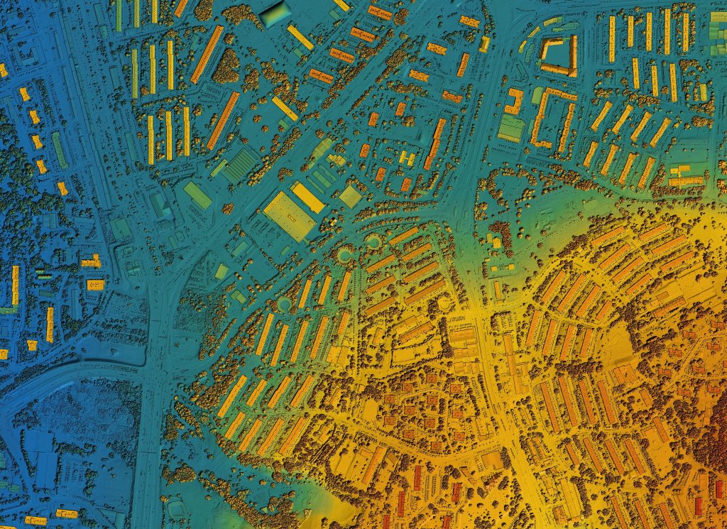
LiDAR, which stands for Light Detection and Ranging, is like giving the Earth a CT scan. It uses laser pulses to measure distances to the Earth’s surface, creating incredibly detailed 3D maps. Imagine being able to see through the dense forest canopy to the ground below—it’s a game-changer for mapping in vegetated areas.
This technology isn’t just about mapping the ground; it’s versatile enough to assist in everything from urban planning to autonomous vehicle navigation. LiDAR units mounted on aircraft can survey vast areas quickly, while handheld devices bring that power to the palm of your hand. It’s like having an X-ray vision of the planet’s surface.
By capturing millions of points, LiDAR creates a “point cloud” that can be analyzed and transformed into a variety of models and maps. This offers insights into terrain, and infrastructure, and even helps in disaster management by modeling flood risks or tracking changes in landscapes over time. It’s not just a surveying tool; it’s a crystal ball for peering into the geography of the future.
2. Advanced GNSS Systems

The Global Navigation Satellite System (GNSS) is the backbone of modern surveying. It’s the tech that takes the “search” out of “search and rescue.” GNSS provides pinpoint positioning and timing information, thanks to a constellation of satellites orbiting the Earth.
Advanced GNSS receivers can tap into multiple satellite systems like GPS, GLONASS, and Galileo. This redundancy ensures that surveyors aren’t left hanging if one system has a hiccup. It’s like having a spare tire for your car—but in space. These receivers can achieve centimeter-level accuracy, which is essential for precise mapping and construction work.
This GNSS software receiver supports the English language. It enables precise location tracking and navigation.

But GNSS isn’t just for the professionals. It’s also embedded in the smartphones we carry every day, allowing anyone to navigate with ease. However, for surveyors, the advanced systems come with features like real-time kinematic (RTK) positioning, which is like GPS on steroids, providing real-time corrections for even greater accuracy.
The Samsung Galaxy S25 Ultra adapts to your needs with intelligent AI assistance. Capture stunning photos and videos with the AI Camera's noise reduction and enjoy effortless switching from your old device.

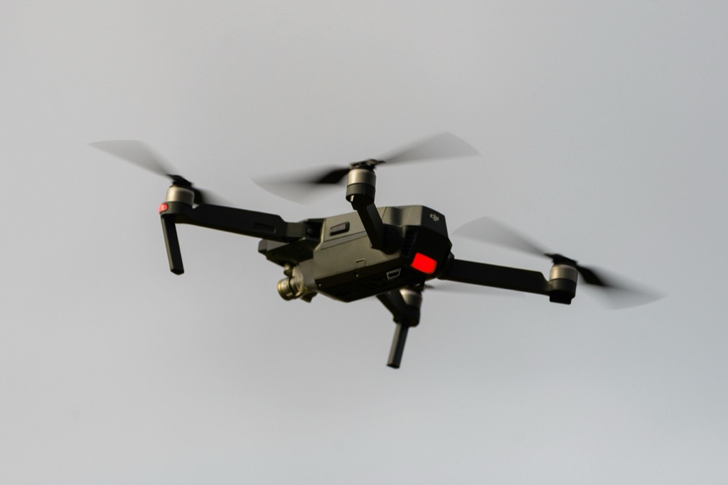
3. UAV Mapping Revolution
Unmanned Aerial Vehicles (UAVs), or drones, have taken surveying to new heights—literally. These nifty gadgets are more than just toys; they’re powerful tools that can carry cameras, LiDAR, and other sensors into the sky to capture data from angles that were once impossible.
Explore the world of military drones and unmanned aerial vehicles (UAVs). This resource provides comprehensive information in English.

The beauty of UAV mapping is its versatility. It’s as useful for a small construction site as it is for monitoring wildlife habitats. Plus, it’s a lot cheaper and faster than traditional aircraft surveys. Think of it as having your satellite that you can deploy at a moment’s notice.
Drones are also transforming the safety of surveying. Instead of sending a crew into a potentially hazardous area, a drone can do the job without putting human lives at risk. It’s like sending a robotic stunt double to do the dangerous work.
4. 3D Laser Scanning Details

3D laser scanning is like having a high-resolution camera that captures the shape of objects and spaces in minute detail. It’s a non-intrusive way to document and analyze the built environment and natural landscapes. These scanners shoot out millions of laser beams to create a dense network of data points.
The resulting 3D models are so detailed that architects and engineers can use them for virtual tours or to create accurate blueprints of existing structures. It’s a bit like time travel for buildings, allowing us to preserve a digital snapshot of a space as it exists today for future generations.
Beyond the built environment, 3D laser scanning is also key in forensic investigations and cultural heritage preservation. It’s like a detective’s magnifying glass, uncovering clues and details that might otherwise be overlooked.
This 30X magnifying glass helps users with low vision easily read small text. Featuring a large 3.15" lens and 18 LEDs with adjustable cool, warm, and mixed light modes, it reduces eye strain and improves reading in any lighting.

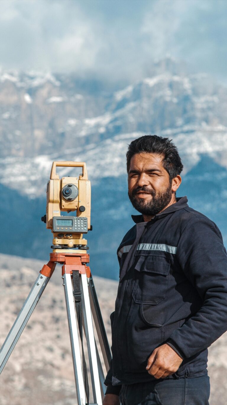
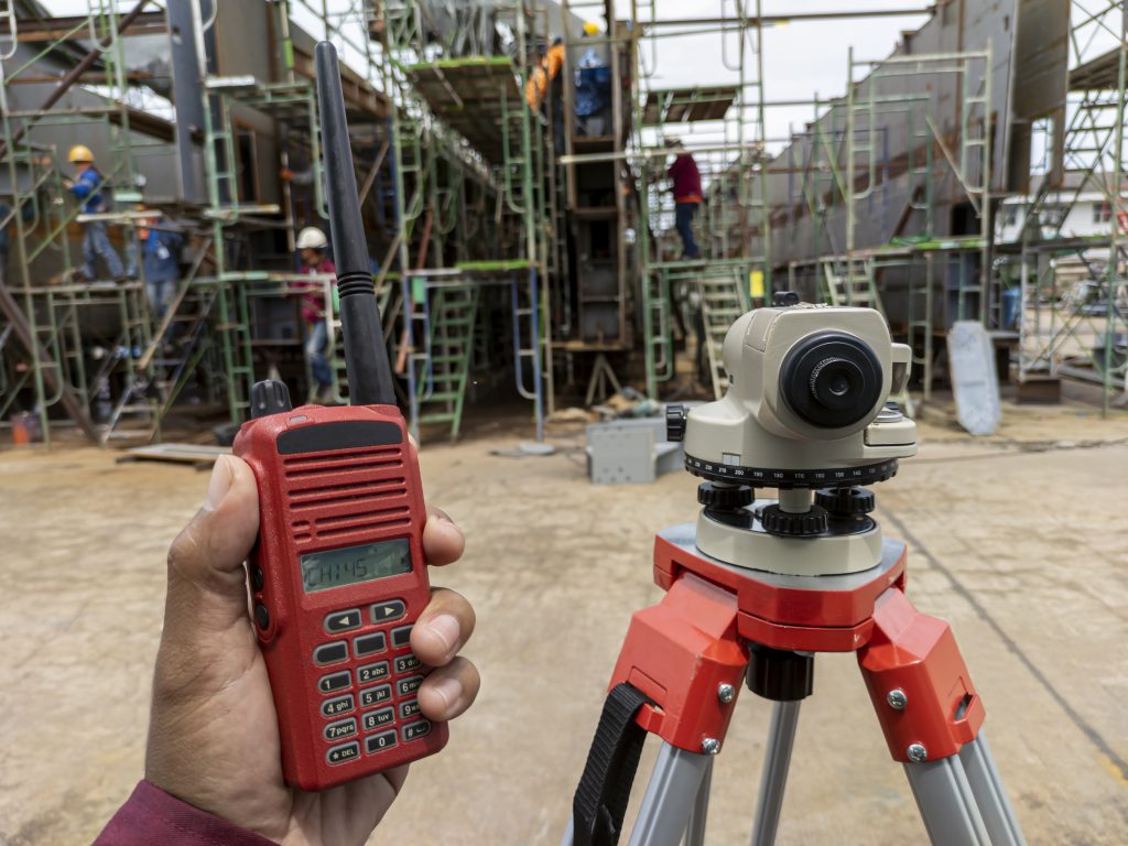
5. Robotic Total Stations
Robotic Total Stations (RTS) are the loyal sidekicks of surveyors. They’re one part telescope, one part calculator, and one part robot. These automated instruments can measure angles and distances with incredible precision, and they’re operated remotely, which means a single surveyor can do the work that used to require a whole team.
The real magic of RTS is in their ability to track a moving prism and adjust measurements on the fly. It’s like having a dance partner that anticipates your every move. This capability makes them ideal for monitoring construction sites where constant changes are the norm.
And when the sun goes down, these robotic marvels don’t call it a day. Many models come equipped with reflector-less technology, allowing them to work in low-light conditions. It’s like night vision for measurements, ensuring that productivity doesn’t have to sunset with the daylight.
Multi-Sensor Integration
Surveying’s latest trend is the integration of multiple sensors to gather comprehensive data sets. It’s the Swiss Army knife approach to mapping—why use one tool when you can use many? By combining sensors like GNSS, LiDAR, and cameras, surveyors can capture a fuller picture of the terrain.
This multi-sensor approach enhances accuracy and provides redundancies, ensuring that if one sensor misses something, another will catch it. It’s like having a backup band; even if the lead singer misses a note, the show goes on.
The integration also streamlines the workflow, as data from different sensors can be fused to create complex models. This holistic view is invaluable for projects that require a detailed understanding of the environment, from urban development to environmental management.
Real-Time Data Processing
Real-time data processing has turned surveying into a live performance. Instead of waiting days or weeks to see the results, data is processed on-site and in the moment. It’s like watching a Polaroid develop in your hands but for maps.
This immediacy allows for quick decision-making, which is crucial in fast-paced industries like construction and emergency management. When time is of the essence, real-time data is like a shot of adrenaline for project timelines.
The power of real-time processing is amplified by cloud computing, which allows for the sharing of data across teams and even across the globe. It’s a way to make sure everyone’s singing from the same song sheet, no matter where they are.
BIM in Surveying Explained
Building Information Modeling (BIM) is a digital twin of the physical world. It’s not just a 3D model; it’s a rich database of information that can be used throughout the lifecycle of a building, from concept to demolition. BIM integrates with surveying data to create a living, breathing representation of a project.
For surveyors, BIM is a bridge between the field and the office. It allows them to contribute real-world data to the digital model, ensuring that the virtual world matches the physical one. It’s like ensuring the reflection in the mirror is true to life.
The collaborative nature of BIM means that architects, engineers, and construction teams can all work together more effectively. It’s a communal canvas where each professional adds their brushstroke, contributing to a cohesive masterpiece.
Future of Surveying Tech
The future of surveying technology is as wide open as the landscapes it maps. We’re looking at the dawn of autonomous surveying robots and even the potential integration of artificial intelligence (AI) to interpret data. It’s like having a crystal ball that not only sees the future but helps to build it.
As these technologies become more accessible and user-friendly, we’ll see a democratization of surveying. Imagine a world where anyone with a smartphone can contribute to the mapping of our world. It’s a future where the line between professional surveyor and citizen is increasingly blurred.
The constant march of innovation will keep pushing the boundaries of what’s possible in surveying. It’s an exciting time to be in the field—or rather, to send your drones and robots into the field—because the map of tomorrow is being drawn with the tools of today.
As we embrace these cutting-edge surveying technologies, we’re not just changing the way we map; we’re redefining our relationship with the physical world. With each technological leap, we’re building a more connected, understood, and navigable planet.