5 Best Geological Mapping Tools for Education
The big picture: You’re standing at the edge of a revolution in geological education where traditional paper maps are giving way to dynamic interactive experiences that bring Earth’s hidden stories to life.
Why it matters: Modern geological mapping isn’t just about plotting rock formations anymore — it’s about creating immersive experiences that help students visualize how our planet evolved over millions of years through cutting-edge technology and hands-on exploration.
What’s next: Whether you’re an educator looking to transform your geology curriculum or a professional seeking innovative mapping techniques these five approaches will revolutionize how you present geological data and engage your audience with the Earth’s complex history.
Disclosure: As an Amazon Associate, this site earns from qualifying purchases. Thank you!
P.S. check out Udemy’s GIS, Mapping & Remote Sensing courses on sale here…
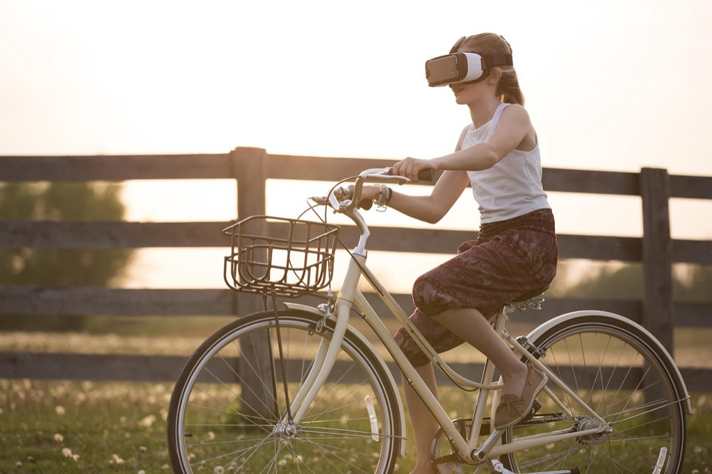
Interactive Digital Field Mapping With Augmented Reality Technology
You’ll transform traditional field mapping by integrating AR technology that overlays digital geological data directly onto real terrain. This approach creates immersive learning experiences that bridge the gap between theoretical knowledge and practical field observation.
Overlay Real-Time Geological Data on Physical Landscapes
You can use AR-enabled tablets and smartphones to display stratigraphic columns, fault lines, and mineral deposits directly over landscape features. Popular applications like ArcGIS Field Maps and GeoAR allow you to access real-time geological databases while standing in the field. Students point their devices at rock outcrops to instantly view formation names, ages, and structural data. This technology eliminates the guesswork between paper maps and actual terrain features.
This USB-C hub provides stable power and 4K display output for phones, tablets, and AR glasses. Its compact design ensures easy portability and secure charging with built-in safety features.

Enable Students to Visualize Underground Rock Formations
You’ll help students understand subsurface geology by using AR to project 3D cross-sections and underground structures above ground level. Applications like Geology AR and FieldMove display hidden bedrock layers, aquifer systems, and ore bodies as translucent overlays. Students can walk through virtual underground spaces to examine folded strata and intrusive bodies. This visualization technique makes abstract geological concepts tangible and spatially comprehensible for field-based learning.
Integrate GPS Coordinates With Geological Survey Information
You can synchronize precise GPS positioning with government geological databases to provide location-specific information automatically. USGS GeoMapper and similar platforms link your exact coordinates to official geological maps, well logs, and hazard assessments. Students receive instant access to formation descriptions, strike and dip measurements, and historical geological observations for their specific location. This integration ensures accurate data collection while teaching proper survey techniques and coordinate systems.
Virtual Reality Cave and Underground Exploration Simulations
Virtual reality technology transforms underground geological exploration by creating immersive environments that surpass traditional mapping limitations. You’ll discover how VR simulations provide unprecedented access to Earth’s subsurface structures through cutting-edge visualization techniques.
Recreate Inaccessible Mining Sites and Deep Cave Systems
Virtual reality platforms let you explore historically significant mining operations and cave networks that are permanently sealed or too dangerous for physical access. You can examine the Homestake Gold Mine’s 8,000-foot depths or navigate Kentucky’s Mammoth Cave system without safety concerns. These digital reconstructions preserve geological data from abandoned sites while allowing detailed analysis of rock formations, mineral deposits, and structural geology. VR environments maintain accurate scale relationships and geological authenticity for comprehensive educational experiences.
Provide Safe Access to Hazardous Geological Environments
Underground VR simulations eliminate exposure to methane gas, unstable rock formations, and flooding risks while maintaining educational value. You’ll experience active volcanic caves, unstable mine shafts, and earthquake-damaged tunnels without physical danger. These controlled environments let you practice emergency procedures and safety protocols before entering real hazardous locations. Students can observe dangerous geological processes like rockfalls, gas emissions, and structural collapses in a risk-free virtual setting that builds confidence for future fieldwork.
Offer Multi-Sensory Learning Through Sound and Visual Effects
Advanced VR systems incorporate spatial audio to simulate underground acoustics, water dripping, and rock movement sounds that enhance geological understanding. You’ll hear how sound travels differently through limestone versus granite formations while observing corresponding visual changes in rock texture and porosity. Haptic feedback controllers let you feel surface roughness, temperature variations, and vibrations from geological processes. These multi-sensory elements create memorable learning experiences that connect theoretical knowledge with realistic underground environmental conditions.
Enhance medical robotic control with precise haptic feedback. This system improves accuracy and dexterity for delicate surgical procedures.

Hands-On Rock Sample Analysis With Digital Microscopy
Digital microscopy transforms traditional petrographic analysis into dynamic learning experiences that bridge physical specimens with comprehensive geological databases.
Connect Physical Specimens to Interactive Digital Databases
Physical rock samples gain new educational value when connected to comprehensive digital databases through QR codes and specimen tracking systems. You’ll create direct links between hand samples and detailed geological information including formation data, mineral compositions, and location coordinates. Students scan specimens to access interactive maps showing original collection sites, stratigraphic context, and regional geology. Digital specimen cards display photomicrographs, chemical analyses, and comparative samples from similar formations worldwide, creating rich learning connections that extend far beyond individual rock samples.
Enable Real-Time Mineral Identification and Classification
Real-time mineral identification systems combine digital microscopy with automated analysis software to accelerate specimen classification processes. You’ll capture high-resolution images that connect directly to mineral identification algorithms, providing instant feedback on crystal structures, optical properties, and diagnostic features. Students receive immediate confirmation of their visual identifications through digital comparison tools that highlight key distinguishing characteristics. Advanced systems integrate polarized light microscopy with spectral analysis databases, enabling precise mineral determination that supports both educational objectives and professional geological survey standards.
Create Collaborative Online Specimen Libraries
Collaborative specimen libraries enable institutions to share digital rock collections across geographical boundaries, expanding access to diverse geological samples. You’ll build comprehensive databases that include detailed metadata, location information, and analytical results for each specimen in your collection. Students contribute to growing libraries by uploading their own field samples with GPS coordinates, photographs, and preliminary identifications. Peer review systems ensure data quality while enabling global collaboration between geology programs, creating extensive resources that support comparative studies and regional geological research initiatives.
3D Terrain Modeling and Topographic Map Creation
Plan your next adventure with the 2025 National Geographic Road Atlas, covering the United States, Canada, and Mexico. Its durable, folded format (11 x 15 in) makes it ideal for hiking and camping trips.

Three-dimensional terrain modeling transforms flat geological data into tangible learning experiences that reveal Earth’s surface complexity. Digital elevation models combined with geological survey data create immersive mapping experiences that enhance spatial understanding.
Build Physical Relief Maps Using 3D Printing Technology
Explore the United States with this 3D raised relief map. Feel the terrain and understand topography through its tactile, vacuum-formed design.

Physical relief maps bring topographic data to life through tactile geological mapping experiences. You’ll convert digital elevation models into STL files using software like ArcGIS Pro or QGIS, then scale vertical exaggeration between 2:1 and 5:1 for optimal detail visibility. Modern 3D printers produce multi-material maps that highlight different geological formations through color coding and texture variations. Print resolution affects detail accuracy – use 0.2mm layer heights for educational models and 0.1mm for research applications.
Integrate Drone Survey Data With Traditional Mapping Methods
Drone survey integration enhances traditional mapping through high-resolution aerial imagery and photogrammetry data. You’ll combine UAV-collected topographic information with existing geological surveys using Structure from Motion (SfM) software like Pix4D or Agisoft Metashape. Flight planning software ensures 80% image overlap for accurate terrain reconstruction. Ground control points establish coordinate accuracy within 2-5 centimeters, while thermal sensors reveal subsurface moisture patterns that indicate geological boundaries invisible to standard photography.
Develop Interactive Watershed and Erosion Pattern Models
Interactive watershed models demonstrate hydrological processes through dynamic geological mapping experiences. You’ll use ArcGIS Hydrology tools to delineate drainage basins from digital elevation models, then create flow accumulation maps that show erosion patterns over time. Web-based platforms like ArcGIS Online enable interactive visualization where users manipulate precipitation variables to observe runoff changes. Temporal analysis reveals how geological formations influence water flow patterns, helping students understand landscape evolution through millions of years of erosion processes.
Collaborative Online Geological Survey Projects
Building on the foundation of individual digital mapping experiences, collaborative online geological survey projects transform isolated learning into connected research communities. These platforms create bridges between academic environments and professional geological practice.
Connect Students With Professional Geologists and Researchers
Partner with working geologists through mentorship programs that connect classrooms to active research projects. Professional geologists guide students through real survey techniques using video conferencing and shared digital workspaces. Students access current fieldwork data from ongoing geological studies, contributing observations to professional databases while learning industry-standard protocols. Universities like Colorado School of Mines facilitate these partnerships through structured programs where students analyze samples from active mining operations. Mentor relationships develop naturally as students work alongside researchers on projects ranging from mineral exploration to environmental geology assessments.
Enable Real-Time Data Collection and Sharing Across Locations
Synchronized data collection connects multiple field teams through cloud-based geological databases that update instantly across all connected devices. Students in different locations contribute measurements to shared surveys, creating comprehensive regional geological maps through coordinated efforts. Mobile applications like FieldMove Clino enable teams to upload stratigraphic data, GPS coordinates, and photographic evidence simultaneously from various field sites. Real-time collaboration allows instructors to monitor student progress remotely while providing immediate feedback on data quality and collection techniques. Weather stations and seismic monitoring equipment feed live environmental data into these collaborative platforms.
Create Citizen Science Opportunities for Community Engagement
Community-based geological surveys engage local residents in collecting environmental data that contributes to regional geological understanding. Projects like EarthCache programs train volunteers to document rock formations, erosion patterns, and mineral occurrences in their neighborhoods using standardized protocols. Citizens upload photographs and GPS-tagged observations through user-friendly mobile applications that automatically organize data for scientific analysis. Public participation expands data collection beyond traditional academic boundaries while building geological literacy in local communities. These initiatives often focus on practical concerns like groundwater quality, landslide risk assessment, and soil composition studies that directly benefit participating communities.
Conclusion
These five innovative approaches represent the future of geological education where technology meets hands-on discovery. You’ll find that implementing even one of these methods can dramatically transform how your students engage with Earth sciences.
The shift from traditional mapping to immersive experiences isn’t just about keeping up with technology—it’s about unlocking deeper understanding of our planet’s complex systems. Your students will develop stronger analytical skills and retain geological concepts more effectively through these interactive methods.
Start small by exploring AR applications or setting up digital microscopy stations in your classroom. As you become more comfortable with these tools you can gradually expand into VR simulations and collaborative online projects.
The investment in these technologies pays dividends in student engagement and learning outcomes. You’re not just teaching geology—you’re preparing the next generation of Earth scientists with the tools they’ll need for tomorrow’s challenges.
Frequently Asked Questions
What is interactive geological mapping and how does it differ from traditional methods?
Interactive geological mapping uses modern technology like augmented reality (AR) and virtual reality (VR) to create immersive learning experiences. Unlike traditional paper maps, this approach overlays digital geological data onto real terrain, displays 3D underground formations, and provides real-time access to geological information, making complex Earth science concepts more tangible and engaging.
How does augmented reality enhance geological field studies?
AR technology overlays digital geological data directly onto real landscapes through AR-enabled devices. Students can view stratigraphic columns, mineral deposits, and underground rock formations projected over actual terrain features. This eliminates guesswork in field studies and helps visualize subsurface structures that are normally invisible to the naked eye.
What are the safety benefits of using VR for geological exploration?
VR allows students to explore hazardous geological environments like deep caves, unstable mine shafts, and dangerous rock formations without physical risk. Students can practice emergency procedures in controlled virtual settings and experience historically significant mining operations that are no longer accessible, all while maintaining complete safety.
How do QR codes enhance rock sample analysis?
QR codes connect physical rock samples to comprehensive digital databases containing detailed geological information. When scanned, students instantly access formation data, mineral compositions, and historical context. This bridges the gap between hands-on specimen examination and digital resources, creating a more complete learning experience.
What advantages do 3D printed geological maps offer?
3D printed maps transform flat geological data into tactile learning tools that reveal Earth’s surface complexity. These physical relief maps use color coding and texture variations to highlight different geological formations, making topographic features and geological structures easier to understand through touch and visual examination.
How do collaborative online geological survey projects benefit students?
These platforms connect students with professional geologists through mentorship programs and real-world research projects. Students contribute observations to professional databases, access current fieldwork data, and participate in citizen science initiatives. This bridges academic learning with practical geological work and creates connected research communities.
What role does drone technology play in modern geological mapping?
Learn the science behind unmanned flight and UAV systems. This guide offers a step-by-step approach to understanding drone and UAV technology engineering.

Drones enhance mapping accuracy by providing high-resolution aerial imagery and photogrammetry data. This technology integrates with traditional mapping methods to create detailed topographic surveys, monitor geological changes over time, and access difficult-to-reach terrain safely and efficiently for comprehensive geological analysis.
How do digital microscopy systems improve mineral identification?
Digital microscopy combines traditional petrographic analysis with automated software that provides instant feedback on mineral characteristics. Real-time identification systems accelerate specimen classification, offer detailed analysis of rock textures and compositions, and create comprehensive digital records for future reference and comparison studies.