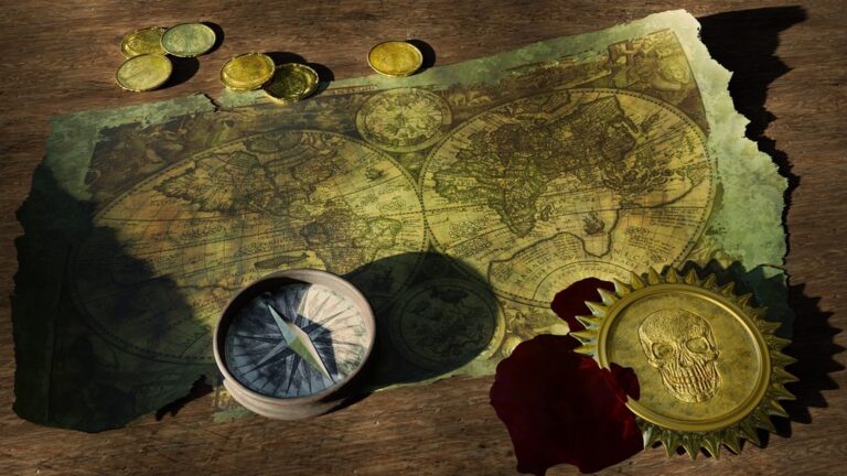
7 Best Map Storytelling Techniques
Why it matters: Maps aren’t just navigation tools – they’re powerful storytelling devices that can transform complex data into compelling visual narratives that captivate your audience.
The big picture: Whether you’re a journalist covering breaking news, a marketer showcasing customer journeys, or a content creator building immersive experiences, strategic map-based storytelling can elevate your content and boost engagement rates significantly.
What’s next: We’ll explore seven proven techniques that turn ordinary geographic data into extraordinary stories that resonate with readers and drive meaningful action.
Disclosure: As an Amazon Associate, this site earns from qualifying purchases. Thank you!
P.S. check out Udemy’s GIS, Mapping & Remote Sensing courses on sale here…
Start With Character-Driven Journey Maps
Character-driven journey maps transform geographical data into compelling human stories by placing individual experiences at the center of your narrative visualization.
Create Emotional Connection Points Along the Route
Mark specific locations where your characters experience significant emotional moments or transformative events. Pin restaurants where they celebrated milestones, hospitals where they recovered, or viewpoints where they made life-changing decisions. These emotional anchors help readers connect personally with the geographic journey. Use custom map markers or color-coded symbols to distinguish different emotional states—red for conflict zones, blue for peaceful moments, or yellow for moments of discovery and growth.
Establish Clear Motivations for Movement
Define why your characters move from point A to point B by incorporating their personal goals into the map’s data layers. Overlay economic indicators for migration stories, add educational institutions for student journeys, or highlight job markets for career-driven narratives. Label each route segment with the specific motivation driving that leg of the journey—whether it’s pursuing opportunity, escaping hardship, or seeking adventure. This contextual information transforms simple travel lines into purposeful narrative arcs that readers can follow and understand.
Incorporate Historical Layers Into Your Cartographic Storytelling
Historical layering transforms your maps from static displays into dynamic narratives that reveal how places evolved over time. You’ll create compelling stories by overlaying temporal data that shows transformation patterns across decades or centuries.
Research Time-Specific Geographic Details
Historical accuracy requires thorough research into period-specific geographic features before you begin mapping. You’ll need to verify coastline changes, urban development patterns, and infrastructure evolution through archival sources like the David Rumsey Map Collection and Library of Congress geographic databases. Check historical gazetteers to confirm place names and boundaries that existed during your target time period. Document source reliability since cartographic errors from historical maps can compound across your narrative layers.
Layer Past and Present Visual Elements
Effective temporal layering requires strategic visual hierarchy to guide readers through chronological changes without overwhelming them. You’ll achieve this by using transparency gradients where historical features fade to 60-70% opacity while current elements remain at full strength. Color coding helps distinguish time periods—sepia tones for historical data and vibrant colors for contemporary information work effectively. Consider using animated transitions or slider controls in digital formats to let users explore temporal changes interactively.
Use Geographic Obstacles as Plot Devices
Natural barriers and environmental challenges on your maps become powerful storytelling catalysts when positioned strategically within your narrative arc.
Transform Natural Barriers Into Story Challenges
Mountains, rivers, and deserts on your maps create natural conflict points that force character decisions and plot advancement. Position major obstacles along your protagonist’s route to generate tension and reveal character traits through their problem-solving approaches.
Mark specific geographic features like narrow mountain passes, seasonal flood zones, or impassable terrain during certain weather conditions. These barriers become plot devices that create urgency, force detours, or require characters to develop new skills to overcome challenges.
Create Tension Through Environmental Conflicts
Weather patterns and seasonal changes mapped across your story’s timeline add layers of environmental pressure that heighten narrative stakes. Overlay climate data, storm tracks, or drought patterns onto character movement paths to show how environmental forces shape story outcomes.
Use topographic variations and natural hazards like avalanche zones, wildfire-prone areas, or unstable geological features as ticking clocks in your narrative. These mapped elements create external pressure that forces characters into action while providing authentic geographic context for your story’s conflicts.
Develop Cultural Boundaries Through Territorial Design
Cultural boundaries create narrative depth by establishing distinct social landscapes that influence character interactions and plot development. Your territorial design choices can reveal societal tensions and cultural exchanges that drive compelling storylines.
Map Different Societies and Their Customs
Establish distinct cultural zones by marking traditional territories with unique visual markers that reflect each society’s characteristics. Use color-coded regions to represent different languages, religions, or governance systems across your narrative landscape.
Define cultural landmarks through symbols that represent temples, marketplaces, or ceremonial grounds specific to each society. These geographic markers help readers understand how cultural practices shape the physical environment and influence character movement patterns throughout your story.
Show Cultural Transitions Through Border Regions
Create transition zones where different cultures blend and conflict by designing border areas with mixed architectural styles and overlapping territorial claims. These liminal spaces generate natural tension points where characters encounter unfamiliar customs and navigate cultural misunderstandings.
Mark trade routes and migration paths that connect different societies, showing how cultural exchange occurs through geographic movement. Border settlements and frontier towns become crucial narrative locations where characters must adapt to shifting cultural norms and territorial disputes.
Integrate Interactive Elements for Reader Engagement
Interactive maps transform passive readers into active explorers who control their own narrative experience. Digital hotspots and branching pathways create immersive storytelling environments that respond to user choices.
Design Clickable Hotspots for Deeper Exploration
Clickable hotspots serve as narrative anchors that reveal hidden story layers when activated by readers. You’ll embed these interactive points at crucial geographic locations where significant events occurred or where additional context enhances understanding. Strategic placement includes battle sites with casualty statistics, landmark buildings with architectural histories, or crossroads where characters made pivotal decisions. Modern mapping platforms like Mapbox and ArcGIS Online support hover effects and popup windows that display photographs, audio clips, or detailed text descriptions without disrupting the main story flow.
Create Branching Pathways for Multiple Story Outcomes
Branching pathways transform linear narratives into choose-your-own-adventure experiences through interactive route selection. You’ll design multiple travel options at decision points where characters face different geographic challenges or opportunities. Readers click alternative routes that lead to distinct story outcomes based on terrain difficulty, cultural encounters, or resource availability. JavaScript libraries like Leaflet enable conditional displays where selecting mountain passes reveals avalanche risks while choosing valley routes shows river crossing challenges. Each pathway maintains geographic accuracy while offering unique narrative consequences that encourage multiple exploration sessions.
Employ Visual Symbolism in Your Map Design
Visual symbolism transforms your map from a simple geographic reference into a powerful narrative communication tool. Strategic color choices and carefully selected icons create immediate emotional connections that guide your readers through the story’s deeper meanings.
Choose Colors That Reflect Narrative Themes
Color psychology drives emotional response in map-based storytelling, making your palette selection crucial for narrative impact. Warm reds and oranges convey conflict zones, danger, or passion-driven character decisions, while cool blues and greens represent safety, hope, or peaceful resolution areas. Use graduated color schemes to show narrative progression—lighter shades for story beginnings transitioning to deeper, more saturated tones as tension builds. Monochromatic palettes work effectively for historical narratives, with sepia tones evoking past eras and grayscale highlighting documentary authenticity.
Use Icons and Imagery to Reinforce Story Elements
Strategic icon placement creates visual anchors that reinforce your narrative’s key themes and plot points. Character-specific symbols—such as swords for warriors, books for scholars, or ships for traders—help readers track individual journeys across geographic space. Environmental icons like storm clouds, mountain peaks, or desert symbols immediately communicate the challenges your characters face. Scale your icon sizes to reflect narrative importance, using larger symbols for pivotal story locations and smaller ones for supporting details. Consistent icon families maintain visual coherence while custom symbols add unique personality to your cartographic storytelling.
Combine Multiple Perspectives Through Layered Cartography
Layered cartography transforms single-perspective maps into multi-dimensional narratives that reveal how different characters experience the same geographic space. You’ll create depth by showing contrasting viewpoints of identical locations through strategic visual layering.
Show Different Characters’ Views of the Same Space
Mark character-specific landmarks that reflect each individual’s priorities and emotional connections to places. A merchant might highlight trade routes and marketplaces while a refugee focuses on safe houses and border crossings. Use distinct color schemes for each character’s perspective layer, allowing readers to toggle between viewpoints and understand how personal experiences shape geographic perception. Create overlapping annotations where characters’ paths intersect but their interpretations of the same location differ dramatically.
Create Before and After Scenarios Through Map Evolution
Document transformation points by layering historical and contemporary map data to show how conflicts, disasters, or development changed landscapes. Mark destroyed buildings alongside new construction using transparency effects and contrasting symbols. Establish temporal anchors through dated annotations that explain specific changes between map states. Use split-screen techniques in digital formats to display simultaneous before-and-after views, helping readers understand how time and events reshape both physical geography and character opportunities within the same narrative space.
Conclusion
Your mapping storytelling toolkit now includes seven powerful techniques that can transform any geographic visualization into an engaging narrative experience. These methods work best when you combine multiple approaches – perhaps layering historical elements with character journeys or integrating interactive features with cultural boundaries.
Remember that effective map narratives require careful balance between geographic accuracy and storytelling impact. You’ll want to test your interactive elements thoroughly and ensure your visual symbols remain consistent throughout the entire experience.
Start implementing these techniques gradually in your next project. Whether you’re crafting a simple character journey or developing complex multi-layered narratives your maps will become compelling story vessels that captivate audiences and drive meaningful engagement with your content.
Frequently Asked Questions
What makes maps effective storytelling tools beyond navigation?
Maps serve as powerful visual narratives that transform complex data into engaging stories. They create emotional connections by combining geographic elements with character journeys, historical context, and cultural boundaries. This approach helps readers visualize and understand information more effectively than traditional text-based content.
How do character-driven journey maps enhance storytelling?
Character-driven journey maps center individual experiences by marking locations where significant emotional moments occur. By overlaying personal goals and contextual information like economic indicators onto travel routes, these maps transform simple movement lines into purposeful narrative arcs that readers can follow and connect with emotionally.
What are historical layers in cartographic storytelling?
Historical layers transform static maps into dynamic narratives showing how places evolved over time. They use transparency gradients, color coding, and visual hierarchy to distinguish between past and present elements. This technique requires research into period-specific geographic features like coastline changes and urban development for accuracy.
How can geographic obstacles drive plot development?
Natural barriers like mountains, rivers, and deserts create conflict points that influence character decisions and advance storylines. By marking specific features like narrow passes or flood zones, these obstacles generate tension and reveal character traits through their problem-solving approaches, adding authentic geographic context to narratives.
What role do cultural boundaries play in map-based storytelling?
Cultural boundaries establish distinct social landscapes using color-coded regions to represent different languages, religions, or governance systems. They create transition zones where cultures blend and conflict, generating natural tension points. Trade routes and migration paths illustrate cultural exchanges through geographic movement.
How do interactive elements improve reader engagement?
Interactive maps transform passive readers into active explorers through clickable hotspots that reveal hidden story layers and branching pathways for choose-your-own-adventure experiences. These features maintain geographic accuracy while offering unique narrative consequences, encouraging multiple exploration sessions and deeper engagement.
What is layered cartography in storytelling?
Layered cartography reveals how different characters experience the same geographic space through contrasting viewpoints. It uses character-specific landmarks, distinct color schemes, and before-and-after scenarios to show how conflicts, disasters, or development reshape landscapes and opportunities within narratives.