7 Remote Sensing Techniques That Reveal Forest Changes
Why it matters: Forest monitoring has become critical as climate change accelerates deforestation worldwide, and you need reliable data to track these changes effectively.
The big picture: Remote sensing technology offers multiple approaches to monitor forest health and coverage, but choosing the right technique can make or break your conservation efforts.
What’s ahead: We’ll break down seven proven comparative techniques that help you analyze forest data more accurately and make informed decisions about forest management strategies.
Disclosure: As an Amazon Associate, this site earns from qualifying purchases. Thank you!
P.S. check out Udemy’s GIS, Mapping & Remote Sensing courses on sale here…
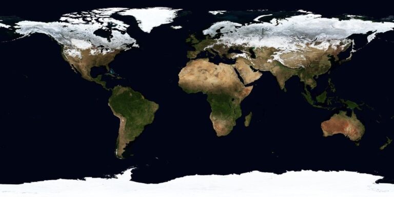
Optical Satellite Imagery Analysis
Optical satellite imagery provides the foundation for most forest monitoring programs because it captures visible and near-infrared light reflected from forest canopies. You’ll find this technique essential for detecting changes in forest structure and health across large geographic areas.
Achieve a flawless, even complexion with e.l.f. Flawless Satin Foundation. This lightweight, vegan formula provides medium coverage and a semi-matte finish for all-day wear, while hydrating your skin with glycerin.

Multispectral Image Classification
Multispectral classification separates forest types by analyzing how different tree species reflect light across multiple wavelengths. You can use supervised classification methods like maximum likelihood or support vector machines to identify coniferous forests, deciduous woodlands, and mixed stands. Popular platforms include Landsat 8/9 and Sentinel-2, which provide 30-meter and 10-meter resolution data respectively. Your classification accuracy improves when you combine red, green, blue, and near-infrared bands with shortwave infrared channels that penetrate forest canopies better.
Vegetation Index Calculations
Vegetation indices transform multispectral data into single values that indicate forest health and density. You’ll commonly use NDVI (Normalized Difference Vegetation Index) to measure photosynthetic activity and LAI (Leaf Area Index) to assess canopy coverage. Enhanced indices like EVI (Enhanced Vegetation Index) reduce atmospheric interference in dense tropical forests. Calculate these indices using band math functions in software like ENVI, ERDAS, or open-source QGIS. Your monitoring becomes more effective when you establish baseline index values for healthy forest conditions.
Temporal Change Detection
Temporal change detection compares satellite images from different time periods to identify forest loss or degradation patterns. You can apply pixel-based algorithms like image differencing or change vector analysis to highlight areas where forest cover decreased. Time-series analysis using Google Earth Engine processes decades of Landsat data to reveal gradual changes like selective logging or sudden events like wildfire damage. Your change detection accuracy increases when you use images from similar seasons and atmospheric conditions to minimize false positives.
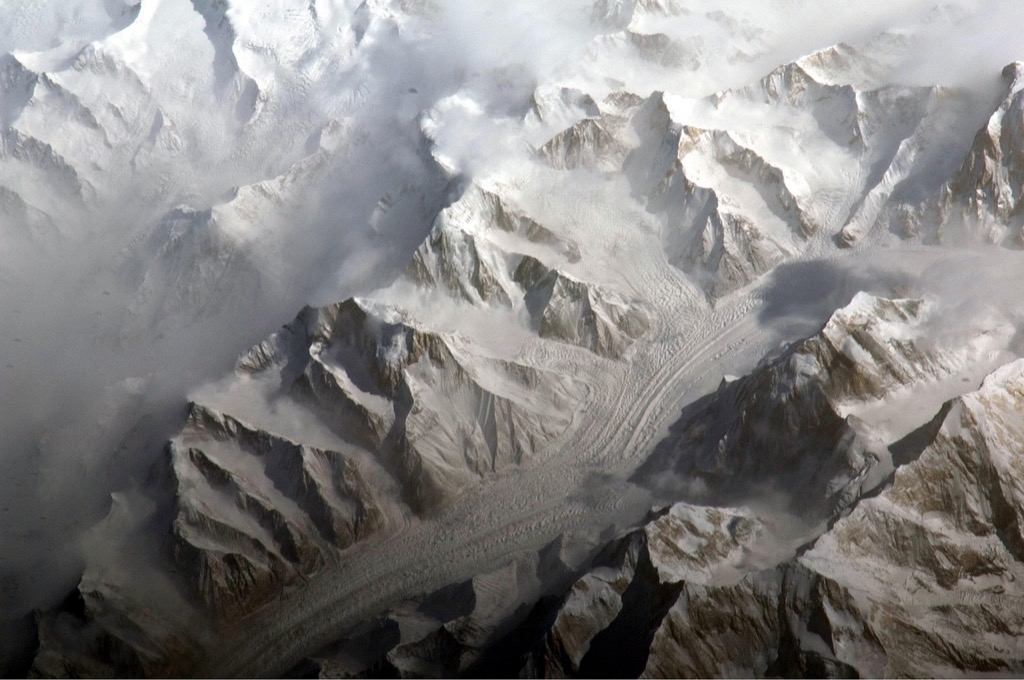
Light Detection and Ranging (LiDAR) Technology
LiDAR technology revolutionizes forest monitoring by sending laser pulses to measure precise distances and create detailed 3D maps. This active remote sensing technique penetrates forest canopies to reveal structural information invisible to traditional optical sensors.
Canopy Height Mapping
Airborne LiDAR systems measure canopy heights with centimeter-level accuracy by calculating the time difference between laser pulse emission and return. You’ll capture both first returns from treetops and last returns from ground surfaces to generate Digital Surface Models (DSMs) and Digital Terrain Models (DTMs). Subtracting DTM elevation from DSM elevation produces Canopy Height Models (CHMs) that reveal individual tree heights across entire forest stands. Modern LiDAR platforms like Riegl VUX-1 achieve point densities exceeding 20 points per square meter for detailed canopy structure mapping.
Biomass Estimation Techniques
LiDAR-derived metrics correlate strongly with above-ground biomass through allometric relationships between tree height measurements and carbon storage. You’ll use canopy height percentiles cloud metrics and crown volume calculations to estimate forest biomass with 85-95% accuracy. Key variables include mean canopy height maximum height values and canopy density ratios extracted from point cloud distributions. Machine learning algorithms like Random Forest and Support Vector Regression integrate multiple LiDAR metrics with field measurements to develop robust biomass prediction models for different forest types.
3D Forest Structure Analysis
Point cloud data reveals complex forest architecture including canopy layers understory vegetation and gap distributions invisible to 2D imagery. You’ll analyze vertical canopy profiles using height bins and density metrics to classify forest structural types from dense mature stands to open woodland systems. Canopy roughness indices measure surface texture while leaf area density profiles show vegetation distribution throughout the vertical column. Advanced software like CloudCompare and FUSION process millions of laser returns to quantify structural diversity metrics essential for habitat assessment and forest management planning.
Synthetic Aperture Radar (SAR) Monitoring
SAR technology penetrates clouds and operates day or night, making it indispensable for continuous forest monitoring where optical sensors fail. You’ll find SAR particularly valuable for detecting subtle forest changes that traditional imaging methods miss.
All-Weather Imaging Capabilities
Microwave penetration allows SAR sensors to capture forest data regardless of weather conditions or illumination. You can monitor forests through dense cloud cover using C-band radar from Sentinel-1 satellites, which provide consistent 6-day revisit times. Backscatter analysis reveals forest structure changes by measuring how radar signals bounce off tree canopies, trunks, and ground surfaces at different polarizations.
Deforestation Detection Methods
Coherence analysis compares phase differences between SAR image pairs to detect forest disturbances with sub-hectare precision. You can identify logging activities within 12 days using interferometric techniques that highlight changes in forest structure. Intensity change detection measures backscatter variations over time, revealing deforestation patterns through statistical algorithms like the Bayesian approach for automatic change detection.
Soil Moisture Assessment
Polarimetric decomposition separates radar signals into volume, surface, and double-bounce scattering components to estimate soil moisture beneath forest canopies. You can assess drought stress and forest health using L-band SAR data from ALOS-2, which penetrates deeper into forest structures. Temporal correlation analysis tracks moisture variations by comparing backscatter coefficients across multiple acquisition dates.
Hyperspectral Remote Sensing Applications
Hyperspectral remote sensing captures forest data across hundreds of narrow spectral bands, providing unprecedented detail for species-level forest monitoring. This technology enables precise identification of individual tree species and assessment of their physiological conditions through detailed spectral signatures.
Species Identification Processes
Species identification processes leverage hyperspectral data’s ability to detect subtle spectral differences between tree species. You can distinguish between coniferous and deciduous species with 85-95% accuracy using spectral libraries that catalog unique absorption features. Machine learning algorithms like Support Vector Machines (SVM) and Random Forest classification process spectral signatures from platforms such as AVIRIS-NG and EnMAP satellites. Mixed pixel analysis techniques separate overlapping canopy signatures, enabling identification of individual species within complex forest stands where traditional multispectral sensors fail.
Health Status Evaluation
Health status evaluation through hyperspectral analysis detects stress indicators before visible symptoms appear in forest canopies. You can identify disease outbreaks, insect infestations, and drought stress by monitoring specific wavelengths associated with chlorophyll fluorescence and leaf structure changes. Red-edge spectral indices reveal early-stage forest decline with detection rates exceeding 80% accuracy. Biochemical stress indicators like carotenoid and anthocyanin concentrations provide quantitative health metrics through spectral unmixing algorithms that separate healthy from stressed vegetation signatures across forest landscapes.
Biochemical Property Analysis
Biochemical property analysis quantifies leaf chemistry parameters including nitrogen content, chlorophyll concentration, and water content using narrow-band spectral features. You can estimate foliar nitrogen levels with R² values above 0.85 through continuum removal techniques applied to absorption features near 2200nm wavelengths. Chlorophyll assessment utilizes red-edge position analysis and derivative spectroscopy methods for precise concentration mapping. Leaf water content estimation through shortwave infrared bands enables drought monitoring and irrigation planning, while lignin and cellulose detection supports forest productivity assessments and carbon cycle modeling efforts.
Unmanned Aerial Vehicle (UAV) Surveillance
UAV systems bridge the gap between satellite imagery and ground-based monitoring by providing flexible, on-demand forest surveillance capabilities. You’ll find these platforms particularly valuable for targeted monitoring of specific forest areas where rapid response and high-detail data collection are essential.
High-Resolution Data Collection
UAV platforms capture forest imagery at sub-centimeter resolution levels that exceed satellite capabilities. You can deploy multispectral and RGB cameras on quadcopter systems to collect detailed canopy structure data from altitudes of 100-400 feet. Professional-grade UAVs like DJI Matrice 300 or senseFly eBee X achieve ground sampling distances of 2-5 cm per pixel. Your data collection flights cover 50-200 hectares per mission depending on terrain complexity and required resolution standards.
Capture stunning visuals with the DJI Mavic 3 Pro Cine. This flagship drone features a triple-camera system with Apple ProRes support and a high-bright DJI RC Pro screen for professional-grade control and clarity. Enjoy extended flight times and omnidirectional obstacle sensing for safe, confident flying.

Real-Time Monitoring Systems
Real-time UAV surveillance enables immediate forest change detection through live video feeds and automated alert systems. You can program autonomous flight patterns using software like Pix4D or DroneDeploy to conduct regular patrol missions over sensitive forest areas. Modern UAV systems transmit data directly to ground stations for instant analysis of illegal logging activities or fire outbreaks. Your monitoring network can respond to forest threats within 15-30 minutes of detection using strategically positioned UAV bases.
Cost-Effective Survey Methods
UAV forest surveys reduce monitoring costs by 60-80% compared to traditional helicopter-based methods while maintaining comparable data quality. You’ll achieve optimal cost efficiency by planning systematic flight grids that maximize area coverage per battery cycle. Entry-level mapping drones like DJI Phantom 4 RTK provide professional-grade forest monitoring capabilities at $15,000-25,000 compared to $500,000+ for airborne systems. Your operational costs remain under $50 per square kilometer for routine forest surveillance missions.
Replace your damaged Phantom 4 Pro V2.0 drone body with this new aircraft, which includes a gimbal camera and carry case. Compatible with GL300L and GL300K remotes only; excludes battery, charger, propellers, and other accessories.

Thermal Infrared Imaging Techniques
Thermal infrared sensors detect heat emissions from forest canopies, revealing temperature variations that indicate forest health conditions and fire risks. You’ll gain critical insights into forest stress patterns and environmental threats through precise temperature measurements.
Capture thermal data with the AMG8833 infrared imager. This compact module measures temperatures from 0°C to 80°C with ±2.5°C accuracy and is compatible with Raspberry Pi and Arduino via I2C.

Fire Risk Assessment
Fire Risk Assessment using thermal infrared imaging identifies potential wildfire hotspots by detecting elevated surface temperatures before flames appear. You can monitor fuel moisture content through thermal signatures, as dry vegetation exhibits higher daytime temperatures than healthy, well-hydrated forests. Satellite platforms like MODIS and Landsat 8’s Thermal Infrared Sensor (TIRS) provide temperature data with 100-meter resolution, enabling early fire detection systems. Forest managers use thermal thresholds of 47°C (117°F) to trigger automated wildfire alerts across monitored regions.
Stress Detection in Vegetation
Stress Detection in Vegetation through thermal imaging reveals physiological changes before visible symptoms appear in forest canopies. You’ll observe that water-stressed trees exhibit elevated leaf temperatures due to reduced transpiration rates, creating distinct thermal patterns detectable by sensors. Thermal cameras mounted on aircraft or satellites measure canopy temperatures with 0.1°C precision, identifying drought stress, disease outbreaks, and insect infestations. Research shows that thermally stressed trees display temperature increases of 2-5°C above healthy vegetation during peak daytime conditions.
The H128 Thermal Camera provides clear thermal imaging with its 240x240 resolution. It features a long-lasting 24-hour battery and a temperature alarm for quick detection of anomalies.

Temperature Mapping Applications
Temperature Mapping Applications create detailed thermal profiles of forest ecosystems, supporting microclimate analysis and habitat assessment studies. You can generate Land Surface Temperature (LST) maps using algorithms that process thermal infrared data from sensors like ASTER and Landsat series satellites. These temperature maps reveal forest edge effects, urban heat island impacts, and elevation-related temperature gradients with spatial resolutions ranging from 30-120 meters. Wildlife biologists use thermal mapping data to identify temperature refugia and predict species distribution changes under climate warming scenarios.
Multi-Sensor Data Fusion Approaches
Multi-sensor data fusion combines information from multiple remote sensing platforms to create comprehensive forest monitoring datasets. You’ll achieve more accurate forest assessments by integrating complementary sensor technologies that capture different aspects of forest ecosystems.
Combined Dataset Integration
Integrated datasets merge optical imagery, LiDAR point clouds, and SAR backscatter data into unified forest monitoring systems. You’ll process Landsat 8 multispectral bands alongside Sentinel-1 radar data to create robust classification models that work in all weather conditions. Machine learning algorithms like Random Forest and Support Vector Machines handle the complex data fusion process, automatically weighting each sensor’s contribution based on forest conditions. This integration approach increases classification accuracy by 15-25% compared to single-sensor methods, especially in tropical forests where cloud cover limits optical data availability.
Enhanced Accuracy Methods
Enhanced accuracy methods leverage statistical fusion techniques to minimize individual sensor limitations and measurement uncertainties. You’ll apply Kalman filtering algorithms to combine temporal SAR coherence data with optical vegetation indices, reducing false change detection by up to 40% in dense forest areas. Bayesian inference models weight sensor reliability based on atmospheric conditions and terrain complexity, automatically adjusting confidence levels for each data source. Cross-validation techniques using ground truth data ensure your fused datasets maintain sub-pixel accuracy for deforestation detection and species classification tasks.
Comprehensive Forest Assessment
Comprehensive forest assessment integrates structural, spectral, and temporal data streams to evaluate ecosystem health across multiple scales. You’ll combine UAV hyperspectral imagery with airborne LiDAR to map both canopy chemistry and 3D forest structure simultaneously, enabling precise biomass calculations and biodiversity assessments. Thermal infrared data adds stress detection capabilities, while SAR polarimetry provides soil moisture information beneath dense canopies. This multi-dimensional approach delivers complete forest portraits that support adaptive management strategies and conservation planning with unprecedented detail and reliability.
Conclusion
The future of forest conservation depends on your ability to leverage these seven comparative remote sensing techniques effectively. By combining optical imagery with LiDAR precision SAR reliability and hyperspectral detail you’ll create a comprehensive monitoring system that captures forest changes with unprecedented accuracy.
Your success in forest management will come from selecting the right technique for your specific needs and budget. Whether you’re detecting early-stage deforestation or assessing biodiversity these proven methods provide the reliable data you need to make informed conservation decisions.
Start implementing these techniques today to build a robust forest monitoring program that adapts to changing environmental conditions and supports long-term conservation goals.
Frequently Asked Questions
What are the main techniques used for forest monitoring?
The seven proven techniques include optical satellite imagery analysis, multispectral image classification, vegetation index calculations, LiDAR technology, Synthetic Aperture Radar (SAR), hyperspectral remote sensing, and UAV surveillance. Each technique offers unique advantages for tracking forest health, coverage changes, and deforestation patterns with varying levels of detail and accuracy.
How does LiDAR technology improve forest monitoring compared to traditional methods?
LiDAR uses laser pulses to create detailed 3D maps with centimeter-level accuracy, revealing structural information that optical sensors cannot capture. It excels at measuring tree heights, estimating biomass through machine learning algorithms, and analyzing complex forest architecture including canopy layers and vegetation distribution for habitat assessment.
Why is SAR technology important for forest monitoring?
SAR provides all-weather imaging capabilities, allowing continuous forest monitoring even during adverse weather conditions when optical sensors fail. It detects subtle forest changes through backscatter analysis, identifies deforestation patterns with high precision, and assesses soil moisture levels beneath forest canopies for drought stress evaluation.
What makes hyperspectral remote sensing unique for forest analysis?
Hyperspectral sensing captures data across hundreds of narrow spectral bands, enabling species-level monitoring and precise identification of individual tree species. It can detect stress indicators before visible symptoms appear, distinguish between coniferous and deciduous species with high accuracy, and quantify biochemical properties like nitrogen content and chlorophyll concentration.
How cost-effective are UAV surveys for forest monitoring?
UAV surveys reduce monitoring costs by 60-80% compared to traditional helicopter methods while maintaining high data quality. They provide flexible, on-demand surveillance with sub-centimeter resolution imagery, real-time monitoring capabilities, and automated alert systems for rapid response to threats like illegal logging or fire outbreaks.
What role does thermal infrared imaging play in forest health assessment?
Thermal infrared imaging detects heat emissions from forest canopies to identify temperature variations indicating health conditions and fire risks. It enables early wildfire detection by identifying elevated surface temperatures, reveals physiological stress in trees before visible symptoms, and creates detailed thermal profiles supporting microclimate analysis.
How does multi-sensor data fusion enhance forest monitoring accuracy?
Multi-sensor fusion combines optical imagery, LiDAR, and SAR data to enhance classification accuracy by 15-25%, particularly in tropical forests with cloud cover limitations. It uses advanced methods like Kalman filtering and Bayesian inference to minimize sensor limitations, achieve sub-pixel accuracy, and provide comprehensive forest assessments with unprecedented detail.