5 Best Georeferencing Techniques for Historical Maps
You’ve discovered an old map tucked away in an archive and want to overlay it on modern digital maps â but first you need to georeference it. This process connects historical coordinate systems to today’s GPS-based mapping standards and unlocks powerful analytical possibilities for researchers historians and cartographers.
Explore and map the wilderness for the Queen in Cartographers! Draw unique terrain shapes and score points based on randomly selected goals each game, but beware of monster ambushes.

Getting georeferencing right transforms static historical documents into dynamic digital assets you can analyze compare and share with modern mapping tools. The techniques we’ll explore range from simple control point matching to advanced polynomial transformations that account for paper distortion and projection differences.
Disclosure: As an Amazon Associate, this site earns from qualifying purchases. Thank you!
Understand the Basics of Historical Map Georeferencing
Before diving into specific techniques, you need to grasp the fundamental concepts that make historical map georeferencing both challenging and rewarding.
P.S. check out Udemy’s GIS, Mapping & Remote Sensing courses on sale here…
Define Georeferencing and Its Importance for Historical Maps
Georeferencing assigns real-world coordinates to historical map features, transforming analog documents into spatially accurate digital resources. You’re essentially creating a mathematical relationship between pixels on your scanned map and geographic coordinates on Earth’s surface. This process enables you to overlay historical maps with modern datasets, analyze spatial changes over time, and integrate archival cartographic materials into contemporary GIS workflows for research and planning applications.
Identify Common Challenges When Working With Historical Maps
Paper distortion creates the most significant obstacle in historical map georeferencing projects. You’ll encounter stretching, shrinking, and warping from age, humidity, and storage conditions. Map projections often differ from modern standards, coordinate systems may be obsolete or poorly documented, and scale variations across the same document are common. Additionally, you’ll face issues with faded text, damaged edges, and inconsistent surveying methods that affect the accuracy of your reference points.
Gather Essential Tools and Software for the Process
QGIS provides the most accessible entry point for georeferencing historical maps with its built-in Georeferencer plugin. You’ll also benefit from ArcGIS Pro’s georeferencing toolbar for advanced polynomial transformations. Essential hardware includes a high-resolution scanner (minimum 600 DPI) and a calibrated monitor for accurate color representation. Supporting tools like Global Mapper, MapAnalyst for distortion analysis, and coordinate transformation utilities such as PROJ help streamline your workflow and improve accuracy throughout the georeferencing process.
Select Appropriate Control Points on Your Historical Map
Selecting accurate control points forms the foundation of successful historical map georeferencing. Your control points must be identifiable on both the historical map and modern reference imagery to establish precise coordinate transformations.
Achieve a flawless, even complexion with e.l.f. Flawless Satin Foundation. This lightweight, vegan formula provides medium coverage and a semi-matte finish for all-day wear, while hydrating your skin with glycerin.

Choose Recognizable Landmarks That Still Exist Today
Target prominent landmarks with clear architectural details that appear unchanged between your historical map and current satellite imagery. Churches, government buildings, and major monuments serve as excellent control points because they typically maintain their original locations and distinctive shapes. Monument corners, church spires, and courthouse centers provide precise reference coordinates that you can match with modern GPS data. Avoid selecting landmarks that may have been demolished, renovated, or relocated since your map’s creation date.
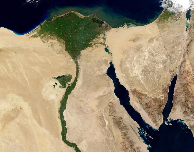
Identify Permanent Geographic Features Like Coastlines and Rivers
Focus on stable natural features that resist significant change over time periods spanning decades or centuries. Rocky coastlines, river confluences, and mountain peaks offer reliable reference points for georeferencing historical maps. Sharp bends in major rivers, distinctive headlands, and lake shorelines create easily identifiable control points that you can match between historical and contemporary datasets. Select features with clear geometric boundaries rather than gradual transitions that introduce measurement uncertainty into your georeferencing process.
Use Road Intersections and Settlement Centers as Reference Points
Select major road intersections that appear on both your historical map and current street networks, particularly those involving highways or primary thoroughfares that maintain consistent alignments over time. Town squares, market centers, and railroad crossings provide additional control points where multiple transportation routes converge. Prioritize intersections with angular geometry over gradual curves, as these offer more precise coordinate matching capabilities. Verify that selected road networks haven’t undergone major realignments that would compromise your georeferencing accuracy.
Apply Ground Control Point (GCP) Matching Techniques
Ground control point matching transforms your historical map’s coordinate system by establishing precise spatial relationships between identifiable features on the old map and their modern counterparts. This process requires systematic identification, verification, and distribution of reference points to ensure accurate geometric transformation.
Match Historical Features to Modern Coordinate Systems
Match historical landmarks with their contemporary locations using high-accuracy basemaps like USGS topographic quadrangles or satellite imagery. Churches, government buildings, and major intersections serve as reliable reference points since they’ve maintained consistent positions over decades. Cross-reference multiple modern datasets including OpenStreetMap, Google Earth Pro, and official municipal GIS layers to verify coordinate accuracy. Document each control point’s transformation parameters and maintain detailed records of feature identification confidence levels for quality assurance purposes.
Use GPS Data to Verify Control Point Accuracy
Verify control point locations through field-collected GPS coordinates using survey-grade receivers with sub-meter accuracy capabilities. RTK GPS systems provide centimeter-level precision for critical reference points like survey monuments and permanent structures. Compare field-collected coordinates against multiple digital basemaps to identify potential discrepancies in modern reference datasets. Record GPS metadata including datum information, coordinate system specifications, and measurement uncertainty values to maintain proper documentation standards throughout your georeferencing workflow.
Get accurate measurements with this 9-foot aluminum grade rod. Featuring easy-to-read markings and a durable, lightweight design, it's ideal for indoor and outdoor leveling tasks.

Create a Network of Well-Distributed Reference Points
Distribute control points evenly across your historical map’s extent to minimize geometric distortion during coordinate transformation processes. Position reference points near map corners, along edges, and throughout the central area to create a balanced triangular network configuration. Maintain minimum spacing of 20% of the map’s total dimension between adjacent control points to ensure adequate geometric strength. Avoid clustering multiple points in small areas while leaving large sections without reference coverage, as this creates transformation accuracy variations across different map regions.
Implement Polynomial Transformation Methods
Polynomial transformations provide mathematical solutions for correcting geometric distortions in historical maps by adjusting coordinate relationships between your reference points and target locations.
Choose the Right Polynomial Order for Your Map Type
First-order polynomials work best for maps with uniform scaling issues and minimal geometric distortion. You’ll achieve optimal results with topographic surveys, city plans, and cadastral maps that maintain consistent projection properties. Second-order transformations suit maps with moderate warping from paper shrinkage or mounting processes. Third-order polynomials handle severely distorted historical atlases and hand-drawn maps with irregular geometric properties.
Apply First-Order Transformations for Simple Scale Adjustments
Affine transformations preserve parallel lines and handle basic scaling, rotation, and translation corrections effectively. You’ll need minimum four control points distributed across your map’s corners to establish accurate coordinate relationships. This method works excellently for surveyor’s plats, engineering drawings, and modern topographic maps where geometric integrity remains intact. First-order corrections typically achieve RMS errors below 2-3 pixels for well-preserved historical documents.
Plan your next adventure with the 2025 National Geographic Road Atlas, covering the United States, Canada, and Mexico. Its durable, folded format (11 x 15 in) makes it ideal for hiking and camping trips.

Use Higher-Order Polynomials for Complex Geometric Corrections
Second and third-order polynomials accommodate non-linear distortions from paper stretching, mounting adhesives, and irregular digitization processes. You’ll require 6-10 control points for second-order and 10-15 points for third-order transformations to achieve stable results. Higher-order methods excel with hand-drawn maps, fabric-mounted charts, and documents with significant physical deterioration. Polynomial orders above third-degree often introduce unwanted oscillations between control points.
Utilize Rubber Sheeting and Spline Interpolation
Rubber sheeting and spline interpolation techniques offer sophisticated solutions for correcting complex geometric distortions that polynomial transformations can’t adequately address in historical maps.
Apply Rubber Sheeting for Non-Linear Distortion Correction
Rubber sheeting transforms your historical map by stretching and compressing different areas independently to match modern coordinate systems. This technique works particularly well for maps with irregular distortions caused by uneven paper shrinkage or mounting problems. You’ll need to distribute control points densely across areas showing the most distortion. The transformation preserves local topology while allowing for significant geometric adjustments in problematic regions.
Use Thin Plate Spline Methods for Smooth Transformations
Thin plate spline interpolation creates smooth, continuous transformations that minimize surface bending energy across your entire historical map. This method excels when you’re working with maps that have gradual distortions rather than sharp geometric breaks. You can achieve optimal results by placing control points at regular intervals and ensuring adequate coverage near map edges. The spline algorithm automatically generates smooth transitions between control points without creating artificial discontinuities.
Combine Multiple Transformation Techniques for Optimal Results
Combining rubber sheeting with polynomial transformations produces the most accurate georeferencing results for severely distorted historical maps. Start with a first-order polynomial transformation to correct overall scaling issues, then apply rubber sheeting to address localized distortions. You can further refine your results by using spline interpolation in areas where control point density is sufficient. This hybrid approach maximizes geometric accuracy while maintaining the historical map’s essential spatial relationships.
Conclusion
Mastering these five georeferencing techniques transforms your historical maps into powerful digital tools that bridge past and present. You’ll find that combining multiple approaches often yields the best results rather than relying on a single method.
Remember that patience and attention to detail make all the difference in your georeferencing success. Each historical map presents unique challenges that require careful consideration of which techniques will work best for your specific project.
Start with simpler methods like control point matching before moving to advanced techniques like spline interpolation. Your skills will improve with practice and you’ll develop an intuitive sense for selecting the right approach.
The investment in learning these georeferencing techniques pays dividends through enhanced research capabilities and more accurate spatial analysis of historical data.
Frequently Asked Questions
What is georeferencing and why is it important for historical maps?
Georeferencing is the process of assigning real-world coordinates to historical map features, connecting old coordinate systems with modern GPS-based mapping standards. This transformation converts static historical documents into dynamic digital assets that can be analyzed, compared, and overlaid with contemporary datasets, enabling researchers to study spatial changes over time.
What are the main challenges when georeferencing old maps?
The primary challenges include paper distortion from age and handling, outdated coordinate systems that don’t align with modern standards, faded text and damaged edges that obscure important details, and projection differences between historical and contemporary mapping methods. These issues can significantly impact the accuracy of the georeferencing process.
Which software tools are recommended for georeferencing historical maps?
QGIS and ArcGIS Pro are the most recommended software tools for georeferencing projects. These programs offer comprehensive georeferencing capabilities and support various transformation methods. Additionally, high-resolution scanners and calibrated monitors are essential hardware components that enhance accuracy and streamline the workflow process.
Get high-quality scans of photos and documents with the Epson Perfection V19 II. This scanner features 4800 dpi resolution for amazing detail and includes software to easily scan and create searchable PDFs.

How do I select appropriate control points on historical maps?
Choose identifiable landmarks that still exist today, such as churches, government buildings, and permanent geographic features like coastlines and rivers. Major road intersections and settlement centers also make excellent control points. Focus on features that have maintained their original locations and geometries to ensure precise coordinate transformations.
What is Ground Control Point (GCP) matching and how does it work?
GCP matching establishes precise spatial relationships between historical map features and their modern counterparts. This technique involves using high-accuracy basemaps and cross-referencing multiple modern datasets to verify coordinate accuracy. GPS data should be used to verify control point accuracy, preferably with survey-grade receivers for optimal precision.
When should I use different polynomial transformation methods?
First-order polynomials work best for maps with uniform scaling issues and require minimum four control points. Second-order transformations suit maps with moderate warping, while third-order polynomials are recommended for severely distorted maps. Higher-order polynomials need more control points but can handle complex geometric corrections more effectively.
What are rubber sheeting and spline interpolation techniques?
Rubber sheeting allows independent stretching and compressing of different map areas to match modern coordinate systems, particularly effective for irregular distortions. Thin plate spline methods create smooth transformations that minimize surface bending energy, ideal for gradual distortions. These advanced techniques address complex geometric issues that standard polynomial transformations cannot handle.
Can I combine different georeferencing techniques for better results?
Yes, a hybrid approach combining rubber sheeting with polynomial transformations often yields optimal results. This method maximizes geometric accuracy while preserving essential spatial relationships in historical maps. The combination approach is particularly effective for maps with varying distortion patterns across different areas.