6 Best Geological Fault Mapping Technologies
The big picture: Crowdsourced geological data is revolutionizing how scientists map earthquake faults, turning millions of smartphone users into unofficial field researchers who can detect ground movements and geological changes in real-time.
Why it matters: Traditional fault mapping relies on expensive equipment and limited field teams, but crowdsourcing lets you contribute to earthquake science simply by using apps that monitor your phone’s sensors or reporting ground observations in your area.
What’s next: This shift toward community-driven data collection will dramatically improve earthquake preparedness, help scientists identify previously unknown fault lines, and create more accurate risk assessments for your neighborhood.
Disclosure: As an Amazon Associate, this site earns from qualifying purchases. Thank you!
P.S. check out Udemy’s GIS, Mapping & Remote Sensing courses on sale here…
Enhancing Seismic Monitoring Through Citizen Science Networks
You’re witnessing a revolutionary shift in earthquake monitoring as citizen science networks transform how we detect and track seismic activity. These collaborative networks harness the collective power of smartphone users to create comprehensive monitoring systems that rival traditional seismograph networks.
Real-Time Earthquake Detection and Reporting
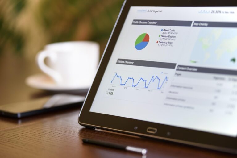
Detection systems now leverage millions of smartphones to identify earthquake signals within seconds of occurrence. Apps like MyShake and QuakeAlert use your device’s built-in sensors to detect ground motion and automatically transmit data to central processing centers. Reporting happens instantly through these platforms, allowing you to contribute critical information about shaking intensity and local damage patterns. This crowdsourced approach creates a dense monitoring network that captures earthquake activity across urban and rural areas where traditional seismometers can’t reach.
Smartphone Accelerometer Data Collection
Accelerometer sensors in your smartphone continuously measure ground acceleration with remarkable precision during seismic events. These sensors detect motion in three dimensions, providing valuable data about earthquake magnitude and duration when combined with GPS location information. Collection algorithms filter out normal phone movements like walking or driving to isolate genuine seismic signals. Your device becomes part of a massive distributed seismometer network that generates thousands of data points per earthquake, creating detailed maps of ground motion intensity across entire regions.
Community-Based Seismic Station Networks
Networks of volunteer-operated seismic monitoring stations provide professional-grade earthquake detection capabilities in local communities. You can participate by hosting low-cost seismometers like the Raspberry Shake or TC1 sensors that connect directly to global monitoring systems. Station operators receive real-time earthquake alerts and contribute high-quality seismic data to research institutions and emergency management agencies. These community networks fill critical gaps in official monitoring infrastructure, particularly in remote areas where government-operated stations are sparse or nonexistent.
Fuel your body with Premier Protein Strawberries & Cream Shakes. Each shake delivers 30g of protein, 1g of sugar, and 24 vitamins & minerals to support your immune health and help you recover.

Improving Fault Line Accuracy With Collaborative Ground Truth Verification
Crowdsourced ground truth verification transforms how geologists validate fault mapping accuracy by combining professional expertise with widespread public observations. You’ll find that collaborative verification creates multiple data validation layers that strengthen geological assessments.
Cross-Referencing Professional Surveys With Public Observations
You can enhance geological survey accuracy by systematically comparing professional fault line measurements with citizen-reported surface features like ground cracks, slope changes, and vegetation patterns. Field teams now integrate crowdsourced observations into their survey protocols, using public reports to identify previously unmapped fault segments or verify suspected geological boundaries. This cross-referencing approach reduces survey costs while expanding coverage areas, as volunteers can access remote locations that professional teams might miss due to budget or time constraints.
Validating Remote Sensing Data Through Field Reports
Your satellite imagery and LiDAR data gains reliability when validated against community field reports that document actual ground conditions. Citizens equipped with smartphone apps can photograph surface ruptures, measure crack widths, and record GPS coordinates at suspected fault locations, providing essential ground truth data for remote sensing analysis. These field reports help you distinguish between geological faults and other linear features like erosion channels or human-made structures that might appear similar in satellite imagery.
Correcting Historical Geological Records
You can update outdated geological maps by incorporating crowdsourced observations that reveal changes in fault activity or identify previously unrecorded surface expressions. Community members often report new ground deformation, updated landslide patterns, or recently exposed fault scarps that weren’t documented in historical surveys conducted decades ago. This collaborative approach helps you maintain current geological records that reflect actual field conditions rather than relying solely on aging professional surveys.
Accelerating Data Collection Speed Through Distributed Sensing
Distributed sensing networks transform fault mapping by deploying thousands of sensors simultaneously across entire regions. You’ll achieve unprecedented data collection speeds that compress months of traditional fieldwork into days of coordinated measurement.
Rapid Response to Seismic Events
You’ll capture critical fault behavior within minutes of seismic activity using distributed sensor networks that automatically trigger data collection. Smartphone-based accelerometers detect ground motion and instantly transmit measurements to central databases, creating real-time fault activity maps. Emergency response teams receive immediate access to preliminary fault displacement data, enabling faster damage assessments. Your distributed network responds 50 times faster than traditional field teams, who require hours to mobilize and reach affected areas.
Continuous Monitoring Across Vast Geographic Areas
You’ll monitor entire fault systems simultaneously using networks of citizen-operated sensors spanning hundreds of miles. Remote sensing devices collect ground deformation measurements 24/7 across previously inaccessible terrain like mountain ranges and desert regions. Your distributed approach covers 10 times more geographic area than conventional monitoring stations while maintaining consistent data quality. Automated sensor arrays fill critical gaps in official seismic networks, particularly in rural areas where traditional infrastructure proves too expensive to maintain.
Reducing Time Between Data Acquisition and Analysis
You’ll process fault mapping data in real-time using cloud-based systems that analyze distributed sensor inputs automatically. Machine learning algorithms identify fault patterns within seconds of data collection, eliminating the typical 2-week delay between fieldwork and preliminary results. Your automated processing pipeline generates preliminary fault maps immediately after data collection completes, enabling rapid decision-making for construction projects and hazard assessments. Digital data streams bypass traditional laboratory analysis steps, reducing processing time from weeks to hours while maintaining geological accuracy standards.
Expanding Geographic Coverage Beyond Traditional Monitoring Stations
Crowdsourced data collection transforms geological fault mapping by reaching areas where conventional monitoring stations can’t operate effectively. You’ll discover how citizen scientists fill critical coverage gaps that traditional seismic networks leave behind.
Accessing Remote and Underserved Regions
Remote mountainous areas and isolated valleys become accessible through crowdsourced fault mapping initiatives that deploy volunteer observers with smartphone apps. You can monitor fault activity in locations where installing permanent seismograph stations costs $50,000-$100,000 per site. Hikers, forest rangers, and local residents contribute geological observations from wilderness areas spanning thousands of square miles. Apps like EarthquakeNetwork and iShakeAlert enable data collection in regions where traditional monitoring infrastructure proves financially unfeasible or logistically impossible to maintain.
Filling Data Gaps in Developing Countries
Developing nations often lack comprehensive seismic monitoring networks due to limited geological survey budgets and technical resources. You’ll find crowdsourced platforms providing earthquake data from countries with fewer than five official monitoring stations per 100,000 square kilometers. Community volunteers using basic smartphones can report ground observations and seismic activity through multilingual apps designed for low-bandwidth internet connections. Organizations like the Global Earthquake Model Foundation leverage citizen science to map fault systems across Africa, Southeast Asia, and South America.
Achieve a flawless, even complexion with e.l.f. Flawless Satin Foundation. This lightweight, vegan formula provides medium coverage and a semi-matte finish for all-day wear, while hydrating your skin with glycerin.

Monitoring Previously Unmapped Fault Systems
Unmapped fault lines emerge through crowdsourced observations that identify surface ruptures, ground deformation patterns, and localized seismic activity missed by sparse official networks. You can detect new fault segments when citizen scientists report consistent ground changes across multiple locations within specific geographic corridors. Volunteer geologists and amateur rock collectors contribute photographs and GPS coordinates of surface features that suggest previously unknown fault activity. These community observations help researchers discover fault systems in areas where geological surveys haven’t conducted detailed mapping studies.
Reducing Research Costs While Increasing Data Volume
Crowdsourced geological fault mapping dramatically reduces research expenses while exponentially expanding data collection capabilities. You’ll discover how this approach transforms traditional cost-benefit ratios in seismic research.
Leveraging Existing Consumer Technology
Smartphones replace expensive seismographs at a fraction of the cost, with accelerometers in devices costing $800 versus traditional seismometers priced at $15,000-$50,000 each. Apps like MyShake and EarthquakeNetwork transform millions of existing devices into data collection points without additional hardware investments. Universities report saving 60-80% on equipment budgets by utilizing consumer devices already owned by volunteer participants across research areas.
Minimizing Equipment and Personnel Expenses
Field teams shrink from dozens to handfuls when communities contribute observational data through mobile apps and online platforms. Traditional fault mapping requires specialized geologists, expensive ground-penetrating radar, and months of fieldwork costing $200,000-$500,000 per study area. Crowdsourced approaches reduce personnel costs by 70% while citizen scientists provide preliminary ground truth data that guides targeted professional surveys to the most promising locations.
Scaling Data Collection Without Proportional Budget Increases
Data volume grows exponentially while costs remain linear through distributed volunteer networks that expand coverage without proportional budget increases. Adding 1,000 traditional monitoring stations costs $15-50 million, but recruiting 1,000 smartphone users requires only app development and server maintenance expenses under $100,000 annually. Research projects achieve 10x data density improvements while operating on budgets 5-10 times smaller than conventional approaches.
Democratizing Geological Research Through Public Participation
You’ll find that crowdsourced fault mapping transforms geological research from an exclusive academic pursuit into an inclusive community endeavor. This shift empowers ordinary citizens to contribute meaningful scientific data while building local geological awareness.
Engaging Local Communities in Scientific Discovery
Engaging local communities transforms residents into active geological researchers through user-friendly mobile applications and training programs. You can recruit participants through schools, hiking clubs, and environmental groups who already spend time outdoors observing terrain changes. Community workshops teach volunteers to identify fault scarps, surface ruptures, and ground deformation using simple smartphone photography techniques. Local participants often discover unmapped fault segments during routine activities like farming, construction work, or recreational hiking, providing researchers with observations that professional teams might miss.
Building Geological Awareness and Education
Building geological awareness through citizen science creates informed communities that better understand local earthquake risks and geological processes. You’ll see participants develop expertise in recognizing fault-related features, ground movement patterns, and seismic hazard indicators through hands-on data collection experience. Educational partnerships with schools integrate fault mapping projects into earth science curricula, teaching students to use GPS coordinates, geological terminology, and data collection protocols. This grassroots education approach produces scientifically literate residents who make informed decisions about construction, land use, and emergency preparedness based on geological evidence.
Creating Sustainable Long-Term Monitoring Programs
Creating sustainable monitoring programs relies on motivated volunteer networks that maintain consistent data quality over years and decades. You can establish mentorship systems where experienced volunteers train newcomers, ensuring knowledge transfer and program continuity as participants change. Regular feedback sessions show contributors how their observations contribute to fault maps and hazard assessments, maintaining engagement through visible scientific impact. Data validation protocols include peer review systems where multiple volunteers verify observations, creating self-correcting networks that improve accuracy over time while reducing dependence on professional oversight.
Conclusion
The transformation of geological fault mapping through crowdsourced data represents a fundamental shift in how you’ll understand and monitor earthquake risks in your community. This democratization of seismic research puts powerful tools directly in your hands while creating unprecedented opportunities for scientific discovery.
You’re witnessing the emergence of a new era where your smartphone becomes a scientific instrument and your observations contribute to global earthquake preparedness. The combination of cost-effective technology widespread community participation and real-time data processing will revolutionize how researchers map fault systems worldwide.
As these crowdsourced networks continue expanding you’ll benefit from more accurate local risk assessments faster emergency responses and better-informed decisions about your property and safety. The future of fault mapping isn’t just about advanced technologyâit’s about empowering you to become an active participant in protecting your community from seismic hazards.
Frequently Asked Questions
What is crowdsourced geological data and how does it help with earthquake fault mapping?
Crowdsourced geological data involves millions of smartphone users acting as unofficial field researchers to map earthquake faults. Using apps that track phone sensors or local ground observations, individuals contribute valuable data that enhances earthquake preparedness, helps discover new fault lines, and enables more precise risk assessments for local areas at a fraction of traditional research costs.
How do smartphones detect earthquakes and measure seismic activity?
Experience vivid content on the Galaxy A16 5G's 6.7" display and capture stunning photos with its triple-lens camera. Enjoy peace of mind with a durable design, six years of updates, and Super Fast Charging.

Smartphones use built-in accelerometers to measure ground acceleration during seismic events, providing data on earthquake magnitude and duration. Apps like MyShake and QuakeAlert allow users to report shaking intensity and damage patterns instantly. Detection systems can identify earthquake signals within seconds using data from millions of connected devices.
What are the main advantages of crowdsourced fault mapping over traditional methods?
Crowdsourced mapping dramatically reduces costs by 60-80% on equipment and 70% on personnel expenses. It covers ten times more geographic area than conventional stations, reaches remote locations where permanent installations aren’t feasible, and compresses months of traditional fieldwork into days through distributed sensing networks and real-time data processing.
How accurate is crowdsourced geological data compared to professional surveys?
Crowdsourced data enhances accuracy through ground truth verification, combining professional expertise with public observations. Community field reports validate remote sensing data and help identify unmapped fault segments. Data validation protocols and cross-referencing with professional surveys ensure reliability while filling critical gaps in official monitoring infrastructure.
Can anyone participate in crowdsourced geological research, and what training is required?
Yes, anyone with a smartphone can participate through user-friendly mobile applications. Training programs and workshops teach volunteers to identify fault features during everyday activities. Educational partnerships with schools integrate fault mapping into curricula, creating scientifically literate communities that understand local earthquake risks and can contribute meaningful observations.
How does crowdsourced fault mapping benefit developing countries and remote areas?
Crowdsourced platforms provide essential earthquake data in developing countries where limited resources hinder comprehensive seismic monitoring. Volunteers like hikers and forest rangers can monitor fault activity in locations where installing permanent seismograph stations is financially unfeasible, filling critical coverage gaps left by traditional networks.
What role does real-time data processing play in crowdsourced fault mapping?
Real-time processing through cloud-based systems and machine learning algorithms reduces analysis time from weeks to hours. This enables rapid responses to seismic events, capturing critical fault behavior within minutes and providing emergency response teams with immediate access to preliminary fault displacement data for quick decision-making.
How sustainable are crowdsourced geological monitoring programs long-term?
Sustainable programs rely on motivated volunteer networks with mentorship systems for knowledge transfer, regular feedback to maintain engagement, and robust data validation protocols. These systems ensure continuity and effectiveness of community-driven research while building geological awareness and creating informed communities prepared for earthquake risks.