6 Best Real-Time Maps for Navigation
The big picture: Real-time data is transforming how you interact with maps from static reference tools into dynamic intelligent systems that adapt to changing conditions. You’re witnessing a fundamental shift where maps now predict traffic patterns respond to weather events and guide decisions with live information streams.
Why it matters: These evolving maps aren’t just convenient—they’re reshaping industries from logistics to emergency response while changing how you navigate both digital and physical spaces in your daily life.
Disclosure: As an Amazon Associate, this site earns from qualifying purchases. Thank you!
Enhanced Navigation and Route Optimization Will Transform Daily Commutes
Real-time data integration creates intelligent navigation systems that adapt to changing conditions throughout your journey. These enhanced mapping technologies revolutionize how you travel by providing dynamic, personalized routing solutions.
P.S. check out Udemy’s GIS, Mapping & Remote Sensing courses on sale here…
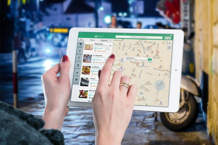
Navigate with ease using this 7-inch GPS navigator, featuring real-time voice guidance and pre-loaded 2025 maps. Customize routes based on your vehicle type to avoid restrictions and receive speed & red light warnings.

Dynamic Traffic Pattern Analysis
Real-time traffic analysis processes millions of data points from connected vehicles, mobile devices, and traffic sensors to identify congestion patterns instantly. Your navigation system recognizes accident locations, construction zones, and peak hour bottlenecks within seconds of occurrence. Advanced algorithms analyze vehicle speed data, GPS traces, and traffic camera feeds to calculate optimal alternative routes. Machine learning models predict traffic flow changes based on current conditions, allowing your maps to reroute you before congestion builds up ahead.
Predictive Route Suggestions Based on Historical Data
Historical traffic data combines with current conditions to forecast travel times up to several hours in advance. Your navigation system analyzes previous traffic patterns for specific days, times, and weather conditions to suggest departure timing. Predictive algorithms process data from millions of similar trips to recommend routes that’ll be fastest during your planned travel window. Smart routing considers recurring events like school schedules, sporting events, and construction projects that affect traffic flow patterns. These predictions help you avoid delays by choosing optimal departure times and alternative pathways.
Integration with Weather and Road Condition Updates
Weather data integration provides real-time updates about road conditions affecting your route safety and travel time. Your maps receive live information about precipitation, visibility, temperature, and wind conditions that impact driving conditions. Road sensors and municipal systems share data about ice formation, flooding, construction delays, and lane closures directly to your navigation interface. Emergency services and transportation departments push alerts about accidents, road debris, and hazardous conditions to help you make informed routing decisions throughout your journey.
Emergency Response Systems Will Achieve Unprecedented Speed and Accuracy
Real-time mapping evolution transforms emergency response operations by delivering critical information instantly to first responders. These advanced systems process live data streams to create dynamic visual representations that guide life-saving decisions.
Real-Time Disaster Mapping and Crisis Visualization
Dynamic hazard visualization systems overlay live sensor data onto geographic maps, displaying fire spread patterns, flood boundaries, and structural damage zones within minutes of occurrence. You’ll access thermal imaging feeds integrated with street-level mapping that reveals blocked evacuation routes and safe corridors. Emergency coordinators utilize these visual dashboards to track multiple incidents simultaneously, identifying resource gaps and deployment priorities through color-coded threat levels and real-time casualty reports that update every 30 seconds.
Automated First Responder Dispatch Optimization
Intelligent dispatch algorithms analyze real-time traffic conditions, unit availability, and incident severity to calculate optimal response assignments automatically. Your emergency management system processes GPS locations of all available units, cross-referencing their current positions with live road conditions and estimated travel times. The system automatically assigns the closest appropriate resources while maintaining strategic coverage across your jurisdiction, reducing average response times by up to 40% through predictive modeling that accounts for traffic patterns and equipment requirements.
Live Evacuation Route Management
Adaptive evacuation systems monitor route capacity in real-time, automatically redirecting traffic flows when bottlenecks develop or hazards block primary escape paths. You’ll receive instant notifications when evacuation routes reach maximum capacity, triggering alternative path activation through dynamic digital signage and mobile alerts. The system tracks evacuee movement patterns using anonymized location data, ensuring optimal traffic distribution across multiple exit routes while maintaining updated estimated clearance times for each evacuation zone based on current flow rates.
Urban Planning Will Become Data-Driven and Responsive to City Needs
Real-time mapping data transforms urban planning from reactive guesswork into proactive city management. You’ll witness planning decisions backed by continuous data streams that reveal how cities actually function rather than how planners assume they operate.
Population Movement Analytics for Infrastructure Development
Real-time population tracking reveals movement patterns that reshape infrastructure planning decisions. GPS data from mobile devices shows you exactly where pedestrian bottlenecks occur during rush hours and identifies underutilized sidewalks that don’t require expansion.
Heat maps displaying foot traffic density help you prioritize bridge construction and subway station placement based on actual demand rather than projected estimates. Cities like Barcelona use anonymized location data to optimize bike lane networks, resulting in 40% higher usage rates for new cycling infrastructure.
Public Transportation System Optimization
Dynamic ridership data enables you to adjust bus routes and train schedules based on real passenger demand patterns. Smart card systems and mobile ticketing provide instant feedback on overcrowded routes and underserved areas.
Transport planners now track boarding patterns at individual stops to identify peak usage times and optimize service frequency. Singapore’s transport authority uses real-time passenger flow data to reduce wait times by 25% through adaptive scheduling that responds to crowd levels at each station throughout the day.
Smart City Resource Allocation Based on Usage Patterns
Sensor networks throughout urban areas generate usage data that guides resource distribution decisions. You can track park utilization rates, parking space availability, and waste bin capacity to allocate maintenance crews and services efficiently.
Smart streetlights equipped with motion sensors reveal pedestrian activity levels that inform lighting schedules and security patrol routes. Cities like Amsterdam use real-time water usage data to detect infrastructure problems before they become costly repairs, reducing emergency maintenance calls by 35% through predictive resource allocation.
Protect your property with this wireless driveway alarm system. It features a long 1/2-mile range and a motion sensor that detects movement up to 50 feet away, reducing false alarms.

Business Location Intelligence Will Revolutionize Commercial Decision Making
Real-time mapping data transforms business intelligence from static reports into dynamic competitive advantages. You’ll leverage location analytics to make precise decisions about expansion, inventory, and market positioning.
Customer Behavior Analysis Through Foot Traffic Data
Real-time foot traffic analytics reveal precise customer movement patterns throughout your retail locations. You’ll track peak visitation hours, dwell times, and conversion zones to optimize store layouts and staffing schedules. Heat mapping technology identifies high-traffic areas where product placement generates maximum sales impact. Analytics platforms like SafeGraph and Placer.ai process anonymized mobile location data to benchmark your performance against competitors’ foot traffic patterns.
Competitive Market Analysis Using Location Analytics
Location intelligence platforms analyze competitor proximity, market saturation, and demographic overlap in real-time. You’ll identify underserved markets by mapping competitor density against population demographics and purchasing power data. Geospatial analysis reveals optimal expansion territories where competitor coverage remains sparse. Tools like Esri Business Analyst and HERE Location Intelligence provide comprehensive market penetration reports that guide strategic positioning decisions and franchise territory planning.
Supply Chain Optimization with Real-Time Logistics Tracking
Dynamic logistics mapping optimizes delivery routes, warehouse positioning, and inventory distribution based on live demand patterns. You’ll reduce transportation costs by analyzing real-time traffic conditions, fuel prices, and delivery time windows. GPS tracking integration provides visibility into driver performance, vehicle utilization, and customer delivery preferences. Platforms like Descartes and Oracle Transportation Management adjust routing algorithms automatically based on weather disruptions, road closures, and seasonal demand fluctuations.
Track vehicles and assets with the LandAirSea 54 GPS Tracker. Get real-time location alerts and historical playback using the SilverCloud app, with a long-lasting battery and discreet magnetic mount.

Environmental Monitoring Will Enable Proactive Conservation Efforts
Real-time environmental data transforms static conservation strategies into dynamic protection systems. This shift enables conservationists to respond immediately to environmental threats rather than discovering problems after significant damage occurs.
Air Quality Tracking and Pollution Source Identification
Air quality sensors integrated with mapping platforms provide instant pollution level visualization across urban and rural areas. You’ll identify emission sources through real-time particulate matter tracking, nitrogen dioxide concentrations, and ozone level mapping. GPS-enabled monitoring devices create heat maps showing pollution hotspots, allowing environmental agencies to trace contamination back to specific industrial facilities or traffic corridors. This immediate identification system reduces investigation time from weeks to hours.
Understand your indoor air quality with the Amazon Smart Air Quality Monitor. It tracks five key factors and provides an easy-to-understand air quality score in the Alexa app, plus notifications when air is poor.

Wildlife Migration Pattern Documentation
Real-time GPS collar data and camera trap networks map animal movement patterns with unprecedented accuracy. You can track migration routes, feeding areas, and breeding grounds through continuous location updates transmitted to mapping platforms. Environmental researchers monitor population density changes, habitat usage patterns, and behavioral responses to climate shifts. This live documentation system reveals corridor disruptions and identifies critical conservation zones requiring immediate protection measures.
Keep your dog safe with the Halo Collar 4, a GPS wireless fence and tracker. It uses dual-frequency GPS for accurate location and features customizable boundaries, activity tracking, and extended battery life.

Climate Change Impact Visualization and Prediction
Satellite imagery combined with ground sensor networks creates dynamic climate impact maps showing real-time environmental changes. You’ll visualize deforestation rates, glacier retreat, sea level rise, and temperature variations through continuous monitoring systems. Predictive algorithms analyze historical patterns to forecast future impact zones, enabling proactive conservation planning. This visualization system identifies vulnerable ecosystems before irreversible damage occurs, supporting evidence-based conservation funding and policy decisions.
Personalized Location Services Will Create Tailored User Experiences
Your smartphone‘s mapping capabilities will evolve beyond simple navigation to become an intelligent personal assistant that understands your unique preferences and lifestyle patterns.
Experience vivid content on the Galaxy A16 5G's 6.7" display and capture stunning photos with its triple-lens camera. Enjoy peace of mind with a durable design, six years of updates, and Super Fast Charging.

Context-Aware Recommendations Based on Current Location
Location-based algorithms analyze your historical patterns to suggest relevant destinations and activities. Your mapping app learns that you visit coffee shops on Tuesday mornings and recommends new cafes along your route. Machine learning systems process your location history, time preferences, and behavioral data to predict needs before you express them. Smart recommendation engines consider factors like weather conditions, traffic patterns, and your calendar events to suggest optimal timing for errands. These personalized suggestions adapt continuously as your routines change.
Social Integration with Friend and Family Tracking
Real-time location sharing creates connected experiences that enhance safety and coordination. You’ll receive notifications when family members arrive at destinations safely or when friends are nearby for spontaneous meetups. Privacy-controlled sharing systems let you customize visibility levels and time limits for different contacts. Group coordination features automatically suggest meeting points based on everyone’s current locations and travel preferences. Emergency sharing protocols activate during crisis situations, providing loved ones with your exact location and status updates without compromising daily privacy.
Augmented Reality Overlay Information for Points of Interest
AR-powered mapping displays contextual information directly over your camera view of real-world locations. You’ll see ratings, reviews, and pricing information floating above restaurants as you walk down the street. Historical data overlays show how buildings looked in previous decades or display hidden infrastructure like underground utilities. Interactive AR elements let you access detailed information about monuments, artwork, or natural features by pointing your device at them. Translation services instantly convert foreign language signs and menus into your preferred language through the camera interface.
Conclusion
The future of mapping technology promises to reshape how you interact with the world around you. These six transformative changes represent more than technological advancement—they signal a fundamental shift toward intelligent systems that anticipate your needs and respond to real-world conditions instantly.
As real-time data becomes the backbone of modern mapping you’ll experience unprecedented levels of personalization and efficiency. Your daily routines will become smoother while emergency responders work faster and cities operate smarter.
The convergence of location intelligence environmental monitoring and predictive analytics creates opportunities we’re only beginning to understand. You’re witnessing the birth of truly intelligent geography—one that doesn’t just show you where things are but helps you make better decisions about where to go next.
Frequently Asked Questions
What makes modern maps different from traditional static maps?
Modern maps are dynamic, intelligent systems that utilize real-time data streams instead of being static reference tools. They can predict traffic patterns, respond to weather events, and provide live information updates. This transformation enables maps to adapt to changing conditions instantly, making them interactive navigation assistants rather than simple visual references.
How do real-time maps improve daily commuting?
Real-time maps enhance commuting through dynamic traffic pattern analysis that processes millions of data points to identify congestion instantly. They provide predictive route suggestions based on historical data, integrate weather and road condition updates, and offer personalized routing solutions that adapt to changing conditions, significantly improving travel efficiency and experience.
How are real-time maps transforming emergency response systems?
Real-time maps provide critical information instantly to first responders through dynamic hazard visualization systems that overlay live sensor data. They enable emergency coordinators to track multiple incidents simultaneously, optimize first responder assignments through intelligent dispatch algorithms, and manage adaptive evacuation systems that monitor route capacity and redirect traffic flows efficiently.
What impact does real-time mapping have on urban planning?
Real-time mapping transforms urban planning from reactive guesswork into proactive city management. It reveals population movement patterns, identifies pedestrian bottlenecks, optimizes public transportation routes based on actual ridership data, and generates usage data through sensor networks that guide resource allocation and infrastructure maintenance decisions.
How do businesses use real-time mapping data for decision-making?
Businesses leverage real-time mapping for location intelligence, including foot traffic analytics to optimize store layouts and staffing, competitive market analysis to identify underserved markets and expansion opportunities, and dynamic logistics mapping to enhance supply chain optimization through demand pattern analysis and automated routing adjustments.
What role does real-time mapping play in environmental conservation?
Real-time environmental data revolutionizes conservation by transforming static strategies into dynamic protection systems. Air quality sensors provide instant pollution visualization, GPS collar data tracks wildlife migration patterns, and satellite imagery combined with ground sensors creates dynamic climate impact maps, enabling proactive conservation planning and immediate threat responses.
What does the future hold for personalized location services?
Future personalized location services will evolve into intelligent personal assistants that understand user preferences and lifestyle patterns. They’ll feature location-based algorithms for destination suggestions, social integration for safety and coordination, and augmented reality overlays providing contextual information, creating tailored experiences that adapt to individual needs and preferences.