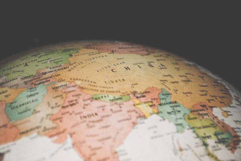
7 Best Map Symbol Considerations for Global Audiences
Why it matters: Map symbols carry deep cultural meanings that can make or break your message across different audiences. What you think is a simple directional arrow might accidentally offend someone or completely miss the mark in another culture.
The bottom line: Whether you’re designing tourist maps for international visitors or creating global navigation systems, understanding how different cultures interpret visual symbols is crucial for effective communication. These seven key considerations will help you avoid costly mistakes and create maps that truly work for everyone.
Navigate with ease using this 7-inch GPS navigator, featuring real-time voice guidance and pre-loaded 2025 maps. Customize routes based on your vehicle type to avoid restrictions and receive speed & red light warnings.

Disclosure: As an Amazon Associate, this site earns from qualifying purchases. Thank you!
Understanding Cultural Context in Color Interpretation
Color perception in map design extends far beyond personal preference, deeply rooting itself in cultural symbolism that can make or break your map’s effectiveness with international audiences.
P.S. check out Udemy’s GIS, Mapping & Remote Sensing courses on sale here…
Red’s Varying Meanings Across Cultures
Red signals danger and prohibition in Western mapping conventions, but you’ll find it represents prosperity and good fortune across much of Asia. Chinese cartographers traditionally use red for positive indicators like economic growth zones, while Middle Eastern cultures associate red with strength and power. Your Western-designed emergency evacuation maps could confuse users in regions where red symbolizes celebration rather than warning.
Explore and map the wilderness for the Queen in Cartographers! Draw unique terrain shapes and score points based on randomly selected goals each game, but beware of monster ambushes.

Blue’s Cultural Significance in Different Regions
Blue universally represents water bodies in most mapping traditions, yet its symbolic weight varies dramatically across cultures. Western audiences associate blue with trust and stability, making it ideal for government or institutional mapping projects. However, you should know that some African cultures link blue with mourning, while certain South American indigenous groups connect blue with sacred spaces requiring respectful representation.
Color Blindness and Accessibility Considerations
Color blindness affects approximately 8% of men and 0.5% of women globally, making your color choices critical for map accessibility. Deuteranopia (red-green color blindness) poses the greatest challenge, requiring you to avoid red-green combinations for critical map elements. You can enhance accessibility by incorporating pattern fills, varying line weights, and using high-contrast color combinations that remain distinguishable across different types of color vision deficiency.
Recognizing Religious and Sacred Symbol Variations
Religious symbols carry profound meaning that varies dramatically across cultures and faiths. You’ll encounter significant challenges when these symbols appear in your mapping projects without proper cultural context.
Cross Symbols in Christian vs. Non-Christian Contexts
Cross symbols represent Christianity in Western contexts but can appear offensive or meaningless in predominantly non-Christian regions. You should avoid using crosses as generic hospital or medical symbols in Buddhist or Hindu areas where red crescents or other culturally appropriate symbols work better. Consider that Greek Orthodox crosses differ from Roman Catholic ones, and some cultures associate crosses with colonialism rather than healing or safety.
Star Symbols and Their Religious Connotations
Star symbols carry distinct religious meanings that you must distinguish carefully in your map design. The six-pointed Star of David represents Judaism while the five-pointed star often symbolizes Islam in many Middle Eastern contexts. You’ll find that eight-pointed stars hold significance in various Christian traditions, and pentagram stars can represent Wiccan or pagan beliefs. Using stars generically for ratings or importance without considering local religious associations can create unintended offense.
Sacred Geography and Holy Site Representations
Sacred sites require special consideration in your mapping approach since different religions designate various geographical features as holy. You’ll need to research whether mountains, rivers, or forests hold religious significance before using standard topographical symbols. Islamic cultures often consider certain directions sacred, while Hindu traditions may designate specific cardinal orientations as spiritually important. Buddhist and indigenous cultures frequently assign sacred status to natural landmarks that shouldn’t be marked with secular symbols.
Adapting Directional Conventions for Global Audiences
Directional conventions vary significantly across cultures, requiring careful adaptation of your mapping approach for international audiences. Understanding these differences prevents navigation confusion and ensures your maps communicate effectively across diverse cultural contexts.
North-Up vs. Alternative Orientation Preferences
North-up orientation dominates Western cartographic traditions, but many cultures prefer alternative orientations based on local geography or cultural significance. Middle Eastern maps traditionally place east at the top, reflecting the direction of Mecca for Islamic navigation. Pacific Island cultures often orient maps toward prevailing winds or ocean currents rather than magnetic north. You’ll need to research regional preferences and consider rotating your base map orientation when targeting specific cultural audiences for maximum usability.
Left-to-Right vs. Right-to-Left Reading Patterns
Reading patterns directly influence how users scan and interpret directional information on your maps. Arabic and Hebrew speakers naturally scan from right to left, affecting their perception of map flow and legend placement. You should position north arrows, scale bars, and directional indicators on the right side for RTL audiences. Chinese and Japanese readers may scan vertically before horizontally, requiring different legend layouts and symbol positioning to match their natural eye movement patterns.
Cardinal Direction Symbolism Across Cultures
Cardinal directions carry distinct cultural meanings that influence map interpretation and user trust. Chinese feng shui principles associate north with water and career, while south represents fire and fame, affecting how audiences perceive directional symbols. Native American traditions often emphasize the four sacred directions with specific colors and spiritual meanings. You’ll achieve better cultural resonance by researching local directional symbolism and adapting your compass roses, arrows, and orientation indicators to reflect culturally appropriate design elements.
Incorporating Culturally Appropriate Animal and Nature Imagery
Animal and plant symbols in maps carry profound cultural meanings that can either enhance or undermine your mapping project’s effectiveness.
Animals as Cultural Symbols and Taboos
Animals represent vastly different concepts across cultures, making careful selection essential for international mapping projects. While elephants symbolize wisdom and good fortune in Asian cultures, they’re associated with memory in Western contexts. Lions evoke courage in European heraldry but represent danger in African communities living near wildlife populations. Pigs appear in Western agricultural mapping but offend Islamic and Jewish audiences. Owls signify wisdom in Greek traditions yet represent death omens in many Native American cultures. Research local animal associations before incorporating fauna symbols into your cartographic work.
Plant Symbolism in Different Traditions
Plant imagery carries cultural weight that varies dramatically between regions and religious traditions. Lotus flowers represent purity and enlightenment in Buddhist and Hindu contexts but lack meaning in Christian cultures. Oak trees symbolize strength in Celtic traditions while bamboo represents flexibility in East Asian cultures. Cannabis leaves, though botanically accurate for agricultural maps, create controversy in conservative regions. Cedar trees hold sacred significance for many Indigenous North American groups. Palm trees suggest tropical paradise in Western marketing but represent basic sustenance in Middle Eastern desert communities.
Navigate international business with ease using The Culture Map. Understand cultural differences and improve communication for successful global collaborations.

Natural Feature Representations and Meanings
Natural landmarks hold sacred or symbolic significance that affects how you should represent them cartographically. Mountains often represent spiritual ascension in Himalayan cultures but signify obstacles in Western interpretations. Rivers symbolize life and fertility in Egyptian traditions yet represent boundaries in European contexts. Deserts evoke spiritual purification in Islamic culture but suggest desolation in Christian symbolism. Forests represent mystery in Germanic folklore while symbolizing community in many African traditions. Volcanic features inspire fear in some Pacific Island cultures but represent creation stories in Hawaiian traditions.
Addressing Text and Typography Cultural Sensitivities
Typography choices significantly impact map readability and cultural acceptance across diverse audiences. Understanding text direction, font selection, and multilingual labeling ensures your maps communicate effectively regardless of cultural background.
Script Direction and Language Considerations
Script direction affects how users visually navigate your maps and interpret spatial relationships. Arabic, Hebrew, and Urdu scripts read from right to left, influencing how speakers of these languages scan map layouts and process information flow. Consider placing legends and text blocks on the left side for right-to-left languages, and test your map orientation with native speakers to ensure natural reading patterns.
Font Choices and Cultural Appropriateness
Font selection carries cultural weight that can enhance or undermine your map’s credibility with specific audiences. Avoid decorative fonts that mimic cultural scripts unless you’re working with native speakers who can verify appropriateness. Stick to clean, readable fonts like Arial or Helvetica for international projects, ensuring proper character support for diacritical marks and special characters required by local languages.
Multilingual Labeling Best Practices
Multilingual labeling requires strategic placement and hierarchy to maintain map clarity while respecting linguistic priorities. Place the dominant local language first, followed by secondary languages in smaller text sizes. Use consistent formatting rules across all language versions, and allocate sufficient space for text expansion since some languages require 30-50% more characters than English for equivalent meaning.
Balancing Universal Symbols with Local Conventions
Achieving effective map communication requires careful balance between internationally recognized symbols and region-specific conventions. You’ll need to evaluate when global standards serve your audience versus when local adaptations enhance usability.
ISO Standards vs. Regional Preferences
ISO 3864 provides internationally standardized symbols for safety signs and pictograms that you can apply to mapping projects. However, you’ll find that regional preferences often override these standards in practice. European mapping typically follows strict ISO guidelines for hazard symbols, while North American cartographers frequently adapt these symbols to match local emergency signage. Asian markets often require hybrid approaches that blend ISO standards with culturally familiar iconography.
Transportation Icons Across Different Countries
Transportation symbols vary significantly across international boundaries, requiring careful research before implementation. Japanese maps commonly use distinctive bullet train icons that wouldn’t translate effectively in European rail networks, where high-speed rail symbols follow different visual conventions. Middle Eastern mapping projects often feature camel or traditional boat icons alongside modern transportation symbols. You’ll need to research local transportation infrastructure and cultural associations before selecting appropriate icons for each region.
Hazard and Warning Symbol Variations
Hazard symbols require particular attention to regional interpretation and legal compliance standards. While skull-and-crossbones universally indicates danger, many cultures prefer alternative warning symbols that don’t carry death-related imagery. Lightning bolt symbols effectively communicate electrical hazards in Western contexts but may require modification in regions where spiritual significance affects interpretation. You should always verify that your chosen hazard symbols align with local safety regulations and cultural sensibilities.
Considering Historical and Political Sensitivities
Political mapping demands careful attention to historical context and current geopolitical realities. Your cartographic decisions can inadvertently communicate political positions or offend specific audiences.
Border Representations and Disputed Territories
Disputed territories require neutral representation techniques that avoid taking sides in territorial conflicts. Use dashed or dotted lines for contested boundaries rather than solid borders. Employ neutral colors like gray for disputed regions instead of assigning them to either claimant nation. Research current territorial disputes in Kashmir, Crimea, and South China Sea before finalizing boundary representations. Consider creating separate legend entries that clearly identify disputed status without favoring any particular claim.
Colonial History Impact on Mapping
Colonial-era place names carry political weight that can alienate indigenous populations and local communities. Research pre-colonial toponyms for significant geographical features and consider dual naming conventions. Avoid European-centric projection systems like Mercator when mapping former colonies, as these can perpetuate colonial perspectives. Include indigenous territorial boundaries and sacred sites when mapping areas with strong native populations. Balance historical accuracy with contemporary political sensitivity by consulting local cultural experts.
Political Symbol Neutrality in International Maps
Political symbols must remain neutral in international mapping contexts to avoid diplomatic complications. Avoid national flags, partisan emblems, or politically charged iconography in multi-national projects. Use geometric shapes instead of culturally specific symbols for government buildings and administrative centers. Select neutral color palettes that don’t inadvertently reference national colors or political movements. Create separate symbol libraries for domestic versus international mapping projects to maintain appropriate neutrality standards.
Conclusion
Creating culturally sensitive maps requires more than technical skill—it demands deep cultural awareness and respect for diverse perspectives. When you consider color meanings religious symbols directional conventions and typography choices you’re building bridges across cultures rather than barriers.
Your commitment to researching local customs and adapting universal standards shows respect for your global audience. Whether you’re designing emergency maps for international organizations or tourist guides for multicultural cities these considerations directly impact how effectively your message reaches its intended users.
Remember that successful cross-cultural mapping isn’t about abandoning established conventions entirely—it’s about knowing when to adapt them thoughtfully. By balancing universal accessibility with local relevance you’ll create maps that truly serve diverse communities and foster better cross-cultural communication.
Frequently Asked Questions
Why do cultural meanings matter in map design?
Cultural meanings in map symbols significantly impact communication with diverse audiences. What appears straightforward to one culture may confuse or offend another. For example, directional arrows or color choices can carry different meanings across cultures. Understanding these variations ensures your maps communicate effectively and respectfully to international audiences, preventing misunderstandings that could undermine your mapping project’s success.
How do different cultures interpret colors on maps?
Color perception varies dramatically across cultures due to symbolic associations. Red signifies danger in Western cultures but represents prosperity in many Asian cultures, potentially confusing emergency maps. Blue typically represents water globally but carries different meanings – trust in Western cultures versus mourning in some African traditions. Map designers must research cultural color associations for their target audience.
What should I know about religious symbols in mapping?
Religious symbols require careful cultural consideration as they carry profound significance. Cross symbols represent Christianity in Western contexts but may be offensive or meaningless in non-Christian regions. Star symbols have distinct meanings – the Star of David for Judaism, five-pointed stars for Islam. Research local religious associations and consider alternatives like red crescents in Buddhist or Hindu areas.
How do directional conventions vary across cultures?
Directional conventions differ significantly worldwide. While Western cartography commonly uses north-up orientation, many cultures prefer alternatives based on local geography or cultural significance. Middle Eastern maps often place east at the top. Additionally, reading patterns affect map interpretation – Arabic and Hebrew speakers read right-to-left, influencing how they navigate maps.
Why is animal and nature imagery culturally sensitive?
Animal symbols carry profound cultural meanings that vary globally. Elephants symbolize wisdom in Asian cultures but memory in Western contexts. Lions represent courage in Europe but danger in Africa. Plant imagery also varies – lotus flowers represent purity in Buddhist traditions while oak trees symbolize strength in Celtic cultures. Research local associations before using any nature imagery.
How does typography affect cultural acceptance of maps?
Typography choices significantly impact map readability and cultural acceptance. Script direction matters for right-to-left languages like Arabic and Hebrew, requiring appropriate legend and text placement. Font selection should prioritize clean, readable options with proper character support for local languages. Multilingual labeling needs strategic placement and hierarchy to maintain clarity while respecting linguistic priorities.
When should I use universal symbols versus local conventions?
Balance universal symbols with local conventions based on your audience’s needs. ISO standards work well for international safety signs, but regional preferences often take precedence. European mapping typically follows strict ISO guidelines, while North American cartographers may adapt symbols to match local emergency signage. Research local transportation infrastructure and cultural associations before choosing symbols.
How do I handle political sensitivities in mapping?
Political mapping requires attention to historical context and current geopolitical realities. Use neutral representation techniques for disputed territories – dashed lines for contested boundaries and neutral colors for disputed regions. Consider colonial history impacts by using dual naming conventions and including indigenous territorial boundaries. Maintain neutrality by avoiding national flags and politically charged symbols.