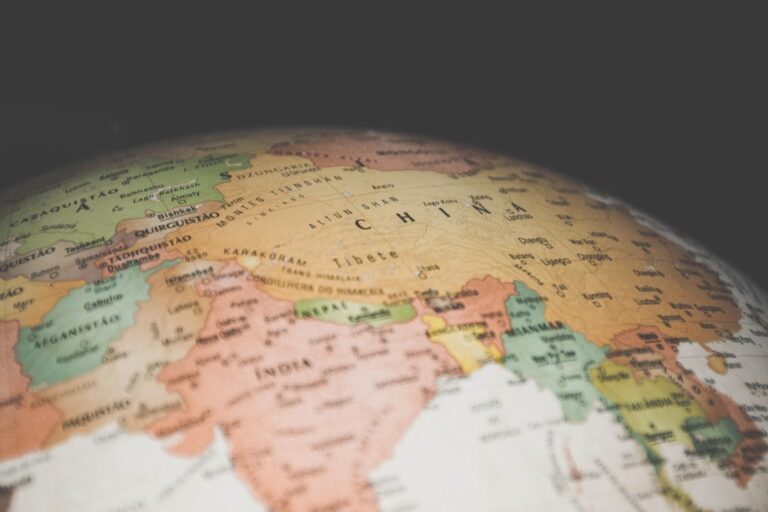
5 Best Cartography Tools for Cultural Representation
Maps tell stories – and for too long they’ve told the same ones from the same perspectives. Traditional cartography has historically centered dominant cultures while pushing marginalized communities to the literal and figurative edges of our understanding.
The big picture: Modern mapmakers are revolutionizing how we visualize the world by amplifying voices that have been systematically excluded from geographic narratives. You’ll discover innovative approaches that transform cartography from a tool of exclusion into one of cultural celebration and recognition.
Why it matters: When underrepresented cultures gain visibility through strategic mapping these communities reclaim their place in our collective geographic consciousness and challenge long-held assumptions about whose stories deserve space on our maps.
Disclosure: As an Amazon Associate, this site earns from qualifying purchases. Thank you!
P.S. check out Udemy’s GIS, Mapping & Remote Sensing courses on sale here…
Mapping Indigenous Land Names and Traditional Territories
Modern cartography must confront centuries of colonial naming practices that erased Indigenous identities from the landscape. Digital mapping platforms now offer unprecedented opportunities to restore traditional place names and acknowledge Indigenous sovereignty over ancestral lands.
Restoring Original Place Names in Digital Maps
Incorporate Indigenous toponyms alongside colonial names using dual-language labeling systems in your mapping software. GIS platforms like ArcGIS Pro and QGIS support multilingual labeling through attribute tables that store both traditional and imposed names. You’ll need to establish consistent transliteration standards when working with Indigenous languages that use different writing systems. Many tribal nations maintain official language departments that provide standardized spellings for geographic features. Connect with these linguistic authorities to ensure accurate representation rather than relying on historical documents that may contain colonial-era transcription errors.
Documenting Sacred Sites and Cultural Boundaries
Map culturally significant locations using sensitive data protocols that respect Indigenous privacy concerns. Traditional territories often extend beyond reservation boundaries and include ceremonial sites, burial grounds, and resource collection areas that require careful documentation. You’ll want to use polygon layers to represent territorial boundaries while point features can mark specific cultural sites. Work with tribal historic preservation offices to determine appropriate visibility levels for different site types. Some locations may require restricted access layers visible only to community members while others can be shared publicly to educate non-Indigenous audiences about territorial relationships.
Collaborating with Tribal Communities for Accurate Representation
Establish formal partnerships with tribal governments before beginning any Indigenous mapping project. Community-based participatory mapping ensures that Indigenous voices guide the cartographic process rather than outside researchers imposing their interpretations. You’ll need to navigate tribal sovereignty protocols and obtain proper permissions through official channels. Many tribes require research agreements that specify data ownership, usage rights, and benefit-sharing arrangements. Include Indigenous community members as co-investigators and compensate them fairly for their knowledge contributions. This collaborative approach produces more accurate maps while building trust between cartographers and Indigenous communities.
Visualizing Migration Patterns and Diaspora Communities
Migration cartography reveals the complex journeys of displaced populations while celebrating their resilience and cultural contributions. These maps transform abstract demographic data into compelling visual narratives that honor underrepresented communities’ experiences.
Tracking Historical Movement of Displaced Populations
Historical migration maps document forced relocations and refugee movements that traditional atlases often overlook. You can layer archival records with demographic data to show how communities like the Hmong diaspora or Palestinian refugees maintained cultural connections across continents. Digital platforms like ArcGIS Online allow you to create temporal visualizations showing population flows from conflict zones, natural disasters, and economic displacement. Include settlement density markers and cultural institution locations to demonstrate how displaced communities rebuilt their identities in new territories.
Highlighting Contemporary Immigrant Settlement Patterns
Modern settlement cartography captures ongoing demographic shifts in urban centers where immigrant communities cluster. You’ll find success mapping language prevalence data from census records alongside business registrations to show cultural enclaves forming in cities like Houston’s Little Saigon or Toronto’s Little Italy. Use choropleth maps with graduated symbols to display both population density and cultural infrastructure like ethnic restaurants, community centers, and religious buildings. Interactive web maps let you showcase how these communities create support networks while maintaining connections to their homelands.
Creating Interactive Timelines of Cultural Dispersal
Timeline cartography combines temporal data with spatial analysis to show how cultures spread globally over decades. You can build interactive maps using tools like Leaflet or Mapbox that animate population movements alongside cultural milestones like festival establishments or language school openings. Layer historical events with migration waves to demonstrate how political changes triggered diaspora formation. Include multimedia elements like photographs, oral histories, and cultural artifacts to create immersive experiences that go beyond simple population statistics and celebrate the rich heritage these communities bring to their new homes.
Showcasing Community Assets and Cultural Resources
You can transform cartographic representation by mapping the tangible cultural infrastructure that underrepresented communities have built. This approach highlights how these groups contribute to their neighborhoods through institutions, businesses, and artistic expressions.
Mapping Community Centers and Cultural Institutions
Map community centers by collecting GPS coordinates of cultural hubs like ethnic community centers, religious institutions, and cultural organizations that serve specific populations. Use ArcGIS Online’s data collection tools to document facility types, languages spoken, and services offered. Create symbol libraries that represent different cultural institutions – mosques, temples, community kitchens, and cultural schools. Layer demographic data from the American Community Survey to show correlation between facility locations and population concentrations, revealing how communities establish support networks in new areas.
Identifying Local Businesses and Economic Contributions
Document ethnic businesses using field surveys combined with business directory APIs to map restaurants, markets, service providers, and specialty shops that reflect cultural diversity. Analyze economic impact by mapping business density alongside foot traffic data from mobile analytics platforms. Create heat maps showing commercial corridors where immigrant-owned businesses cluster, demonstrating economic vitality. Include business longevity data to highlight establishments that’ve served as cultural anchors for decades, showing how underrepresented communities contribute to neighborhood stability and economic growth.
Documenting Public Art and Cultural Landmarks
Catalog murals and street art using mobile GIS apps like Survey123 to record artist information, cultural themes, and community significance of public artworks. Map cultural landmarks including monuments, historical markers, and buildings with architectural significance to specific communities. Document storytelling sites where oral traditions are shared or cultural events occur regularly. Use drone photography combined with ground-level imagery to create comprehensive visual documentation. Integrate QR codes linking to audio recordings or historical context, transforming static maps into interactive cultural experiences that preserve community narratives.
Telling Stories Through Neighborhood Histories
Neighborhood cartography reveals how communities evolve and adapt over generations. You’ll discover how mapping temporal changes creates powerful narratives of cultural persistence and transformation.
Layering Historical Demographics Over Time
Temporal mapping reveals how cultural populations shifted across decades within specific neighborhoods. You can use Census data from 1900-2020 to create animated visualizations showing ethnic composition changes in areas like Chicago’s Pilsen or New York’s Chinatown. Tools like QGIS TimeManager allow you to overlay demographic data by decade, revealing patterns of settlement, displacement, and community growth. This technique helps document how redlining policies affected minority communities and how gentrification altered cultural landscapes over time.
Preserving Oral Histories Through Geographic Context
Story-mapping platforms like StoryMaps JS and ArcGIS StoryMaps let you embed audio recordings and interviews directly into neighborhood maps. You can collect elder testimonies about historical businesses, gathering places, and community events tied to specific locations. Mobile apps like Survey123 enable field collection of oral histories with GPS coordinates, creating searchable archives of community memory. This approach transforms intangible cultural knowledge into permanent geographic records that preserve neighborhood stories for future generations.
Connecting Past Events to Present-Day Communities
Historical overlay mapping demonstrates how past events continue shaping current community dynamics and cultural identity. You can map historical sites of significance—like former segregation boundaries or cultural institutions—alongside contemporary demographic data and community resources. Tools like Leaflet.js enable interactive maps showing how historical trauma or celebration sites influence present-day cultural practices and community organizing. This temporal connection helps communities understand their current challenges and strengths through the lens of historical context and cultural continuity.
Creating Participatory Maps with Community Input
Participatory mapping transforms residents from passive subjects into active cartographers who shape their own geographic narratives. This approach ensures that underrepresented cultures maintain control over how their communities are documented and represented on maps.
Empowering Residents to Share Their Own Stories
Community members become the primary data collectors when you implement resident-led mapping initiatives. You’ll find that local residents possess intimate knowledge of neighborhood boundaries, cultural landmarks, and historical events that external mappers often miss. Digital storytelling platforms like Esri Story Maps allow residents to embed personal narratives directly into geographic locations, creating authentic cultural documentation. Training programs in neighborhoods like Detroit’s Corktown have shown that residents identify 40% more culturally significant sites than professional surveyors alone.
Understand the structure of a one-hour TV drama pilot. This book provides a guide to story mapping for television.

Building Collaborative Mapping Projects
Partnership structures between cartographers and communities require formal agreements that establish data ownership and usage rights. You’ll need to create shared governance models where community representatives participate in project design and data validation processes. Organizations like the Detroit Community Mapping Project demonstrate effective collaboration by hosting monthly workshops where residents and GIS professionals work together using tablets and mobile data collection apps. These partnerships typically involve 15-20 community volunteers who contribute 2-3 hours monthly to mapping activities.
Training Community Members in Cartographic Tools
Technical capacity building enables long-term community ownership of mapping initiatives beyond initial project phases. You should focus training on user-friendly platforms like Survey123 and Collector for ArcGIS that require minimal technical background. Successful programs dedicate 6-8 hours of hands-on training covering GPS data collection, attribute entry, and basic map creation. Community mapping coordinators in Chicago’s Little Village neighborhood report that 75% of trained residents continue using mapping tools independently after completing certification programs.
Conclusion
Modern cartography offers you unprecedented opportunities to amplify voices that traditional mapping has silenced for centuries. By embracing these five approaches you’re not just creating maps – you’re building bridges between communities and fostering deeper cultural understanding.
The real power lies in your ability to transform static geographic data into dynamic storytelling platforms. When you combine digital tools with community collaboration you create maps that serve as living documents of cultural resilience and identity.
Your commitment to inclusive mapping practices helps ensure that future generations will see their stories reflected in the geographic narratives that shape our world. Every map you create with cultural sensitivity becomes a step toward more equitable representation in cartography.
Frequently Asked Questions
What is cultural bias in traditional cartography?
Traditional cartography has historically favored dominant cultures while marginalizing underrepresented communities. This bias manifests through colonial naming practices that erase Indigenous identities and the exclusion of culturally significant sites from mainstream maps. Modern mapmakers are now working to address these inequities by incorporating diverse voices and perspectives into their mapping processes.
How are Indigenous place names being restored in modern maps?
Digital mapping platforms are increasingly incorporating dual-language labeling systems that include Indigenous toponyms alongside colonial names. This restoration process requires collaboration with tribal communities to ensure accuracy and cultural sensitivity. Many platforms now allow users to toggle between different naming conventions, helping preserve and revitalize Indigenous languages and cultural heritage.
What is migration cartography and why is it important?
Migration cartography documents the complex journeys of displaced populations, including forced relocations, refugee movements, and immigrant settlement patterns. These maps reveal stories often overlooked by traditional atlases, using digital platforms to visualize population flows from conflict zones and natural disasters while celebrating the resilience and cultural contributions of migrant communities.
How does timeline cartography enhance cultural mapping?
Timeline cartography combines temporal data with spatial analysis to depict how cultures spread and evolve over time. This approach uses multimedia elements like audio recordings, photographs, and historical documents to create interactive narratives that show cultural persistence and transformation across generations, providing deeper context than static maps alone.
What are community asset maps and how do they help underrepresented groups?
Community asset maps document cultural resources, businesses, institutions, and landmarks within neighborhoods. These maps help visualize the economic contributions and cultural infrastructure of underrepresented communities, revealing support networks and community strengths that might otherwise go unrecognized by policymakers and researchers.
How does participatory mapping empower communities?
Participatory mapping allows residents to become active cartographers who control their own geographic narratives. Community members receive training in mapping tools and identify culturally significant sites that external mappers might miss. This approach ensures data ownership remains with the community and creates more accurate, culturally sensitive representations.
What is neighborhood cartography and its benefits?
Neighborhood cartography uses temporal mapping to show how communities evolve over generations. By analyzing Census data and historical records, these maps reveal patterns of cultural persistence and adaptation. They help communities understand their challenges and strengths through historical context while preserving oral histories tied to specific locations.
How do modern maps address sacred sites and cultural boundaries?
Modern cartography approaches sacred sites with sensitivity, collaborating directly with tribal communities to determine appropriate representation levels. Some sites may be mapped generally without specific details to respect privacy concerns, while others might be documented more thoroughly based on community preferences and formal partnerships with tribal governments.