8 Ways to Use Scale Bars Effectively in Large Maps That Enhance Readability
Why it matters: Scale bars transform confusing large maps into precise navigation tools that help you accurately measure distances and understand spatial relationships at a glance.
The big picture: Most mapmakers struggle with scale bar placement and sizing, leading to maps that confuse rather than clarify – but getting it right dramatically improves your map’s usability and professional appearance.
What’s ahead: You’ll discover proven techniques for positioning scale bars strategically, choosing the right measurements for your audience, and avoiding common mistakes that make even detailed maps hard to interpret.
Disclosure: As an Amazon Associate, this site earns from qualifying purchases. Thank you!
P.S. check out Udemy’s GIS, Mapping & Remote Sensing courses on sale here…
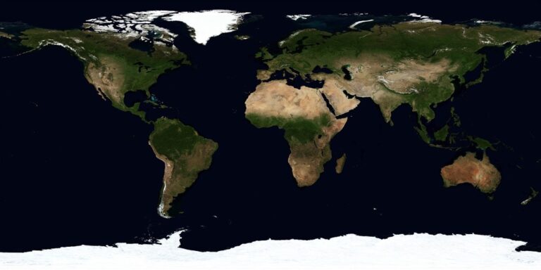
Understanding the Purpose of Scale Bars in Large Map Design
Scale bars serve as the foundation for accurate distance interpretation in large-format maps. They transform abstract cartographic representations into measurable reality for your viewers.
Achieve a flawless, even complexion with e.l.f. Flawless Satin Foundation. This lightweight, vegan formula provides medium coverage and a semi-matte finish for all-day wear, while hydrating your skin with glycerin.

Visual Reference for Distance Measurement
Scale bars provide immediate visual context for measuring distances without requiring mathematical calculations. Your viewers can quickly estimate travel times, compare route lengths, and understand territorial boundaries by referencing the scale bar against map features. This eliminates guesswork and enables confident decision-making for navigation, planning, and analysis tasks across your mapped area.
Maintaining Spatial Accuracy Across Map Viewers
Scale bars ensure consistent distance interpretation regardless of viewing conditions or display methods. Whether your map appears on a wall-mounted display, tablet screen, or printed poster, the scale bar maintains proportional accuracy for measurements. This consistency prevents errors that occur when viewers attempt to estimate distances without proper reference points across different viewing formats.
Building Trust and Credibility in Cartographic Work
Scale bars demonstrate professional cartographic standards and technical competence in your mapping projects. They signal to viewers that you’ve considered measurement accuracy and spatial relationships in your design process. This attention to detail builds confidence in your map’s reliability and establishes credibility for complex geographic information, particularly in professional or educational contexts.
Choosing the Right Scale Bar Type for Your Large Map
Your scale bar type directly impacts how effectively users interpret distance measurements across your large map format.
Linear Scale Bars for Straightforward Distance Reading
Linear scale bars display distance measurements along a horizontal line with marked intervals, making them ideal for quick distance estimates on large maps. You’ll find these most effective when your audience needs to measure walking distances, property boundaries, or trail lengths without calculations. Position linear bars with clear numerical labels at major intervals—typically 0, 500m, 1km, 2km for urban maps—ensuring the bar length doesn’t exceed 25% of your map’s width to maintain proportional clarity.
Representative Fraction Scales for Technical Applications
Representative fraction scales express your map’s relationship as ratios like 1:10,000 or 1:25,000, providing precise mathematical accuracy for engineering and surveying applications. You should include RF scales when your large map serves technical professionals who need exact measurements for construction planning, land surveying, or GIS analysis. These scales work best alongside linear bars since they require mathematical conversion—displaying “1:12,000” tells experienced users that one inch equals 1,000 feet without visual measurement tools.
Verbal Scale Descriptions for General Audiences
Verbal scale descriptions translate mathematical relationships into plain language statements like “1 inch equals 2 miles” or “1 centimeter represents 500 meters.” You’ll achieve better user comprehension with verbal scales when creating large maps for public display, educational materials, or general navigation purposes. Include both metric and imperial units in your verbal descriptions to accommodate diverse user preferences—”1 inch = 1 mile (1 cm = 0.6 km)” covers most audience needs effectively.
Graphic Scale Combinations for Maximum Clarity
Graphic scale combinations integrate linear bars with numerical labels and representative fractions to serve multiple user types simultaneously on large format displays. You should design combination scales with a primary linear bar for visual measurement, secondary RF notation for technical users, and brief verbal descriptions for general audiences. Stack these elements vertically in your scale bar area, allocating 60% space to the linear component while keeping total scale bar width under 4 inches on large prints.
Positioning Scale Bars Strategically on Large Format Maps
Strategic positioning transforms scale bars from afterthoughts into integral navigation tools that enhance your map’s functionality without compromising its visual appeal.
Lower Corner Placement for Traditional Cartographic Standards
Position your scale bar in the lower left or right corner to follow established cartographic conventions that users expect. This placement keeps the scale accessible while maintaining visual balance across your large format design. Lower corner positioning works particularly well for wall maps and printed atlases where viewers naturally scan from top to bottom. You’ll want to maintain at least 0.5 inches of margin space to prevent the scale from appearing cramped against the map border.
Avoiding Interference With Important Map Features
Analyze your map’s feature density before finalizing scale bar placement to prevent obscuring critical geographic information. Avoid positioning scales over dense urban areas, major transportation networks, or detailed topographic features that require clear visibility. Test different locations by temporarily overlaying your scale bar and checking for conflicts with labels, symbols, or natural features. Consider using semi-transparent backgrounds or white borders around your scale bar when unavoidable feature overlap occurs.
Considering Reading Flow and Visual Hierarchy
Align your scale bar placement with natural reading patterns to create intuitive map navigation experiences. Position scales where users’ eyes naturally pause during map exploration, typically in lower quadrants after examining the main map content. Maintain consistent visual weight between your scale bar and other map elements like legends or north arrows. Ensure your scale bar doesn’t compete with the map title or primary focal points by using appropriate sizing and contrast levels.
Multiple Scale Bar Placement for Complex Large Maps
Deploy multiple scale bars across complex large format maps to accommodate varying projection distortions and user needs in different map regions. Place primary scales in standard lower corners while adding secondary scales near detailed insets or areas with significant scale variations. Use consistent styling across all scale bars while adjusting sizes proportionally to their map sections. This approach works especially well for multi-sheet maps or large regional displays where single scale bars become impractical for accurate distance measurement.
Sizing Scale Bars Appropriately for Map Scale and Format
Proper scale bar dimensioning requires careful calculation based on your map’s scale, intended audience, and display format. You’ll need to balance mathematical precision with visual clarity to ensure your scale bars enhance rather than clutter your cartographic design.
Calculating Optimal Scale Bar Length for Readability
Calculate your scale bar length using the 1/3 to 1/2 rule for optimal readability on large format maps. Your scale bar should span roughly one-third of your map’s width, ensuring it’s substantial enough to read without dominating the composition. For a 36-inch wide map at 1:24,000 scale, aim for a 10-12 inch scale bar representing 2-3 miles of ground distance. Test different lengths using your map’s representative fraction to verify accuracy.
Adjusting Scale Bar Thickness for Large Format Visibility
Set your scale bar thickness between 0.125 and 0.25 inches for large format maps to ensure visibility from typical viewing distances. Thicker bars work better for maps displayed at distances greater than 3 feet, while thinner bars suit close-up examination. Use consistent line weights that match your map’s border thickness or legend elements. Consider increasing thickness by 25% for outdoor display conditions where lighting variations affect readability.
Balancing Scale Bar Size With Overall Map Composition
Design your scale bar to occupy 2-5% of your total map area, maintaining visual hierarchy with other cartographic elements. Position and size your scale bar to complement your title block, north arrow, and legend without creating visual competition. Use the same font family and sizing principles as your map labels to ensure compositional unity. Your scale bar should feel integrated rather than added as an afterthought.
Testing Scale Bar Visibility at Various Viewing Distances
Test your scale bar readability at distances of 2, 4, and 6 feet to simulate real-world viewing conditions for large format maps. Print test sections at full scale and evaluate legibility under different lighting conditions including fluorescent office lighting and natural daylight. Check that subdivision marks remain visible and text labels stay readable at your target viewing distance. Adjust thickness and spacing based on these visibility tests before final production.
Designing Clear and Professional Scale Bar Elements
Professional scale bar design requires careful attention to visual hierarchy and technical precision. Your scale bar elements must work harmoniously with your map’s overall aesthetic while maintaining their functional purpose.
Using High Contrast Colors for Maximum Readability
Choose black scale bars on light backgrounds for optimal contrast ratios. White or light gray scale bars work effectively against dark map backgrounds, ensuring readability across various lighting conditions. Avoid using map colors that compete with your scale bar’s visibility. Test your color choices at different zoom levels to maintain consistent legibility. Consider using a thin white outline around dark scale bars when placing them over complex map features.
Selecting Appropriate Fonts and Text Sizing
Use clean sans-serif fonts like Arial or Helvetica for scale bar labels. Your text size should be at least 10-12 points for large format maps to ensure readability from standard viewing distances. Maintain consistent font weight throughout your scale bar elements. Avoid decorative fonts that compromise legibility. Position text labels directly below or above scale divisions for clear association with measurements.
Creating Clean Lines and Precise Measurements
Draw scale bar lines using consistent stroke weights between 1-2 points. Your measurement divisions should align precisely with calculated distances using your map’s projection parameters. Use alternating black and white segments for traditional scale bar design. Ensure your scale increments follow logical progression like 0-100-200 meters or 0-1-2 miles. Double-check your measurements against known distances to verify accuracy before finalizing your design.
Incorporating Professional Cartographic Symbols
Add north arrows and coordinate grid references near your scale bars. Your cartographic symbols should follow established conventions from organizations like the USGS or international mapping standards. Include projection information and datum details in your map legend area. Use standard symbols for elevation profiles, coordinate systems, and measurement units. Maintain consistent symbol sizing that complements your scale bar’s visual weight without overwhelming the map composition.
Adapting Scale Bars for Different Map Projections
Map projections introduce varying degrees of distortion that directly affect your scale bar accuracy across large geographic areas. You’ll need to adjust your scale bar approach based on the projection type and geographic extent of your map.
Understanding Distortion Effects on Large Area Maps
Distortion varies significantly across different map projections, creating zones where your scale bar accuracy changes dramatically. Mercator projections stretch distances increasingly toward the poles, making your scale bar accurate only along specific latitude lines. Conic projections maintain better distance accuracy along standard parallels but introduce distortion as you move away from these reference lines. Equal-area projections preserve relative sizes but distort shapes and distances in predictable patterns. You’ll find that azimuthal projections maintain accurate distances only from the projection center point outward.
Providing Multiple Scale References for Projection Variations
Multiple scale bars become essential when your map covers extensive geographic areas with varying projection distortion. Position primary scale bars in areas of minimal distortion, typically along standard parallels or central meridians. Add secondary scale indicators near map edges where distortion reaches maximum levels. Include textual notes explaining scale variation, such as “Scale accurate along 45°N parallel” or “Distance measurements vary ±15% at map extremes.” Consider using graduated scale references that show increasing distortion factors at different latitudes or distances from projection centers.
Explaining Scale Limitations in Map Documentation
Scale limitation documentation protects your professional credibility while educating map users about projection constraints. Include clear statements about where your scale bar maintains accuracy, specifying geographic coordinates or landmark references. Document the projection parameters used, including central meridian, standard parallels, and datum information. Add percentage error estimates for different map regions, helping users understand measurement reliability. Create legend entries that explain scale variation patterns, using simple language like “Distances most accurate in central map area” or “Scale increases 5% per degree latitude northward.”
Using Variable Scale Indicators When Necessary
Variable scale indicators provide sophisticated solutions for maps with significant projection distortion across large areas. Design graduated scale bars that show different distance measurements at various map locations, clearly labeling each zone. Implement color-coded scale zones using subtle background tinting to indicate areas of similar scale accuracy. Create interactive digital scale tools that automatically adjust measurements based on cursor location when working with web-based mapping applications. Consider using grid-based scale references that provide localized accuracy within specific coordinate squares or projection zones.
Testing Scale Bar Effectiveness With Your Target Audience
Real-world validation ensures your scale bar design choices actually serve your map users effectively. Testing with representative audiences reveals gaps between theoretical design principles and practical usability.
Conducting Usability Tests for Scale Bar Clarity
Set up controlled testing sessions with 5-10 users from your target demographic who’ll use your large format maps. Present your map and ask participants to measure specific distances using the scale bar while thinking aloud about their process. Time how long each measurement takes and note any hesitation or confusion. Record where users look first when attempting measurements and whether they immediately understand the scale bar’s increments. Test different lighting conditions that match your map’s intended display environment to ensure visibility remains consistent.
Gathering Feedback on Scale Bar Placement and Design
Create multiple versions of your map with scale bars in different positions and design configurations. Ask users to rank their preferences and explain their reasoning for each choice. Focus on specific elements like font size, color contrast, and positioning relative to map features. Use structured questionnaires that address visibility, accessibility, and intuitive understanding of measurements. Document which design elements cause the most confusion and which facilitate quick distance estimation across your user group.
Iterating Based on User Comprehension Rates
Analyze your testing data to identify patterns in user success rates with different scale bar configurations. Calculate accuracy percentages for distance measurements and response times for each design variant. Modify elements that consistently caused problems, such as insufficient contrast or unclear labeling. Run follow-up tests with your revised designs to measure improvement in comprehension rates. Track which modifications produce the most significant gains in user performance and satisfaction.
Documenting Best Practices for Future Map Projects
Create a comprehensive style guide that captures your testing results and successful design decisions. Record specific measurements like optimal font sizes, color values, and positioning coordinates that worked best for your audience. Document the reasoning behind each design choice and link it to your testing data. Include screenshots of both successful and problematic scale bar designs with annotations explaining the differences. Store this documentation in an accessible format for your team to reference during future large format mapping projects.
Master the art of concise writing with The Elements of Style. This classic guide offers clear rules and principles for effective communication.

Common Mistakes to Avoid When Adding Scale Bars
Understanding these common pitfalls will help you create more effective and professional-looking maps that serve your users better.
Oversizing Scale Bars That Dominate Map Space
Oversized scale bars steal attention from your map’s primary content and create visual imbalance. You’ll want to limit scale bar length to roughly one-third of your map’s width, maintaining proportional thickness between 0.125 and 0.25 inches for large format displays. When scale bars exceed these dimensions, they compete with geographic features for viewer attention and can make your map appear cluttered and unprofessional.
Using Inappropriate Units for Your Audience
Mismatched units confuse users and reduce map effectiveness significantly. You should select metric units for international audiences, imperial measurements for US-focused maps, and consider dual-unit displays for diverse user groups. Professional surveyors need precise decimal measurements, while recreational hikers prefer rounded distances in familiar units. Always research your target audience’s measurement preferences before finalizing scale bar units.
Neglecting to Update Scale Bars After Map Modifications
Outdated scale bars provide inaccurate distance measurements and undermine map credibility. You must recalculate scale bar divisions whenever you modify map scale, change projections, or resize output formats. Digital mapping software often requires manual scale bar updates after zoom changes or coordinate system transformations. Establish a quality control checklist that includes scale bar verification as a final production step.
Placing Scale Bars Over Critical Map Information
Poor placement obscures important geographic features and frustrates map users. You should position scale bars in empty map areas, typically lower corners where they won’t interfere with roads, water bodies, or labels. Test multiple placement options before finalizing your design, ensuring scale bars remain visible without blocking essential map elements. Consider using semi-transparent backgrounds or outline styles when space constraints require placement over minor features.
Conclusion
Mastering scale bar implementation transforms your large-format maps from simple visual representations into powerful navigation tools. Your attention to placement positioning design and audience testing ensures users can confidently measure distances and understand spatial relationships.
Remember that effective scale bars aren’t just technical additions—they’re communication bridges between cartographic data and user comprehension. By avoiding common mistakes and following professional standards you’ll create maps that serve their intended purpose while building trust with your audience.
The investment you make in proper scale bar design pays dividends in user satisfaction and professional credibility. Your maps will stand out as reliable resources that users can depend on for accurate distance measurements and spatial understanding.
Frequently Asked Questions
What is the purpose of a scale bar on a map?
Scale bars allow users to measure distances and understand spatial relationships on maps. They transform abstract cartographic representations into measurable reality, providing immediate visual context for estimating travel times and comparing route lengths without complex calculations. Scale bars maintain spatial accuracy across various viewing conditions and demonstrate professional cartographic standards.
Where should I position a scale bar on a large format map?
Position scale bars in the lower corners to follow traditional cartographic standards and ensure accessibility. Avoid placing them over important map features that could obscure critical information. Test different locations for optimal visibility and align placement with natural reading patterns to enhance user navigation while maintaining visual balance.
What are the different types of scale bars I can use?
The main types include linear scale bars for quick distance estimates, representative fraction scales for technical applications providing precise ratios, verbal scale descriptions for general audiences using plain language, and graphic scale combinations that integrate multiple scale types to cater to various user needs simultaneously.
How do I determine the appropriate size for a scale bar?
Follow the 1/3 to 1/2 rule – scale bars should span roughly one-third of the map’s width for optimal readability. For large format maps, maintain thickness between 0.125 and 0.25 inches. Balance scale bar size with overall map composition and test visibility at various viewing distances before final production.
What design elements should I consider for scale bar visibility?
Use high-contrast colors like black on light backgrounds or white on dark ones. Select clean sans-serif fonts like Arial or Helvetica with minimum 10-12 point text size. Create precise measurements with clean lines, ensure accurate alignment of divisions, and incorporate professional cartographic symbols while adhering to established conventions.
How do map projections affect scale bar accuracy?
Different projections introduce varying degrees of distortion that affect scale accuracy. Position primary scale bars in areas of minimal distortion and add secondary indicators near map edges where distortion is greatest. For extensive geographic areas, use multiple scale references and document scale limitations to maintain professional credibility.
What common mistakes should I avoid when adding scale bars?
Avoid oversizing scale bars beyond one-third of the map’s width, using inappropriate units for your audience, neglecting updates after map modifications, and placing scale bars over critical map information. Always maintain proportional thickness, select audience-appropriate units, update after changes, and position in empty map areas when possible.
How can I test if my scale bar design is effective?
Conduct usability tests with representative users by having them measure distances using your scale bar. Analyze success rates and gather feedback on placement and design clarity. Set up controlled testing sessions, identify patterns in user performance, and iterate your design based on comprehension rates and user feedback.