6 Best 3D Map Experiences for Engagement
The big picture: 3D maps are revolutionizing how you engage with digital content by transforming flat navigation into dynamic interactive experiences that captivate users and drive meaningful engagement.
Why it matters: Whether you’re developing mobile apps gaming experiences or enterprise solutions mastering 3D mapping technology gives you a competitive edge in creating memorable user journeys that keep audiences coming back.
What’s ahead: We’ll explore six proven strategies that’ll help you leverage 3D maps to build immersive experiences that not only wow your users but also deliver measurable results for your business goals.
Disclosure: As an Amazon Associate, this site earns from qualifying purchases. Thank you!
P.S. check out Udemy’s GIS, Mapping & Remote Sensing courses on sale here…
Create Interactive Virtual Tours for Real Estate and Tourism
Interactive virtual tours transform property exploration and destination marketing by combining spatial visualization with immersive navigation capabilities. These experiences allow potential buyers and travelers to explore locations remotely while maintaining the spatial context that traditional photos and videos can’t provide.
Integrate 360-Degree Photography with 3D Map Navigation
Capture panoramic imagery at strategic waypoints throughout your property or destination to create seamless transitions between 3D map views and immersive photo experiences. Position 360-degree cameras at entrances, key rooms, and scenic viewpoints to ensure comprehensive coverage. Link these panoramic nodes directly to corresponding locations on your 3D map interface, allowing users to jump between aerial perspectives and ground-level views instantly. This integration maintains spatial awareness while providing detailed visual information that helps users understand room layouts, property flow, and environmental context.
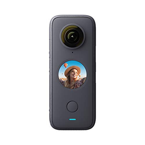
Capture every angle with the Insta360 ONE X2. This waterproof 360 camera boasts 5.7K resolution and FlowState stabilization for smooth, gimbal-free footage.
Add Clickable Hotspots for Detailed Property Information
Embed interactive information points throughout your 3D map interface to deliver contextual details without cluttering the visual experience. Place hotspots on specific features like appliances, architectural elements, or points of interest that reveal detailed specifications, pricing information, or historical context when clicked. Configure these interactive elements to display multimedia content including photo galleries, video demonstrations, or detailed text descriptions. Design hotspots with clear visual indicators that distinguish between different information types, such as property features, neighborhood amenities, or pricing details, ensuring users can quickly identify relevant content categories.
Enable Virtual Walkthrough Experiences
Design guided navigation paths that simulate natural movement through spaces while maintaining connection to your 3D map framework. Create predetermined routes that highlight key features and selling points, allowing users to follow logical progression through properties or tourist destinations. Implement smooth camera transitions that mimic human walking patterns, including realistic speed controls and pause points at significant locations. Integrate breadcrumb navigation that shows user progress along the walkthrough route while providing options to jump to specific sections or return to the main 3D map view for independent exploration.
Build Engaging Educational Experiences for Museums and Universities
Museums and universities can transform traditional learning environments using 3D maps to create compelling educational narratives. These immersive experiences help students visualize complex historical events and scientific concepts through interactive spatial storytelling.
Design Historical Timeline Overlays on Geographic Locations
Historical timeline overlays transform 3D maps into dynamic educational tools that show how locations evolved over time. You can layer historical events directly onto specific geographic coordinates to help students understand cause-and-effect relationships between geography and historical developments.
Create temporal controls that allow learners to scrub through different time periods while maintaining spatial context. This approach helps students visualize how civilizations expanded, battles unfolded, or cities developed across centuries. The combination of chronological progression with geographic accuracy creates memorable learning experiences that traditional textbooks can’t match.
Incorporate Augmented Reality Elements for Enhanced Learning
Augmented reality integration with 3D maps creates hands-on learning opportunities that bridge digital and physical educational spaces. You can overlay historical reconstructions, scientific data visualizations, or cultural artifacts directly onto real-world locations through mobile devices or AR headsets.
Immerse yourself in games with 7.1 surround sound for precise audio. Enjoy clear communication with a noise-canceling microphone and comfortable over-ear pads, compatible with PC, PlayStation, Xbox, Switch, and more.

Students can point their devices at specific campus locations or museum exhibits to reveal additional 3D content layers. This technology allows learners to see molecular structures floating above chemistry lab tables or watch historical figures appear in the exact locations where significant events occurred. The tactile nature of AR exploration increases retention rates compared to passive learning methods.
Create Interactive Archaeological Site Reconstructions
Archaeological site reconstructions using 3D mapping technology allow students to explore ancient civilizations without physical site visits. You can recreate entire settlements, temples, or burial grounds based on excavation data and historical research to provide immersive educational experiences.
These digital reconstructions enable learners to walk through ancient Rome, explore Egyptian pyramids, or examine prehistoric cave paintings with unprecedented detail. Interactive elements like clickable artifacts, audio narrations from archaeologists, or time-lapse construction sequences help students understand how these sites were built and used. The ability to toggle between current ruins and historical reconstructions provides powerful before-and-after learning comparisons.
Develop Gaming and Entertainment Applications with Realistic Environments
3D maps transform gaming experiences by providing authentic geographic foundations that blur the line between virtual and real-world environments. You’ll create more engaging entertainment applications when you leverage accurate spatial data as your canvas.
Achieve a flawless, even complexion with e.l.f. Flawless Satin Foundation. This lightweight, vegan formula provides medium coverage and a semi-matte finish for all-day wear, while hydrating your skin with glycerin.

Implement Location-Based Gameplay Mechanics
Location-based gameplay mechanics enhance user engagement by connecting virtual actions to real-world coordinates. You can integrate GPS tracking with 3D terrain models to create dynamic challenges that adapt based on players’ physical locations. Popular mechanics include territory control systems where players claim geographic areas, weather-responsive gameplay that mirrors actual meteorological conditions, and proximity-based interactions that trigger when users approach specific landmarks. These mechanics encourage outdoor exploration while maintaining immersive digital storytelling elements.
Track vehicles and assets with the LandAirSea 54 GPS Tracker. Get real-time location alerts and historical playback using the SilverCloud app, with a long-lasting battery and discreet magnetic mount.

Design Multiplayer Experiences in Virtual 3D Worlds
Multiplayer experiences benefit from shared 3D environments that provide consistent spatial references for all participants. You’ll achieve seamless collaboration by implementing synchronized coordinate systems that maintain accurate player positioning across different devices. Essential features include real-time avatar tracking within detailed terrain models, voice chat systems that adjust audio based on virtual proximity, and collaborative building tools that let teams modify shared environments. These synchronized worlds create social gaming experiences that feel naturally connected to geographic spaces.
Create Treasure Hunt Adventures Using Real-World Geography
Treasure hunt adventures leverage authentic geographic data to create compelling exploration challenges rooted in actual locations. You can design multi-layered quests by combining historical site information with interactive 3D models that reveal hidden clues through environmental storytelling. Effective implementations include puzzle sequences that require understanding local topography, augmented reality overlays that transform familiar landmarks into quest objectives, and progressive revelation systems that unlock new areas as players complete geographic challenges. These adventures encourage cultural discovery while maintaining engaging gameplay mechanics.
Design Data Visualization Dashboards for Business Intelligence
Transform your business data into compelling visual narratives by overlaying key metrics directly onto 3D geographic surfaces. You’ll create intuitive dashboards that help stakeholders understand complex data relationships through spatial context.
Display Real-Time Analytics on Geographic Surfaces
Project live performance data directly onto 3D terrain to create dynamic visual reporting systems. You can stream customer activity metrics onto city models or display supply chain data across topographic surfaces. This approach transforms traditional charts into spatial intelligence tools that update automatically. Heat mapping visualization reveals patterns across geographic regions while maintaining real-time accuracy for critical business decisions.
Create Interactive Sales Territory Mapping Tools
Build comprehensive territory management systems that visualize sales performance across defined geographic boundaries. You’ll design clickable regions that display individual rep metrics, quota attainment levels, and competitive analysis data. Interactive filtering allows managers to drill down into specific territories or time periods. These tools help optimize territory assignments by revealing coverage gaps and performance variations across different geographic markets.
Build Performance Metrics Overlays for Location-Based Insights
Layer multiple data streams onto 3D maps to reveal correlations between geographic factors and business outcomes. You can overlay demographic data with sales performance or combine weather patterns with supply chain efficiency metrics. Interactive toggles let users switch between different metric combinations. This multi-layered approach helps identify location-specific opportunities and challenges that traditional reporting methods often miss.
Construct Emergency Response and Training Simulations
Emergency response training demands realistic environments that replicate critical scenarios without real-world risks. 3D maps provide the foundation for immersive simulations that prepare first responders for complex situations.
Develop Disaster Preparedness Training Scenarios
Create realistic disaster environments using 3D terrain modeling to simulate flooding, earthquakes, or wildfire conditions. You’ll design scenarios where trainees navigate through damaged infrastructure, collapsed buildings, and blocked roadways. Import real geographic data from USGS and FEMA flood maps to ensure accuracy. Layer weather data, population density information, and infrastructure details to build comprehensive training environments. These simulations help emergency teams practice decision-making in controlled settings that mirror actual disaster conditions.
Create First Responder Navigation Systems
Navigate with ease using this 7-inch GPS navigator, featuring real-time voice guidance and pre-loaded 2025 maps. Customize routes based on your vehicle type to avoid restrictions and receive speed & red light warnings.

Build specialized navigation tools that integrate real-time data feeds with 3D mapping interfaces for emergency personnel. You’ll incorporate traffic conditions, road closures, and incident locations into dynamic routing systems. Design interfaces that display building layouts, utility locations, and hazardous material storage areas overlaid on 3D models. Connect these systems to dispatch centers and GPS tracking for coordinated response efforts. Your navigation tools should prioritize speed and clarity during high-stress situations while providing critical situational awareness.
Build Evacuation Route Planning Tools
Design evacuation route visualization systems that model crowd flow and capacity constraints across 3D terrain. You’ll calculate optimal exit paths considering population density, mobility limitations, and infrastructure capacity. Create interactive tools that test different evacuation scenarios, showing bottlenecks and alternative routes in real-time. Integrate demographic data to account for elderly populations, schools, and hospitals requiring special assistance. Your planning tools should generate clear visual instructions that emergency managers can communicate effectively to the public during actual evacuations.
Enhance Urban Planning and Smart City Development
3D maps revolutionize urban planning by providing comprehensive spatial context that traditional 2D blueprints can’t match. These immersive visualization tools enable planners to communicate complex development concepts effectively while engaging diverse stakeholder groups in meaningful collaboration.
Create Collaborative Design Platforms for Stakeholders
You’ll transform stakeholder engagement by implementing 3D map platforms that allow multiple parties to visualize proposed developments simultaneously. Interactive annotation tools let city council members, residents, and developers mark specific concerns directly on 3D models. Real-time collaboration features enable immediate feedback during public hearings, while version control systems track design iterations across multiple planning phases. These platforms reduce miscommunication by providing shared visual references that eliminate ambiguity in traditional planning documents.
Implement Traffic Flow Analysis and Optimization Tools
You can analyze traffic patterns by overlaying vehicle flow data onto 3D street networks, revealing congestion hotspots that aren’t visible in 2D analysis. Dynamic simulation capabilities let you test proposed road modifications before construction begins, while predictive modeling shows how new developments will impact existing traffic patterns. Integration with IoT sensor data provides real-time traffic visualization, enabling responsive traffic signal adjustments. These tools help you optimize intersection timing and identify alternative route options for improved urban mobility.
Design Sustainable Development Impact Visualizations
You’ll showcase environmental impacts by layering sustainability metrics onto 3D terrain models, making abstract concepts like carbon footprint reduction tangible for decision-makers. Shadow analysis tools demonstrate how proposed buildings affect solar access for neighboring properties and renewable energy potential. Water runoff simulations visualize drainage patterns and flood risk areas, while air quality modeling shows pollution dispersion patterns. These visualizations help you communicate the long-term environmental benefits of green building practices and sustainable infrastructure investments.
Conclusion
The six strategies you’ve explored represent just the beginning of what’s possible when you harness 3D mapping technology effectively. Whether you’re developing educational experiences or building emergency response systems your success depends on understanding how spatial visualization transforms user engagement.
Your next step is choosing the approach that aligns best with your specific goals and audience needs. Remember that the most successful 3D map implementations combine technical excellence with intuitive user experience design.
The future belongs to creators who can bridge the gap between complex geographic data and meaningful human interaction. By implementing these strategies you’re positioning yourself to deliver experiences that don’t just inform but truly captivate your users.
Frequently Asked Questions
What are 3D maps and how do they differ from traditional maps?
3D maps are interactive digital representations that provide depth, elevation, and spatial context beyond traditional flat maps. Unlike 2D maps, they offer immersive experiences with features like virtual tours, clickable hotspots, and real-time data overlays. They transform static navigation into dynamic, engaging experiences that enhance user understanding of geographic spaces and spatial relationships.
How can businesses use 3D maps for data visualization?
Businesses can overlay key metrics onto 3D geographic surfaces to create intuitive dashboards and visual narratives. This includes real-time analytics projected onto 3D terrain, interactive sales territory mapping, and layering multiple data streams to reveal correlations between geographic factors and business outcomes, providing insights that traditional reporting methods may miss.
What role do 3D maps play in emergency response training?
3D maps create realistic disaster environments for training first responders in scenarios like floods, earthquakes, and wildfires. They integrate real geographic data for accuracy, help develop specialized navigation systems with real-time data feeds, and design evacuation route planning tools that visualize crowd flow and capacity constraints during emergencies.
How are 3D maps transforming the real estate industry?
3D maps enable interactive virtual property tours with 360-degree photography, seamless transitions between aerial and ground-level views, and clickable hotspots for detailed information. They create virtual walkthrough experiences that simulate natural movement through spaces, allowing potential buyers to explore properties remotely with comprehensive spatial context and enhanced engagement.
What educational benefits do 3D maps provide?
3D maps create compelling educational narratives that help students visualize complex historical events and scientific concepts through interactive spatial storytelling. They feature historical timeline overlays, augmented reality elements for hands-on learning, and interactive archaeological site reconstructions that allow exploration of ancient civilizations without physical site visits.
How do 3D maps enhance gaming and entertainment experiences?
3D maps provide realistic geographic foundations that enhance gaming immersion through location-based gameplay mechanics connecting virtual actions to real-world coordinates. They enable seamless multiplayer collaboration in shared 3D environments and create treasure hunt adventures using authentic geographic data combined with historical information and interactive models.
What advantages do 3D maps offer for urban planning?
3D maps provide comprehensive spatial context that 2D blueprints cannot match, enabling collaborative design platforms for stakeholder visualization and real-time feedback. They facilitate traffic flow analysis by overlaying vehicle data onto 3D street networks and create sustainable development impact visualizations that layer environmental metrics onto terrain models.