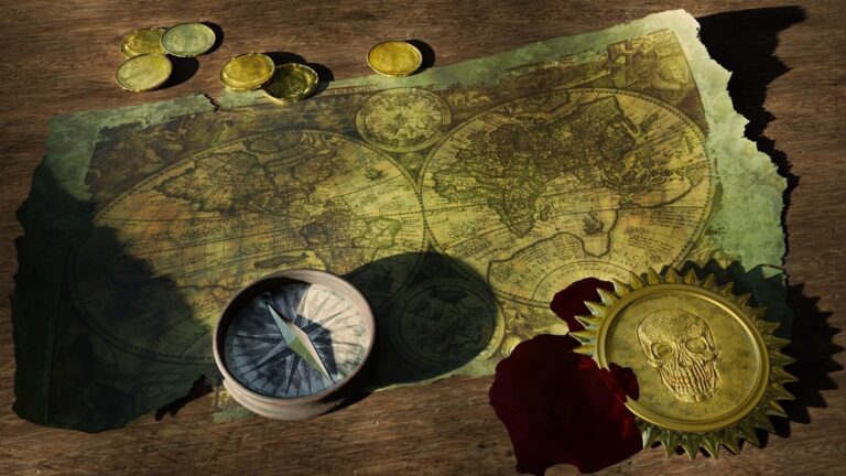
5 Ideas for Innovative Shadow Effects in Cartography That Transform Maps
Maps aren’t just functional tools anymore—they’re powerful visual statements that can captivate audiences and transform how people interact with geographic data. Shadow effects have emerged as one of the most compelling techniques for adding depth and dimension to modern cartographic designs.
You’ll discover how strategic shadow implementation can elevate your maps from flat representations to dynamic visual experiences. These innovative approaches blend traditional cartographic principles with cutting-edge design techniques to create maps that truly stand out in today’s crowded digital landscape.
Disclosure: As an Amazon Associate, this site earns from qualifying purchases. Thank you!
Layered Depth Shadows for Topographic Enhancement
Layered depth shadows transform flat elevation data into compelling three-dimensional representations that communicate terrain complexity at multiple scales. This technique builds visual hierarchy by stacking shadow layers at different elevations and intensities.
P.S. check out Udemy’s GIS, Mapping & Remote Sensing courses on sale here…
Creating Multi-Level Terrain Visualization
Build terrain depth by applying separate shadow layers for major elevation breaks, ridgelines, and valley systems. You’ll establish primary shadows for peaks above 1,000 feet, secondary shadows for mid-level ridges, and tertiary shadows for valley floors. Tools like QGIS’s hillshade renderer and ArcGIS Pro’s multidirectional hillshade allow you to combine multiple elevation bands with distinct shadow intensities, creating natural-looking terrain progression that guides readers through complex topographic relationships.
Implementing Gradient Shadow Techniques
Apply gradient shadows using transparency masks that transition from 80% opacity at ridge peaks to 20% in valleys. You’ll achieve smooth elevation transitions by blending multiple hillshade layers with different azimuth angles—typically 315°, 45°, and 180°—each set to 30-40% transparency. GDAL’s gdaldem tool generates consistent gradient calculations, while Photoshop’s gradient overlay effects fine-tune shadow falloff patterns. This approach eliminates harsh shadow boundaries that often plague single-layer hillshade applications.
Balancing Light Source Positioning
Position light sources at 45° elevation with 315° azimuth as your primary illumination, then add secondary sources at 135° azimuth for shadow fill. You’ll prevent over-darkened valleys by maintaining light source elevation between 35-55° depending on terrain steepness. Multiple light sources reduce harsh contrasts while preserving essential topographic detail. Test different combinations using your GIS software’s hillshade parameters, adjusting altitude and azimuth values until shadows enhance rather than obscure elevation patterns and drainage networks.
Digital Relief Shading with Color Temperature Variations
Digital relief shading becomes more sophisticated when you incorporate color temperature variations that mimic natural lighting conditions. This technique creates visual depth while maintaining scientific accuracy in your elevation representations.
Warm and Cool Shadow Mapping
You’ll achieve realistic terrain visualization by applying warm colors (reds, oranges) to sun-facing slopes and cool colors (blues, purples) to shadowed areas. Set your light source angle between 315-345 degrees in ArcGIS Pro or QGIS to create natural northwest illumination. Apply color temperature gradients using HSV color space adjustments, where warm slopes receive higher saturation values around 40-60% while cool shadows maintain lower saturation at 20-35%. This mimics how atmospheric conditions affect light wavelengths across different terrain aspects.
Atmospheric Perspective Integration
You can enhance distance perception by incorporating atmospheric haze effects that fade distant terrain features. Apply progressive blue-shift to elevation zones above 2,000 meters using layer blending modes in your GIS software. Reduce contrast and saturation by 15-25% for background mountain ranges while maintaining full intensity for foreground features. Use Gaussian blur with 1-2 pixel radius on distant terrain layers to simulate atmospheric scattering. This creates natural depth cues that help viewers interpret elevation relationships more intuitively.
Seasonal Lighting Considerations
You should adjust your color temperature mapping based on intended seasonal representation to maintain cartographic authenticity. Winter lighting requires cooler overall temperatures with sun angles between 25-35 degrees, creating longer shadows and more pronounced blue tones. Summer conditions call for warmer base temperatures with 55-65 degree sun angles, emphasizing golden and amber hues in your relief shading. Apply seasonal vegetation color schemes simultaneously with your shadow mapping using normalized difference vegetation index (NDVI) data to create cohesive environmental representation.
Interactive Shadow Casting for Dynamic Map Exploration
Interactive shadow casting transforms static cartographic representations into dynamic exploration tools that respond to user input and temporal changes. You’ll discover how these advanced techniques enable real-time terrain analysis and enhance spatial understanding through controllable lighting systems.
Real-Time Sun Position Simulation
Real-time sun position algorithms calculate solar angles based on geographic coordinates, date, and time parameters to generate accurate shadow patterns. You can implement astronomical calculation libraries like SunCalc or NOAA’s Solar Position Algorithm in web mapping frameworks such as Leaflet or Mapbox GL JS. These systems automatically adjust shadow direction and intensity throughout simulated time periods, providing realistic terrain visualization that matches actual solar conditions. Configure your shadow calculations using latitude/longitude inputs with specific time zones to ensure accuracy across different geographic regions.
User-Controlled Light Source Tools
User-controlled lighting interfaces allow map viewers to manipulate shadow direction, intensity, and color temperature through interactive sliders and directional controls. You’ll implement these features using WebGL-based rendering engines that support dynamic light source positioning with real-time shadow recalculation. Create intuitive control panels featuring azimuth angle sliders (0-360 degrees), elevation angle controls (0-90 degrees), and shadow opacity adjustments to give users complete lighting control. Advanced implementations include preset lighting scenarios for dawn, noon, and dusk conditions with smooth transition animations between different lighting states.
Temporal Shadow Animation Features
Temporal shadow animations simulate daily and seasonal lighting changes through automated keyframe sequences that progress shadow patterns over specified time periods. You can develop these animations using time-based interpolation functions that smoothly transition between calculated solar positions at predetermined intervals. Create animation controls with play/pause functionality, speed adjustment sliders, and timeline scrubbing capabilities to let users explore temporal lighting changes at their preferred pace. Export these animations as video sequences or interactive web components for presentations and educational applications.
Artistic Stylized Shadows for Thematic Cartography
Stylized shadows transform thematic maps into compelling visual narratives that transcend traditional cartographic conventions. These artistic approaches allow you to create memorable maps that communicate complex themes through intentional shadow design choices.
Hand-Drawn Shadow Aesthetics
Hand-drawn shadow effects bring organic warmth to digital thematic maps, creating approachable visualizations that invite exploration. You can achieve this aesthetic using digital brushes in Adobe Illustrator or Procreate, applying irregular shadow patterns that mimic traditional pen-and-ink techniques. Vary your shadow density and stroke weight to create natural inconsistencies that feel authentically hand-crafted. Consider using cross-hatching patterns for dense urban areas and stippling techniques for natural features like forests or water bodies.
Learn Adobe Illustrator with the 2025 release of this comprehensive guide. Master essential skills through hands-on lessons.

Cultural Design Influences
Cultural shadow traditions offer rich inspiration for thematic cartography, connecting your maps to specific artistic heritage. Japanese woodblock printing techniques provide bold, angular shadows perfect for tourism maps, while Art Nouveau flowing shadows work beautifully for environmental themes. You can incorporate Islamic geometric shadow patterns for Middle Eastern regional maps or use Aboriginal dot-painting shadow styles for Australian cultural mapping projects. Research historical map-making traditions from your target region to create culturally resonant shadow designs.
Narrative-Driven Shadow Storytelling
Shadow direction and intensity become powerful storytelling tools when aligned with your map’s thematic message. Position light sources to emphasize hopeful themes with upward-casting shadows or create dramatic tension with harsh diagonal lighting for conflict mapping. Use shadow color psychology—warm golden shadows for prosperity themes, cool blue shadows for environmental conservation, or deep purple shadows for historical narratives. Layer multiple shadow sources to create complex emotional undertones that support your map’s primary message.
Hybrid Analytical Hillshading Techniques
Hybrid analytical hillshading combines computational precision with artistic interpretation to create terrain visualizations that serve both scientific accuracy and visual appeal. You’ll achieve superior results by merging algorithmic calculations with manual refinements.
Combining Traditional and Modern Methods
Traditional hand-drawn techniques enhance computer-generated hillshades through selective manual adjustments. You can use tools like Adobe Illustrator or Affinity Designer to add organic texture variations over your GIS-generated base shadows. Import your analytical hillshade from ArcGIS Pro or QGIS as a foundation layer, then apply traditional cross-hatching patterns in areas where algorithmic smoothing creates unrealistic uniformity. This approach preserves elevation accuracy while introducing the subtle irregularities that make terrain feel natural and engaging to viewers.
Master Affinity Designer with this comprehensive workbook. Learn essential techniques through hands-on projects and develop your design skills.

Data-Driven Shadow Accuracy
High-resolution elevation models drive precise shadow calculations using solar position algorithms and terrain analysis functions. You’ll optimize accuracy by combining multiple DEM sources—LIDAR data for detailed surface features with SRTM data for broader terrain context. Tools like Global Mapper and ArcGIS Spatial Analyst calculate shadow angles using actual sun ephemeris data, accounting for atmospheric refraction and seasonal variations. Configure your light source parameters to match specific geographic coordinates and time stamps, ensuring shadows align with real-world lighting conditions for scientific applications.
Scientific Visualization Applications
Research and analysis applications require hillshading that preserves quantitative relationships while enhancing visual interpretation. You can generate multi-temporal shadow sequences for geological studies, using consistent lighting parameters across different elevation datasets to reveal landscape changes. Configure shadow transparency levels between 15-35% to maintain data visibility underneath terrain visualization. Export hillshades as separate layers for integration with specialized scientific software like ENVI or ERDAS IMAGINE, enabling researchers to toggle shadow effects while preserving underlying measurement accuracy for publication-quality scientific illustrations.
Conclusion
These innovative shadow techniques represent the future of cartographic design where artistic vision meets technical precision. You now have the tools to transform ordinary maps into extraordinary visual experiences that capture your audience’s attention and enhance their understanding of geographic data.
Whether you’re implementing layered depth shadows for topographic clarity or experimenting with interactive shadow casting for user engagement your maps will stand out in today’s competitive digital landscape. The key lies in choosing the right technique for your specific mapping goals and audience needs.
Your cartographic journey doesn’t end here. Start experimenting with these shadow effects in your next project and discover how they can elevate your maps from simple data visualization to compelling storytelling tools that resonate with viewers long after they’ve left your page.
Frequently Asked Questions
What are shadow effects in cartographic design?
Shadow effects in cartographic design are visual techniques that add depth and dimension to maps by simulating natural lighting conditions. These effects transform flat geographic data into three-dimensional visualizations that enhance terrain representation and make maps more visually engaging and easier to interpret.
How do layered depth shadows improve topographic maps?
Learn essential map reading and navigation skills with this U.S. Army guide. Designed for practical use, it provides clear instructions for navigating any terrain.

Layered depth shadows create multi-level terrain visualizations by applying separate shadow layers for different elevation breaks. This technique transforms flat elevation data into realistic three-dimensional visuals that effectively convey terrain complexity, making topographic features more intuitive and accessible to map users.
What tools are commonly used for creating advanced map shadows?
QGIS and ArcGIS Pro are the primary tools for creating advanced map shadows. These platforms offer sophisticated shadow rendering capabilities, including gradient techniques, multi-layer shadow systems, and precise light source positioning controls that enable cartographers to produce professional-quality terrain visualizations.
How does color temperature affect shadow visualization in maps?
Color temperature variations mimic natural lighting conditions by applying warm colors to sun-facing slopes and cool colors to shadowed areas. This technique enhances visual depth while maintaining scientific accuracy, creating more realistic and visually appealing terrain representations that feel natural to viewers.
What is interactive shadow casting in digital mapping?
Interactive shadow casting transforms static maps into dynamic exploration tools that respond to user input. It includes real-time sun position simulation, user-controlled light source manipulation, and temporal shadow animation features that allow viewers to explore lighting changes throughout different times and seasons.
How can artistic shadows enhance thematic cartography?
Artistic stylized shadows transform maps into compelling visual narratives by incorporating hand-drawn aesthetics, cultural design influences, and narrative-driven storytelling elements. These techniques use shadow direction, intensity, and color to convey complex themes and emotions, making thematic maps more engaging and memorable.
What are hybrid analytical hillshading techniques?
Hybrid analytical hillshading combines computational precision with artistic interpretation to achieve superior terrain visualizations. This approach enhances computer-generated hillshades with manual adjustments and traditional hand-drawn techniques while preserving elevation accuracy and adding natural texture for optimal visual appeal.
Why is high-resolution elevation data important for shadow accuracy?
High-resolution elevation models provide precise shadow calculations by offering detailed terrain information necessary for accurate light simulation. Multiple DEM sources can be used to optimize shadow accuracy, ensuring that the resulting visualizations maintain scientific validity while delivering enhanced visual interpretation capabilities.