6 Examples of Historical Context in Border Representation That Shape Modern Maps
The big picture: Border representations throughout history reveal how political power shapes geographic narratives — and how those visual choices influence public perception for generations.
Why it matters: From medieval maps that stretched kingdoms beyond their actual reach to Cold War-era depictions that emphasized ideological divisions, cartographers have long used borders as tools of propaganda and national identity.
What’s next: Understanding these historical examples helps you recognize how modern border representations continue to reflect political agendas rather than neutral geographic facts.
Disclosure: As an Amazon Associate, this site earns from qualifying purchases. Thank you!
The Berlin Wall: Cold War Ideological Division Made Physical
The Berlin Wall stands as history’s most stark example of how political ideology transforms into concrete barriers, literally dividing a city for 28 years.
Political Tensions Between East and West Germany
East Germany’s government erected the Berlin Wall on August 13, 1961, to stop mass emigration to West Germany. You’ll find that over 2.7 million East Germans had fled to the West between 1949 and 1961, creating an economic and political crisis. The Wall served as a physical manifestation of the Iron Curtain, separating communist East Berlin from capitalist West Berlin. Border guards received orders to shoot anyone attempting to cross, resulting in at least 140 documented deaths along the Wall’s perimeter.
Symbolic Representation of Freedom Versus Oppression
The Wall became an immediate symbol of oppression versus freedom in Cold War propaganda. Western media portrayed it as a “Wall of Shame” that imprisoned East Berliners, while Eastern propaganda called it an “Anti-Fascist Protection Rampart” defending socialism. You can see how both sides used the Wall in political cartoons, speeches, and diplomatic messaging to represent their ideological positions. President Reagan’s famous “Tear down this wall!” speech in 1987 exemplified how the barrier symbolized the broader struggle between democratic and communist systems.
Cultural Impact on Art and Literature
Artists and writers on both sides transformed the Berlin Wall into a canvas for cultural expression and resistance. You’ll discover that West Berlin’s side became covered in colorful graffiti and murals, while East Berlin’s side remained stark and militarized. Literature like John le Carré’s spy novels used the Wall as a metaphor for ideological division and human separation. Films such as “The Spy Who Came in from the Cold” and “Wings of Desire” depicted the Wall’s psychological impact on Berlin’s residents, showing how physical barriers create lasting cultural trauma.
The Mason-Dixon Line: Regional Identity and Civil War Legacy
The Mason-Dixon Line represents one of America’s most politically charged border representations, transforming from a simple colonial boundary dispute into a symbol that defined the nation’s sectional divide.
Historical Survey Origins and Practical Boundaries
You’ll find the Mason-Dixon Line originated from a practical surveying dispute between Pennsylvania and Maryland in the 1760s. Charles Mason and Jeremiah Dixon spent four years establishing the 233-mile boundary using advanced astronomical instruments and precise mathematical calculations. Their surveying techniques included crown stones placed every mile and marker stones every five miles, creating a permanent physical demarcation. The line resolved decades of territorial conflicts between the Penn and Calvert families while establishing surveying standards that influenced American boundary-making practices.
Slavery and Free State Divisions
You can trace how the Mason-Dixon Line became America’s most significant cultural boundary through the Missouri Compromise of 1820. The line separated Pennsylvania’s gradual abolition laws from Maryland’s slave-holding society, creating a stark economic and social divide. By 1861, the boundary represented the philosophical split between 23 free states and 15 slave states. Underground Railroad conductors used “crossing the line” as code for reaching freedom, while Southern politicians referenced it when discussing secession. This transformation shows how surveyed boundaries acquire meanings far beyond their original surveying purpose.
Modern-Day Cultural and Political Symbolism
You’ll notice the Mason-Dixon Line continues influencing American political discourse and regional identity today. Political analysts reference “below the Mason-Dixon Line” when discussing Southern voting patterns, cultural attitudes, and economic policies. The boundary appears in demographic studies, with researchers noting distinct differences in income levels, education rates, and political affiliations on either side. Modern mapping applications and GPS systems still reference the historical line, while cultural institutions use it to define regional characteristics in everything from dialect studies to barbecue preferences.
Navigate with ease using this 7-inch GPS navigator, featuring real-time voice guidance and pre-loaded 2025 maps. Customize routes based on your vehicle type to avoid restrictions and receive speed & red light warnings.
The Great Wall of China: Ancient Defense Transformed Into National Symbol
China’s massive border fortification demonstrates how defensive structures evolve from military necessity into powerful symbols of national identity. You can trace its transformation through centuries of changing political contexts and cultural meanings.
Military Fortification Against Northern Invasions
You’ll find the Wall’s original purpose centered on defending Chinese kingdoms from nomadic raids between the 7th century BCE and 16th century CE. The Qin Dynasty connected existing state walls around 220 BCE to create a unified barrier spanning over 13,000 miles. Strategic watchtowers positioned every few miles enabled rapid communication through smoke signals and beacon fires. Military garrisons stationed along the Wall maintained constant surveillance of potential invasion routes from Mongol and Manchurian territories.
Imperial Power and State Control Representation
You can observe how successive dynasties used the Wall to project imperial authority and legitimize territorial claims. The Ming Dynasty reconstructed major sections during the 14th-17th centuries, creating the stone fortifications tourists recognize today. Court officials portrayed the Wall in imperial records as evidence of China’s civilizational superiority over “barbarian” neighbors. Cartographers depicted the barrier on official maps to establish clear boundaries between Chinese civilization and the northern wilderness.
Contemporary Tourism and Cultural Pride
You’ll discover the Wall now serves as China’s most recognizable cultural symbol, attracting over 10 million visitors annually to restored sections near Beijing. The government promotes it as evidence of Chinese engineering excellence and national resilience through centuries of foreign threats. Modern Chinese media celebrates the Wall as a unifying symbol that transcends regional differences and political divisions. International recognition as a UNESCO World Heritage Site in 1987 reinforced its status as a global icon of Chinese civilization.
Hadrian’s Wall: Roman Imperial Authority at Empire’s Edge
You’ll find Hadrian’s Wall stands as one of history’s most impressive examples of how empires used physical barriers to project power and define territorial boundaries. Built across northern England between 122-128 CE, this 73-mile fortification demonstrates Roman engineering prowess while serving multiple strategic purposes.
Military Strategy and Barbarian Containment
Hadrian’s Wall functioned as Rome’s northern frontier defense system, designed to control movement between Roman Britain and unconquered Scottish territories. The fortification included 16 major forts, 80 milecastles, and 160 turrets, creating an integrated defensive network. Roman forces stationed along the wall could monitor tribal movements, launch coordinated attacks, and retreat to fortified positions when necessary. This strategic placement allowed Rome to contain Pictish and Celtic raids while maintaining offensive capabilities against northern tribes.
Administrative Control Over Conquered Territories
The wall served as Rome’s administrative boundary, establishing clear jurisdictional limits for Roman law and taxation. Customs posts at designated crossing points regulated trade between Roman and barbarian territories, generating revenue while controlling resource flow. Roman officials used the wall to define citizenship boundaries, with different legal rights applying north and south of the fortification. This administrative function helped Rome maintain political control over conquered British tribes while preventing unauthorized movement of people and goods.
Archaeological Preservation and Historical Interpretation
Modern archaeological evidence reveals how Romans used the wall for propaganda purposes, with inscriptions and decorative elements displaying imperial power to both subjects and enemies. UNESCO’s World Heritage designation in 1987 has preserved extensive sections, allowing historians to study Roman border management techniques. Contemporary interpretations emphasize the wall’s role in projecting Roman civilization’s superiority over “barbarian” cultures, with visitor centers and museums presenting contrasting perspectives on imperial expansion versus indigenous resistance.
The Iron Curtain: Metaphorical Border Defining Geopolitical Reality
The Iron Curtain represents perhaps history’s most influential metaphorical border, transforming from Churchill’s powerful rhetoric into a tangible geopolitical reality that divided Europe for nearly half a century.
Winston Churchill’s Famous Speech and Cold War Origins
Churchill coined the term “Iron Curtain” during his March 5, 1946 speech at Westminster College in Missouri, declaring that “an iron curtain has descended across the continent.” This metaphorical border initially described the Soviet Union’s growing influence over Eastern European nations following World War II. The phrase captured Western fears about communist expansion and became the defining symbol of Cold War tensions. Churchill’s vivid imagery transformed abstract geopolitical concerns into a concrete mental map that shaped how you’d understand European division for decades.
Physical Manifestations Across Eastern Europe
The metaphorical Iron Curtain materialized into approximately 4,300 miles of physical barriers stretching from the Baltic Sea to the Black Sea by the 1950s. East Germany constructed the most fortified sections, including electrified fences, guard towers, and minefields along its western border. Hungary’s border with Austria featured 150 miles of barbed wire and electronic detection systems until 1989. Czechoslovakia maintained similar fortifications along its borders with West Germany and Austria. These physical manifestations created what you’d recognize as Europe’s most heavily militarized peacetime frontier.
Media and Propaganda Representation
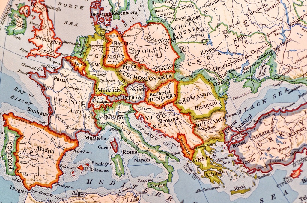
Western media consistently portrayed the Iron Curtain as a symbol of oppression, featuring dramatic escape attempts and refugee stories in newspapers and television broadcasts. Soviet propaganda countered by depicting these barriers as “anti-fascist protection ramparts” defending socialist achievements from Western imperialism. Hollywood films like “The Spy Who Came in from the Cold” popularized the Iron Curtain’s mystique, while Eastern European cinema emphasized collective security themes. Maps published during this period showed stark visual divisions, with Western cartographers often highlighting the barrier’s restrictive nature through bold black lines and shading techniques.
The Rio Grande: Natural Boundary Shaped by Political Conflict
You’ll find that the Rio Grande represents one of North America’s most contested natural boundaries, where geographic features intersect with centuries of political tension. This 1,896-mile river demonstrates how natural borders can become focal points for national identity and territorial disputes.
Mexican-American War and Treaty of Guadalupe Hidalgo
Mexican-American War (1846-1848) transformed the Rio Grande from a regional waterway into an international boundary through military conquest. You can trace how the Treaty of Guadalupe Hidalgo established the river as the official border between Texas and Mexico, ceding approximately 525,000 square miles of Mexican territory to the United States. This agreement displaced thousands of Mexican citizens who suddenly found themselves on American soil, creating lasting demographic and cultural tensions along the newly defined boundary.
Immigration and Border Security Debates
Immigration enforcement along the Rio Grande has intensified dramatically since the 1990s, with Border Patrol apprehensions peaking at over 1.6 million in 2000. You’ll observe how political rhetoric consistently frames this natural boundary as either a barrier requiring fortification or a humanitarian corridor needing protection. Modern border security measures include approximately 700 miles of fencing, surveillance technology, and increased agent presence, transforming the river’s representation from a geographic feature into a symbol of national security debates.
Environmental and Cultural Significance
Environmental challenges along the Rio Grande reveal how political boundaries can complicate natural resource management across two nations. You can examine how water rights disputes, pollution concerns, and habitat preservation efforts require binational cooperation despite political tensions. Cultural communities like the Tejanos and border tribes maintain traditional connections that predate the 1848 boundary, demonstrating how natural borders often divide unified cultural regions rather than separating distinct populations.
Conclusion
Understanding historical context in border representations reveals how these boundaries reflect far more than simple geographic divisions. You’ll find that each example demonstrates how political power social movements and cultural identity shape the way borders are portrayed and perceived across different eras.
These historical perspectives help you recognize that today’s border representations continue to carry embedded meanings from their past. Whether examining ancient fortifications or modern boundaries you can better interpret the underlying narratives that influence contemporary discussions about territory sovereignty and national identity.
By studying these examples you gain valuable insight into how borders function as both physical markers and powerful symbols that continue to shape our world’s political and cultural landscape.
Frequently Asked Questions
What role did cartographers play in political propaganda throughout history?
Cartographers have long used maps as instruments of propaganda and national identity. From medieval times to the Cold War, they deliberately exaggerated territorial claims, emphasized ideological divides, and created representations that served political agendas rather than objective geographic realities. Understanding this historical context helps us recognize that contemporary border representations often reflect political motivations.
Why was the Berlin Wall built and what did it symbolize?
The Berlin Wall was erected by East Germany in 1961 to halt mass emigration to the West. For 28 years, it physically divided East and West Berlin, becoming a powerful symbol of the Iron Curtain. The Wall represented the stark contrast between oppression and freedom, with Western and Eastern propaganda portraying it very differently.
What is the historical significance of the Mason-Dixon Line?
Originally established in the 1760s as a surveying boundary between Pennsylvania and Maryland, the Mason-Dixon Line evolved into a symbol of America’s sectional divide. During the Civil War era, it separated free states from slave states, influencing social and economic dynamics. Today, it continues to shape American political discourse and regional identity.
How did the Great Wall of China transform from military fortification to cultural symbol?
Built initially for defense against northern invasions and unified under the Qin Dynasty, the Great Wall evolved from military necessity to national symbol. Today, it represents Chinese engineering excellence and resilience, attracting millions of visitors as a UNESCO World Heritage Site and serving as a global emblem of Chinese civilization.
What was the strategic purpose of Hadrian’s Wall in Roman Britain?
Built between 122-128 CE across northern England, Hadrian’s Wall served multiple strategic purposes including military defense, administrative control, and trade regulation. The 73-mile fortification also functioned as propaganda, showcasing Roman superiority over “barbarian” cultures while establishing clear territorial boundaries and jurisdictional limits for Roman law.
What did Winston Churchill’s “Iron Curtain” represent during the Cold War?
Coined by Churchill in 1946, the Iron Curtain represented Western fears of Soviet expansion in Eastern Europe. By the 1950s, it became a physical reality with approximately 4,300 miles of barriers, electrified fences, and guard towers. Western media portrayed it as oppression, while Soviet propaganda framed it as defense against Western imperialism.
How did the Rio Grande become a contested international border?
The Mexican-American War transformed the Rio Grande into an international border through the Treaty of Guadalupe Hidalgo. This change displaced thousands of Mexican citizens and created lasting demographic tensions. Today, it remains central to immigration and border security debates, symbolizing either national security barriers or humanitarian corridors depending on political perspective.


