6 Best Elevation Mapping Methods
Why it matters: You’re dealing with massive amounts of elevation data from satellites, drones, and ground surveys – but choosing the wrong comparison method can lead to costly errors in everything from flood modeling to construction planning.
The big picture: Modern elevation mapping generates datasets so complex that traditional comparison techniques often fall short, leaving engineers and scientists struggling to validate their terrain models effectively.
What’s next: Six proven approaches can transform how you analyze elevation data accuracy, giving you the confidence to make critical decisions based on reliable terrain information.
Disclosure: As an Amazon Associate, this site earns from qualifying purchases. Thank you!
P.S. check out Udemy’s GIS, Mapping & Remote Sensing courses on sale here…
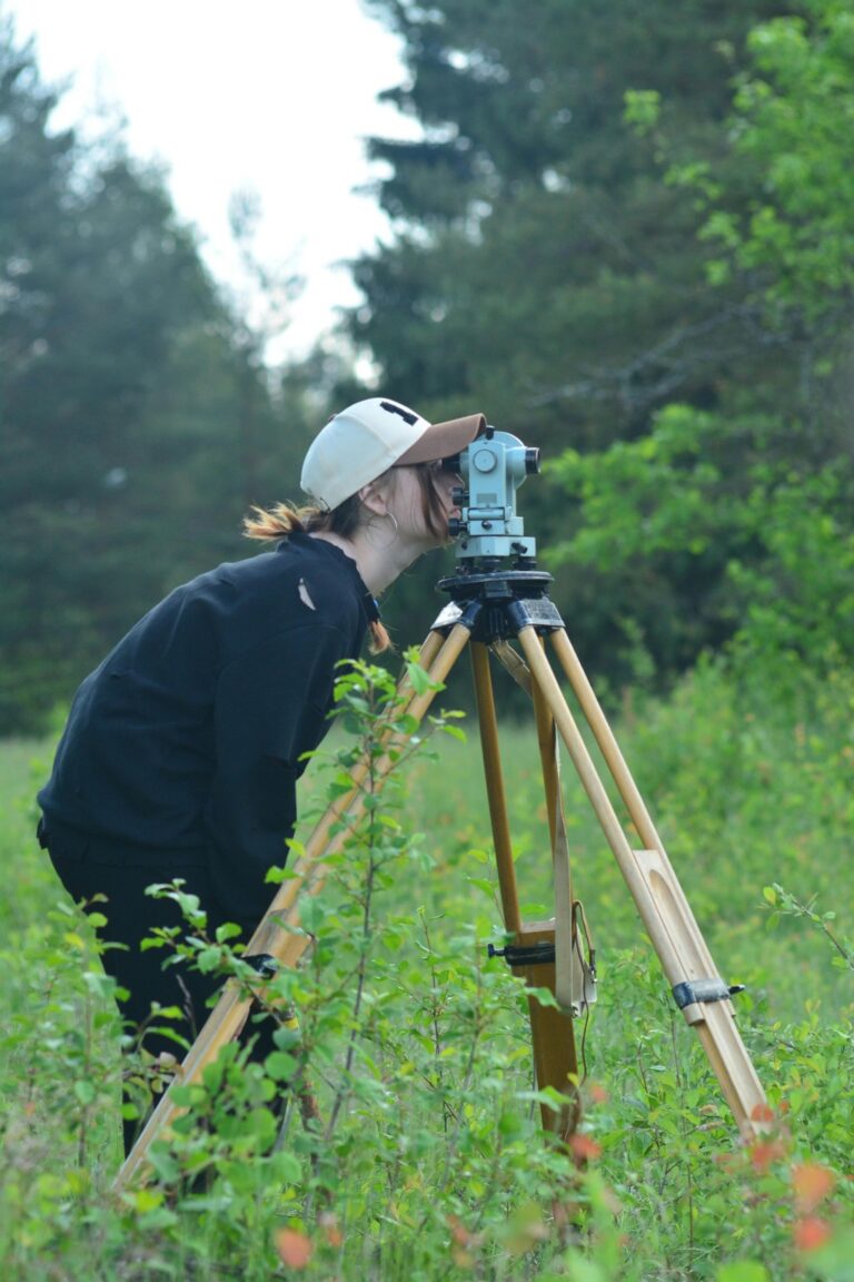
Traditional Surveying Methods for Baseline Elevation Comparison
Traditional surveying provides the foundation for validating modern elevation datasets. These time-tested methods establish reference standards that help you assess the accuracy of newer data-driven mapping techniques.
Achieve a flawless, even complexion with e.l.f. Flawless Satin Foundation. This lightweight, vegan formula provides medium coverage and a semi-matte finish for all-day wear, while hydrating your skin with glycerin.

Ground-Based Survey Techniques
Total station surveys deliver precise elevation measurements with accuracies typically within 2-3 millimeters for horizontal positions and 5-10 millimeters vertically. You’ll achieve optimal results by establishing multiple instrument positions across your study area and conducting reciprocal observations between known points. Differential leveling using digital levels provides even higher vertical accuracy, often reaching 1-2 millimeters per kilometer for first-order surveys. These methods require direct field access but generate the most reliable baseline data for comparison studies.
Measure distances accurately with the NorthWest Instrument NTS03 Total Station. This reflectorless instrument offers 2-second accuracy for precise surveying.

Benchmarking Against Known Control Points
National Geodetic Survey benchmarks serve as your primary reference framework for elevation comparison work. You can access over 240,000 established control points through the NGS database, each with documented coordinates and elevation values. Local survey monuments established by municipal agencies provide additional reference points for regional projects. Before using any control point, verify its current condition and stability through recent survey observations. Many benchmarks suffer from displacement due to ground movement, construction activity, or natural disasters.
Accuracy Standards and Measurement Protocols
FGDC accuracy standards specify that 95% of your elevation measurements should fall within established tolerance limits for each accuracy class. Class I surveys require vertical accuracy of 12.5 centimeters RMSE, while Class II allows 25 centimeters RMSE. ISO 19157 protocols guide your quality assessment procedures, requiring statistical analysis of elevation differences at checkpoints distributed throughout your project area. Document all measurement procedures, instrument calibrations, and environmental conditions that might affect accuracy during field operations.
LiDAR Technology Integration for High-Resolution Mapping
LiDAR technology represents a significant advancement over traditional surveying methods by capturing millions of elevation points per second. You’ll find that integrating LiDAR data with your existing elevation datasets provides unprecedented accuracy for terrain modeling and validation.
Airborne LiDAR Data Collection Methods
Airborne LiDAR systems collect elevation data using aircraft-mounted laser scanners that measure ground returns with centimeter-level accuracy. You can choose between discrete return systems that capture 2-15 returns per laser pulse or full-waveform systems that record complete signal characteristics. Most professional mapping projects use discrete return LiDAR with point densities ranging from 1-8 points per square meter, while specialized applications like forestry mapping require higher densities up to 25 points per square meter for detailed canopy analysis.
This WoneNice handheld barcode scanner offers fast, reliable scanning for businesses. It's easy to install via USB and boasts a rapid 200 scans per second, compatible with Windows, Mac, and Linux.

Point Cloud Processing and Analysis
Point cloud processing transforms raw LiDAR data into usable elevation information through classification and filtering algorithms. You’ll need to separate ground points from vegetation, buildings, and other features using automated classification tools like TerraScan or LAStools. Statistical outlier removal eliminates erroneous points that fall outside acceptable elevation ranges, typically defined as points exceeding 3 standard deviations from neighboring measurements. Quality control procedures should verify that ground point classifications achieve 95% accuracy against field-validated reference data.
Terrain Model Generation from LiDAR Datasets
Terrain model generation converts classified ground points into continuous elevation surfaces using interpolation algorithms. You can create Digital Terrain Models (DTMs) using triangulated irregular networks (TINs) for complex terrain or regular grids for standard applications. Kriging interpolation provides optimal results for sparse point distributions, while inverse distance weighting works well for dense LiDAR datasets. Your final terrain models should maintain vertical accuracy within 15 centimeters RMSE for most engineering applications, with higher precision achievable through careful processing parameter selection.
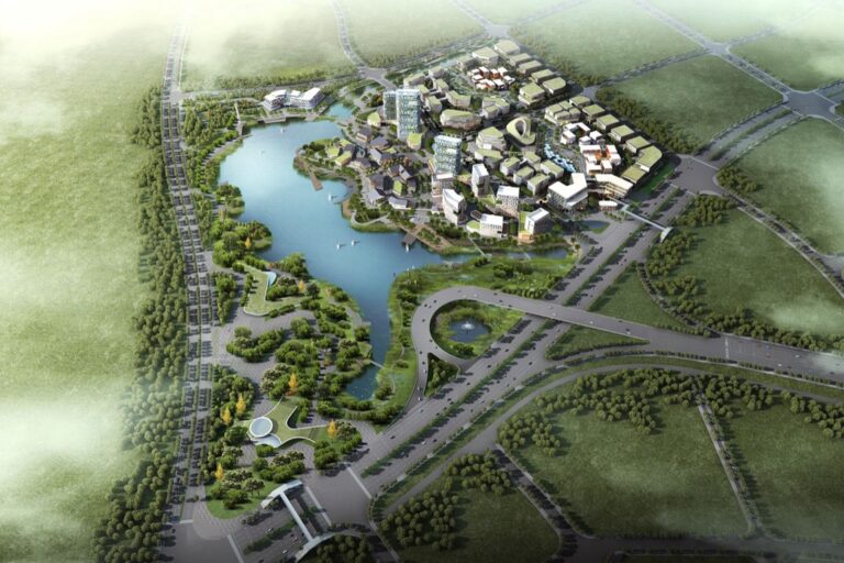
Satellite-Based Remote Sensing Comparison Techniques
Satellite imagery provides comprehensive elevation data across vast geographic areas, making it essential for regional terrain analysis and validation studies.
Digital Elevation Model (DEM) Analysis
DEM differencing reveals elevation changes by subtracting one dataset from another, highlighting discrepancies between satellite-derived models and reference data. You’ll achieve optimal results using 30-meter SRTM data compared against 10-meter ASTER Global DEM for regional validation. Calculate root mean square error (RMSE) values to quantify accuracy differences across terrain types. Focus analysis on areas with slope gradients below 20 degrees where satellite data performs most reliably.
Multi-Temporal Satellite Image Processing
Temporal analysis compares elevation datasets captured at different time periods to identify terrain changes and data quality variations. You can process Landsat 8 and Sentinel-2 imagery using radiometric correction algorithms to normalize atmospheric conditions between acquisitions. Apply co-registration techniques with sub-pixel accuracy to ensure proper alignment before conducting elevation comparisons. Monitor seasonal variations in vegetation cover that may affect surface elevation measurements in forested areas.
Resolution and Coverage Trade-Offs
Spatial resolution directly impacts elevation accuracy, with higher resolution datasets providing better terrain detail but covering smaller geographic areas. You’ll find 1-meter WorldView imagery offers superior building detection compared to 30-meter Landsat data, though processing costs increase significantly. Balance coverage requirements against budget constraints by using coarser resolution for regional analysis and higher resolution for critical validation zones. Consider data acquisition frequency limitations when planning multi-temporal comparison studies.
Photogrammetry and Stereo Image Processing Methods
Photogrammetry transforms overlapping aerial photographs into precise elevation measurements through automated processing workflows. These stereo image processing techniques complement satellite and LiDAR data by providing cost-effective elevation mapping solutions for medium-scale terrain analysis projects.
Aerial Photography Triangulation
Aerial triangulation establishes the geometric relationship between multiple overlapping photographs to create accurate 3D positioning data. You’ll need at least 60% forward overlap and 30% side overlap between adjacent flight lines to ensure proper stereo coverage. Modern digital photogrammetric workstations like Trimble Inpho or Hexagon ImageStation process bundle adjustment calculations that simultaneously solve for camera positions and ground coordinates. This triangulation process typically achieves vertical accuracies of 1-3 times the ground sampling distance when using proper control points.
Stay organized with this 48-inch workbench featuring drawers, shelves, and a pegboard. The enamel-coated work surface supports up to 220 pounds and includes built-in power outlets and a fluorescent light.
Structure from Motion (SfM) Algorithms
Structure from Motion algorithms automatically extract 3D terrain information from unordered photograph collections without requiring pre-existing camera calibration data. You can use SfM software like Agisoft Metashape or Pix4D to process drone imagery and generate dense point clouds with millions of elevation measurements. These algorithms identify matching features across multiple images and calculate camera positions through iterative bundle adjustment processes. SfM workflows typically produce elevation models with 2-5 centimeter vertical accuracy when using high-resolution imagery and sufficient ground control points for georeferencing.
Improve drone mapping accuracy with this 10-pack of numbered (0-9) 24"x24" GCP targets. Durable, waterproof Oxford cloth with high-contrast black and white design ensures clear visibility and reliable performance in various conditions.

Ground Control Point Integration
Ground control point integration provides the essential geometric framework that transforms photogrammetric measurements into accurate real-world coordinates. You’ll need to establish at least 3-5 surveyed control points per square kilometer for optimal results in challenging terrain conditions. Survey-grade GPS measurements with sub-centimeter accuracy serve as the foundation for control point networks in photogrammetric projects. Professional workflows require control point distribution that covers the project perimeter and includes elevation checkpoints for independent accuracy verification throughout the mapped area.
Machine Learning and AI-Driven Elevation Analysis
Machine learning algorithms revolutionize elevation data comparison by automating complex pattern recognition tasks that traditional methods struggle to handle efficiently. These AI-driven approaches process massive datasets while identifying subtle terrain features and anomalies that human analysis might miss.
Neural Network Training for Terrain Classification
Convolutional neural networks excel at classifying terrain features from elevation data by learning complex spatial patterns through supervised training on labeled datasets. You’ll need training datasets containing 10,000+ elevation profiles with corresponding terrain classifications like ridges, valleys, and slope breaks. Deep learning frameworks such as TensorFlow and PyTorch provide pre-built architectures for processing Digital Elevation Models (DEMs) with typical accuracies reaching 85-92% for standard terrain classes.
Automated Feature Recognition Systems
Computer vision algorithms automatically detect and extract terrain features from elevation datasets using edge detection and morphological analysis techniques. These systems identify ridgelines, drainage networks, and topographic breaks with pixel-level precision across large study areas. You can implement OpenCV-based solutions or specialized GIS tools like ArcGIS Pro’s Deep Learning package to process elevation grids and generate feature classification maps with processing speeds of 1,000+ square kilometers per hour.
Predictive Modeling for Elevation Interpolation
Machine learning interpolation methods predict elevation values at unmeasured locations using algorithms like Random Forest and Support Vector Regression trained on existing elevation points. These models analyze spatial relationships and terrain characteristics to generate more accurate predictions than traditional kriging methods. You’ll achieve optimal results by training models on datasets with 500+ control points per square kilometer, producing interpolated surfaces with root mean square errors typically 15-25% lower than conventional geostatistical approaches.
Cross-Platform Data Validation and Quality Assessment
Cross-platform validation ensures elevation datasets from different sources maintain consistent accuracy standards across your mapping project. You’ll need systematic approaches to identify discrepancies between satellite, LiDAR, and photogrammetric data sources.
Statistical Comparison Metrics
Root Mean Square Error (RMSE) serves as your primary metric for quantifying elevation differences between datasets. Calculate RMSE values for each comparison pair, with acceptable thresholds typically ranging from 0.3 to 2.0 meters depending on your application requirements. Mean Absolute Error (MAE) provides additional insight by revealing systematic bias patterns across terrain types. Standard deviation calculations help you identify outliers that exceed ±2 sigma limits, indicating potential data quality issues requiring further investigation.
Error Analysis and Uncertainty Quantification
Vertical accuracy assessment requires systematic error propagation analysis across all data sources in your elevation comparison workflow. Document uncertainty values for each dataset, typically ranging from ±0.15 meters for high-quality LiDAR to ±10 meters for global satellite DEMs. Confidence intervals calculated at 95% probability levels help you establish acceptable error margins for decision-making processes. Spatial correlation analysis reveals whether errors cluster in specific terrain types, elevation ranges, or geographic regions within your study area.
Data Fusion Techniques for Enhanced Accuracy
Weighted averaging algorithms combine multiple elevation datasets based on their individual accuracy ratings and spatial resolution characteristics. Assign higher weights to datasets with lower RMSE values and appropriate spatial scales for your mapping objectives. Kriging interpolation methods leverage spatial autocorrelation to fill data gaps while maintaining statistical relationships between neighboring elevation points. Kalman filtering approaches provide dynamic data fusion capabilities that continuously update elevation estimates as new observations become available from different platforms.
Conclusion
These six data-driven approaches give you the tools to tackle elevation mapping challenges with confidence. You’ll find that combining traditional surveying with modern technologies like LiDAR and machine learning creates a robust validation framework that minimizes costly errors.
Your success depends on selecting the right combination of methods for your specific project requirements. Whether you’re working on flood modeling or construction planning you now have proven strategies to ensure your elevation data meets the highest accuracy standards.
The landscape of terrain analysis continues evolving rapidly. By mastering these approaches you’re positioning yourself to leverage emerging technologies while maintaining the reliability that professional applications demand.
Frequently Asked Questions
What are the main challenges in managing elevation data from different sources?
The primary challenges include handling vast amounts of data from satellites, drones, and ground surveys, selecting appropriate comparison methods, and avoiding costly mistakes in applications like flood modeling and construction planning. Traditional validation techniques often fail with complex terrain models, leaving professionals without reliable methods to ensure data accuracy.
How do traditional surveying methods help validate modern elevation datasets?
Traditional methods like total station surveys and differential leveling provide precise baseline measurements for validation. They establish reliable reference data through ground-based techniques and benchmarking against National Geodetic Survey control points. These methods require 95% of measurements to meet established tolerance limits following ISO 19157 quality guidelines.
What makes LiDAR technology effective for elevation data validation?
LiDAR captures millions of elevation points per second, providing high-resolution terrain mapping. It uses discrete return and full-waveform systems with varying point densities for different applications. The technology creates Digital Terrain Models (DTMs) through classification and filtering algorithms, maintaining high vertical accuracy essential for engineering applications.
How do satellite-based remote sensing techniques compare elevation data?
Satellite methods use Digital Elevation Model (DEM) analysis to reveal elevation changes by comparing different datasets. Multi-temporal processing identifies terrain changes over time using radiometric correction and co-registration techniques. While higher resolution offers better detail, it increases processing costs, requiring balance between coverage needs and budget constraints.
What role does photogrammetry play in elevation data analysis?
Photogrammetry transforms overlapping aerial photographs into precise elevation measurements through automated workflows. It uses aerial triangulation for 3D positioning and Structure from Motion (SfM) algorithms to create dense point clouds. Ground control points ensure accurate real-world coordinates, requiring specific distribution patterns for effective elevation mapping.
How do machine learning and AI improve elevation data validation?
AI automates complex pattern recognition tasks that traditional methods can’t handle effectively. Convolutional neural networks perform terrain classification with high accuracy rates, while computer vision algorithms detect terrain features with pixel-level precision. Machine learning provides more accurate elevation interpolation by analyzing spatial relationships in existing data.
What are the key methods for cross-platform data validation?
Cross-platform validation uses statistical metrics like Root Mean Square Error (RMSE) and Mean Absolute Error (MAE) to quantify elevation differences. Data fusion techniques such as weighted averaging and Kriging interpolation combine multiple datasets based on their characteristics. These systematic approaches ensure consistent accuracy standards across different elevation data sources.