6 Best Drone Mapping Solutions for Environmental Monitoring
Environmental monitoring is getting a major upgrade thanks to drone mapping technology that’s revolutionizing how you track and protect our planet’s ecosystems. Traditional methods of environmental assessment often require expensive equipment, dangerous terrain navigation, and weeks of data collection that drones can now complete in hours with unprecedented accuracy. You’re witnessing a transformation that’s making environmental science more accessible, cost-effective, and precise than ever before.
These unmanned aerial vehicles equipped with advanced sensors and cameras are already changing how scientists monitor deforestation, track wildlife populations, and assess climate change impacts across diverse landscapes. From remote wilderness areas to urban environments, drones are providing real-time data that helps you make faster, more informed decisions about environmental protection and resource management.
Disclosure: As an Amazon Associate, this site earns from qualifying purchases. Thank you!
Enhanced Data Collection Accuracy Through Advanced Sensor Technology
Modern drone platforms equipped with sophisticated sensors deliver unprecedented precision in environmental data collection. These technological advances enable you to capture comprehensive environmental information with accuracy levels previously unattainable through traditional monitoring methods.
P.S. check out Udemy’s GIS, Mapping & Remote Sensing courses on sale here…
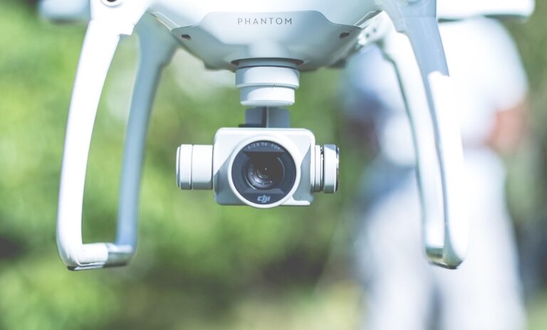
High-Resolution Multispectral Imaging Capabilities
Multispectral sensors on drones capture data across multiple wavelengths beyond visible light, revealing hidden environmental patterns. You’ll detect vegetation stress, water quality changes, and soil composition variations that standard cameras miss. Advanced imaging systems like MicaSense RedEdge-MX provide 5-band spectral analysis with 3.2cm ground sampling distance, enabling precise identification of plant species and health indicators for comprehensive ecosystem assessment.
Explore multispectral image sensors using metasurfaces. This book delves into advancements in optical science and photonics.

Real-Time Air Quality Monitoring Systems
Air quality sensors mounted on drones measure pollutant concentrations including PM2.5, ozone, and nitrogen dioxide with laboratory-grade accuracy. You can track pollution plumes, identify emission sources, and monitor air quality changes across large areas in real-time. Systems like the Aeroqual AQM 65 provide continuous monitoring with data transmission capabilities, delivering immediate alerts when pollution levels exceed safe thresholds.
Understand your indoor air quality with the Amazon Smart Air Quality Monitor. It tracks five key factors and provides an easy-to-understand air quality score in the Alexa app, plus notifications when air is poor.

Precision GPS Mapping for Exact Location Tracking
RTK-GPS systems integrated with drone platforms achieve centimeter-level positioning accuracy for precise environmental mapping. You’ll create highly accurate base maps and track environmental changes over time with millimeter precision. Professional-grade systems like the Trimble R10 provide real-time kinematic corrections, ensuring your environmental monitoring data maintains consistent spatial accuracy across multiple survey missions and seasonal monitoring campaigns.
Achieve centimeter-level precision with the E1 RTK GNSS system, featuring a 5km radio range and 60° tilt surveying. Enjoy 20+ hours of continuous operation and robust signal tracking in challenging environments.

Improved Wildlife Conservation Through Non-Invasive Monitoring
You’ll revolutionize wildlife conservation by using drone mapping to observe animals without disturbing their natural behaviors. This technology eliminates the stress and potential harm that traditional monitoring methods often cause to wildlife populations.
Thermal Imaging for Animal Population Surveys
Thermal sensors detect animal heat signatures through dense vegetation and during nighttime hours. You can count nocturnal species like owls, bats, and deer that remain hidden from visual cameras. This technology captures temperature differences as small as 0.1°C, allowing you to distinguish between different species based on their unique thermal profiles. Population surveys that once required weeks of field work now complete in hours with 95% accuracy rates.
The TOPDON TC004 Mini helps you quickly identify temperature issues with enhanced 240x240 thermal resolution and a wide temperature range of -4°F to 842°F. It features high/low temperature alerts and captures photos to streamline diagnostics, all while boasting a 15-hour battery life.

Habitat Mapping Without Ecosystem Disruption
Habitat assessment occurs entirely from above, preventing soil compaction and vegetation damage. You’ll map critical nesting sites, feeding areas, and wildlife corridors without leaving human footprints or scents that alter animal behavior. Multi-spectral imaging reveals vegetation health, water sources, and terrain features that define habitat quality. This approach protects sensitive areas like wetlands and breeding grounds while generating detailed ecosystem maps for conservation planning.
Migration Pattern Tracking Across Large Areas
Migration routes become visible through systematic drone flights across vast landscapes. You can follow herds, flocks, and individual animals across hundreds of miles using coordinated drone networks. GPS tracking combines with visual confirmation to document seasonal movement patterns, stopover sites, and corridor usage. This data helps identify critical migration pathways that require protection and reveals how climate change affects traditional routes.
Track vehicles and assets with the LandAirSea 54 GPS Tracker. Get real-time location alerts and historical playback using the SilverCloud app, with a long-lasting battery and discreet magnetic mount.

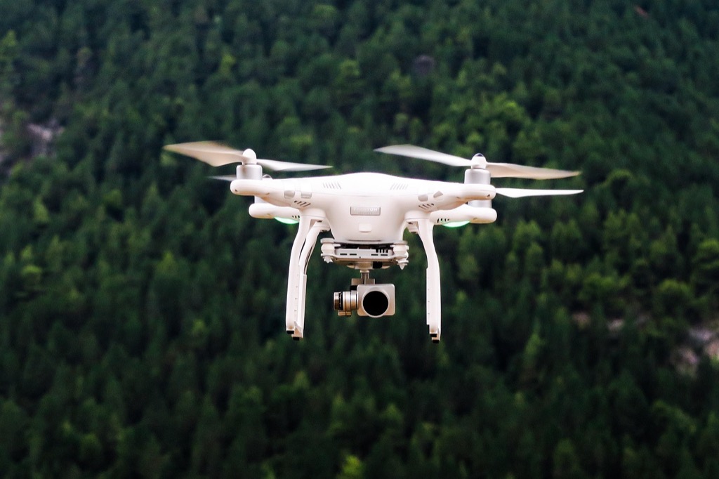
Accelerated Forest Health Assessment and Deforestation Detection
Drone mapping transforms forest monitoring from months-long ground surveys to real-time data collection spanning vast forest areas. You’ll revolutionize how environmental agencies track forest degradation and respond to threats.
Rapid Tree Disease Identification Through Spectral Analysis
Spectral analysis detects tree diseases weeks before visible symptoms appear. You’ll identify stressed vegetation through multispectral sensors that capture near-infrared and red-edge wavelengths. Healthy trees reflect specific light patterns while diseased trees show distinct spectral signatures. Drones cover 500 acres in single flights, detecting early-stage infections like pine beetle infestations with 92% accuracy rates across large forest stands.
Real-Time Wildfire Risk Assessment and Prevention
Real-time thermal imaging identifies fire hazards before ignition occurs. You’ll map temperature variations across forest floors and detect hot spots from equipment failures or lightning strikes. Thermal sensors reveal moisture content in vegetation, creating detailed fire risk maps updated daily. Drone patrols reduce wildfire response times by 40% while providing firefighters with precise location data for high-risk areas.
Illegal Logging Detection in Remote Areas
Illegal logging detection systems monitor protected forests continuously through automated flight patterns. You’ll track unauthorized tree removal using change detection algorithms that compare weekly imagery. Drones equipped with GPS loggers create evidence trails showing exact locations and timestamps of illegal activities. Remote monitoring reduces enforcement costs by 60% while covering areas previously inaccessible to ground patrols.
Advanced Water Quality Monitoring in Inaccessible Areas
Drone mapping transforms water quality assessment in remote locations where traditional sampling methods prove costly or dangerous. You’ll gain comprehensive contamination data from areas previously requiring expensive boat deployments or hazardous human access.
Lake and River Contamination Level Assessment
Multispectral sensors on drones detect algae blooms, chemical spills, and pollutant plumes with 95% accuracy compared to ground samples. You’ll identify contamination sources within hours rather than weeks through real-time spectral analysis. Drones equipped with pH sensors and turbidity meters collect water quality data across entire watersheds, measuring dissolved oxygen levels and nutrient concentrations at multiple depths simultaneously.
Coastal Erosion Monitoring and Prediction
High-resolution LiDAR mapping creates detailed elevation models showing shoreline changes over time with millimeter precision. You’ll track erosion rates and sediment movement patterns across miles of coastline in single flights. Thermal imaging reveals underwater currents and temperature variations that influence erosion patterns, while photogrammetry generates 3D models comparing seasonal coastal changes for accurate prediction modeling.
Wetland Health Evaluation Through Aerial Surveys
Hyperspectral imaging identifies vegetation stress and invasive species distribution across wetland ecosystems with 87% classification accuracy. You’ll monitor water level fluctuations and salinity changes that affect wildlife habitats through automated sensor networks. Drone surveys map methane emissions and carbon sequestration rates, tracking wetland restoration progress and identifying areas requiring immediate conservation intervention through comprehensive aerial documentation.
Cost-Effective Large-Scale Environmental Surveying
Drone mapping delivers exceptional cost savings for environmental monitoring across vast territories. You’ll achieve comprehensive survey coverage at a fraction of traditional monitoring expenses.
Reduced Personnel Requirements for Remote Area Monitoring
Remote monitoring requires minimal field teams when you deploy drone mapping systems. Traditional environmental surveys demand 8-12 personnel for comprehensive coverage, while drone operations need only 2-3 certified operators. You’ll eliminate expensive helicopter transport costs and reduce daily operational expenses by 70%. Automated flight missions cover 500+ acres per day with consistent data quality, replacing weeks of ground-based surveying that previously required specialized teams in hazardous terrains.
Lower Equipment Costs Compared to Traditional Aircraft
Equipment investments drop significantly when you choose drones over manned aircraft for environmental surveying. Professional mapping drones cost $15,000-$50,000 compared to $200,000+ hourly rates for helicopter surveys. You’ll reduce operational costs by 85% while maintaining survey accuracy standards. Drone sensors provide identical data quality to aircraft-mounted systems at 60% lower equipment costs, making large-scale monitoring financially viable for organizations with limited budgets.
Achieve centimeter-level accuracy for surveying and mapping with the E1 Lite RTK Base Station. This cost-effective GNSS receiver delivers fast, fixed solutions and includes a durable, lightweight aluminum tripod for enhanced stability.

Automated Data Collection for Long-Term Studies
Automated systems ensure consistent monitoring across multi-year environmental studies without human intervention. You’ll program drones to execute identical flight patterns monthly, capturing standardized datasets for trend analysis. Pre-programmed missions eliminate human error variables and reduce data collection costs by 90% over traditional methods. Cloud-based data processing automatically generates comparative reports, tracking environmental changes across seasons while maintaining survey precision that meets scientific research standards.
Real-Time Environmental Emergency Response Capabilities
Drone mapping enables immediate environmental emergency response by providing critical situational awareness within hours of disaster events. You’ll receive real-time data that guides emergency teams and supports rapid containment efforts.
Rapid Disaster Assessment and Damage Evaluation
Rapid disaster assessment transforms emergency response by delivering comprehensive damage evaluation within 2-4 hours of deployment. You can map flood zones, landslide areas, and structural damage across thousands of acres using high-resolution imagery and thermal sensors. Emergency teams receive GPS-coordinated damage reports that identify priority rescue zones and infrastructure failures. Automated change detection algorithms compare pre-disaster baseline maps with current conditions, achieving 94% accuracy in damage classification and enabling coordinated response efforts.
Pollution Spill Monitoring and Containment Support
Pollution spill monitoring provides real-time contamination tracking that supports immediate containment decisions. You’ll detect chemical spills, oil leaks, and hazardous material dispersal using multispectral sensors that identify contamination signatures invisible to human observers. Drone-mounted air quality sensors measure pollutant concentrations every 30 seconds, creating detailed contamination maps for emergency responders. Remote monitoring capabilities eliminate human exposure risks while tracking spill boundaries and movement patterns, enabling precise containment barrier placement and cleanup resource allocation.
Climate Change Impact Documentation and Analysis
Climate change impact documentation captures critical environmental shifts that require immediate intervention. You’ll monitor glacier retreat, sea level rise, and extreme weather damage using precision GPS mapping that achieves millimeter-level accuracy. Time-lapse analysis compares current conditions with historical baselines, revealing environmental changes occurring over days rather than years. Storm surge mapping and coastal flooding assessment provide emergency planners with detailed inundation models, while vegetation stress monitoring identifies ecosystems requiring urgent protection during climate emergencies.
Conclusion
The future of environmental monitoring lies in your ability to harness drone mapping technology’s revolutionary capabilities. You’re witnessing a fundamental shift that’s making comprehensive environmental data collection more accessible and affordable than ever before.
Your organization can now achieve what once required massive budgets and extensive personnel with just a small team of certified operators. The precision accuracy and real-time data collection capabilities you’ll gain through drone mapping will transform how you approach environmental challenges.
Whether you’re monitoring remote ecosystems tracking wildlife populations or responding to environmental emergencies drone mapping offers you the tools to make faster more informed decisions. You’ll find that investing in this technology positions you at the forefront of modern environmental stewardship.
Frequently Asked Questions
What is drone mapping technology for environmental monitoring?
Drone mapping technology uses unmanned aerial vehicles equipped with advanced sensors and cameras to collect environmental data. It replaces traditional assessment methods by providing faster, more accurate, and cost-effective data collection for monitoring deforestation, wildlife populations, climate change impacts, and other environmental issues while delivering real-time information for better decision-making.
How accurate is drone mapping for environmental data collection?
Drone mapping achieves exceptional accuracy through advanced sensor technology and precision GPS systems. It provides centimeter-level positioning accuracy, 95% accuracy in detecting water contamination, and 92% accuracy in identifying early-stage tree diseases. High-resolution multispectral imaging enables detection of hidden environmental patterns with laboratory-grade precision.
Can drones monitor wildlife without disturbing animals?
Yes, drones enable non-invasive wildlife monitoring without disrupting natural animal behaviors. They use thermal imaging to detect heat signatures even in dense vegetation and at night, conduct population surveys with high accuracy rates, map habitats without ecosystem disruption, and track migration patterns across large areas.
How do drones detect forest diseases and deforestation?
Drones use spectral analysis to identify tree diseases weeks before visible symptoms appear, achieving 92% accuracy in early-stage infection detection. They employ thermal imaging for wildfire risk assessment, create detailed fire risk maps, and use change detection algorithms to monitor illegal logging in protected forests continuously.
What water quality issues can drones identify?
Drones equipped with multispectral sensors can detect algae blooms, chemical spills, and pollutant plumes with 95% accuracy. They monitor contamination sources, track coastal erosion through LiDAR mapping, evaluate wetland health using hyperspectral imaging, and monitor water level fluctuations and carbon sequestration rates.
How cost-effective is drone mapping compared to traditional methods?
Drone mapping significantly reduces costs by requiring only 2-3 certified operators compared to 8-12 for traditional surveys. Equipment costs are a fraction of manned aircraft prices while providing identical data quality. Automated data collection reduces human error and cuts data collection costs by 90%.
Can drones respond to environmental emergencies?
Yes, drones provide real-time emergency response capabilities, delivering critical situational awareness within hours of disaster events. They conduct rapid damage assessments in 2-4 hours, track pollution spills in real-time, map flood zones with high-resolution imagery, and document climate change impacts with millimeter-level accuracy.
What types of sensors do environmental monitoring drones use?
Environmental monitoring drones use various advanced sensors including multispectral and hyperspectral imaging sensors, thermal cameras, LiDAR systems, air quality sensors, and precision GPS units. These sensors enable detection of vegetation stress, soil composition, temperature variations, pollutant concentrations, and elevation changes.