6 Best Environmental Mapping Tools
Environmental mapping has revolutionized how you understand and protect ecosystems but traditional satellite data and scientific surveys often miss crucial details that only locals can provide. Communities living in these environments for generations possess invaluable insights about seasonal patterns wildlife behavior and environmental changes that technology simply can’t capture. By combining cutting-edge mapping tools with local expertise you’ll discover how this powerful partnership creates more accurate comprehensive and actionable environmental data.
Disclosure: As an Amazon Associate, this site earns from qualifying purchases. Thank you!
Incorporating Traditional Ecological Knowledge Enhances Data Accuracy
Traditional ecological knowledge from indigenous communities and long-term residents fills critical data gaps that satellite imagery and field surveys often miss. You’ll discover that local observers can identify seasonal patterns, species behavior changes, and micro-environmental variations that aren’t visible in remote sensing data.
Combining traditional knowledge with your GIS datasets creates more precise environmental baselines. Community members provide temporal context spanning decades or generations, helping you understand natural cycles and distinguish between normal variations and concerning environmental changes. This historical depth transforms your mapping from static snapshots into dynamic environmental narratives.
P.S. check out Udemy’s GIS, Mapping & Remote Sensing courses on sale here…
You can validate your scientific measurements against traditional observations to improve overall data reliability. Local knowledge holders often detect subtle ecosystem shifts months or years before they appear in satellite data, giving you early warning indicators for environmental monitoring programs.
Leveraging Community Observations Fills Critical Data Gaps
Community-based environmental monitoring transforms incomplete datasets into comprehensive mapping resources. Local observers bridge the temporal and spatial gaps that exist between formal scientific surveys and satellite data collection cycles.
Identifying Seasonal Patterns and Changes
Local residents provide year-round environmental observations that capture seasonal variations missed by periodic scientific surveys. They’ll document migration timing changes, flowering patterns, and water level fluctuations across multiple years. This continuous monitoring reveals subtle environmental shifts that occur between formal data collection periods. Community observations help you establish baseline conditions and identify when ecosystems deviate from historical norms, providing early indicators of environmental stress or climate impacts.
Documenting Rare Species and Phenomena
Community members often encounter uncommon wildlife, plants, and environmental events that scientists rarely observe during scheduled fieldwork. Local knowledge holders can pinpoint exact locations where rare species appear seasonally or describe unusual weather patterns specific to microclimates. Their observations help you map biodiversity hotspots and document environmental anomalies that don’t appear in standard ecological surveys. This information proves invaluable for conservation planning and identifying areas requiring special protection or further scientific investigation.
Utilizing Indigenous Land Management Practices Improves Habitat Assessment
Indigenous communities possess centuries of land management wisdom that transforms how you’ll assess habitat conditions. These time-tested practices reveal ecosystem dynamics that conventional mapping often overlooks.
Understanding Historical Land Use Patterns
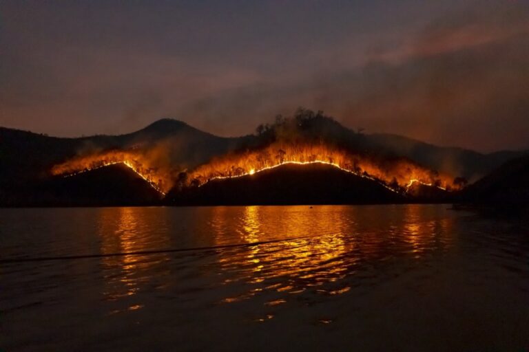
Indigenous land management records provide historical baselines spanning centuries, revealing how ecosystems functioned before industrial disruption. You’ll discover traditional burning cycles, seasonal harvesting patterns, and migration corridors that shaped current habitat conditions. These historical insights help you identify natural ecosystem states and distinguish between human-caused degradation and natural variations. Traditional fire management practices particularly reveal how indigenous communities maintained healthy forest ecosystems through controlled burns.
Recognizing Sustainable Resource Management Techniques
Indigenous resource management techniques offer proven sustainable practices that maintain ecosystem health while supporting human communities. You’ll learn about rotational harvesting systems, selective species management, and water conservation methods that preserve biodiversity. These practices demonstrate successful long-term habitat stewardship, showing how traditional agroforestry, selective hunting protocols, and seasonal restrictions maintain ecological balance. Understanding these techniques helps you identify areas where traditional management could restore degraded habitats.
Engaging Local Stakeholders Increases Mapping Coverage Areas
Local stakeholder engagement transforms environmental mapping from limited geographic surveys into comprehensive territorial assessments. Community participation expands data collection beyond traditional scientific boundaries.
Accessing Remote and Restricted Locations
Accessing remote territories becomes achievable through local partnerships that overcome geographic and logistical barriers. Community members navigate challenging terrain like steep mountainsides, dense forests, and wetland areas that standard surveying teams can’t reach safely. Local guides provide essential knowledge about seasonal access routes, weather patterns, and wildlife behavior that affect field work timing. You’ll discover that indigenous communities often hold permits or traditional access rights to protected areas where external researchers face restrictions. Remote sensing data alone can’t capture the environmental details found in these inaccessible locations that locals visit regularly.
Expanding Geographic Scope Through Volunteer Networks
Expanding mapping coverage through volunteer networks creates unprecedented data collection scale across diverse landscapes and ecosystems. Citizen science programs recruit hundreds of volunteers who document environmental conditions in their local areas simultaneously. Community members provide observations from agricultural lands, urban green spaces, suburban watersheds, and rural forests that professional teams couldn’t systematically survey. You’ll leverage existing social networks like hiking clubs, environmental groups, and school programs to establish consistent monitoring protocols. Volunteer participation creates continuous data streams that fill temporal gaps between formal scientific surveys while covering geographic areas that would require massive professional resources.
Combining Citizen Science with Professional Expertise Validates Results
You’ll achieve the most reliable environmental data when citizen observations undergo rigorous scientific validation protocols. This dual-verification approach creates robust datasets that professional researchers can confidently use for critical environmental decisions.
Cross-Referencing Local Reports with Scientific Data
Cross-referencing transforms anecdotal observations into scientifically validated environmental indicators. You can verify citizen reports against satellite imagery, weather station data, and biological surveys to identify patterns and anomalies. Local water quality observations correlate with laboratory testing results, while wildlife sighting reports align with GPS tracking data from research collars. This systematic comparison reveals where citizen science excels and where professional monitoring fills gaps. Ground-truthing protocols ensure that community observations meet scientific accuracy standards while maintaining the valuable context that only local knowledge provides.
Get real-time weather data with the Ambient Weather WS-2902. This WiFi-enabled station measures wind, temperature, humidity, rainfall, UV, and solar radiation, plus it connects to smart home devices and the Ambient Weather Network.

Building Comprehensive Monitoring Systems
Building integrated monitoring systems combines automated sensors with trained citizen observers for continuous environmental surveillance. You’ll establish standardized reporting protocols that allow volunteers to contribute meaningful data alongside professional equipment. Weather stations complement community rainfall measurements, while camera traps verify wildlife behavior patterns reported by local residents. Coordinated data collection creates redundant verification systems that catch environmental changes from multiple angles. These hybrid networks provide real-time alerts when citizen observations diverge from sensor readings, triggering immediate professional investigation of potential environmental threats.
Capture wildlife with this mini trail camera, featuring 36MP photos and 2.7K videos. Its fast 0.1s trigger time and 130° wide-angle lens ensure you won't miss any action, day or night.

Integrating Cultural Perspectives Strengthens Conservation Strategies
When you incorporate cultural values into environmental planning, you create conservation strategies that local communities truly embrace and sustain long-term.
Incorporating Traditional Values into Environmental Planning
Traditional values shape how communities view environmental stewardship and resource management practices. You’ll find that Indigenous fire management cycles align with natural ecosystem rhythms, creating fire-resistant landscapes that prevent catastrophic wildfires. Sacred site designations protect biodiversity hotspots through cultural protocols that restrict access during sensitive breeding seasons. Community elders identify keystone species based on spiritual significance, often revealing ecological relationships that scientific surveys miss. Traditional seasonal calendars guide restoration timing, ensuring plantings occur when natural conditions support successful establishment.
Developing Culturally Appropriate Management Solutions
Culturally appropriate management solutions respect local customs while achieving conservation goals through community-led implementation strategies. You can design rotational harvesting systems that maintain traditional resource access while protecting species populations from overexploitation. Community-based ranger programs train local residents in monitoring techniques that align with traditional knowledge systems. Gender-specific conservation roles honor cultural practices while expanding participation in environmental stewardship activities. Collaborative decision-making processes ensure that conservation strategies reflect both scientific evidence and cultural values, creating sustainable management frameworks that communities actively support.
Conclusion
When you combine local knowledge with advanced mapping technologies you’re not just improving data qualityâyou’re revolutionizing how environmental conservation happens. This approach transforms static maps into living documents that reflect the true complexity of ecosystems.
Your environmental mapping efforts will achieve unprecedented accuracy and relevance when you embrace community partnerships. Local observers provide the context that satellites can’t capture while bridging critical gaps in scientific data collection.
The future of environmental protection depends on your willingness to integrate traditional wisdom with modern technology. By respecting and incorporating local expertise you’ll create mapping solutions that are both scientifically sound and culturally sustainable.
Frequently Asked Questions
What is the main benefit of combining traditional mapping with local knowledge?
Combining traditional environmental mapping with local knowledge creates more accurate and comprehensive environmental data. While satellite imagery and scientific surveys provide valuable information, local communities who have lived in these environments for generations can identify critical details, seasonal patterns, and micro-environmental variations that remote sensing often misses, resulting in more actionable conservation strategies.
How does traditional ecological knowledge fill data gaps in environmental mapping?
Traditional ecological knowledge from indigenous communities and long-term residents fills critical gaps by providing insights into seasonal patterns, species behavior changes, and historical environmental conditions. Local observers can identify subtle variations invisible in satellite data and offer historical context spanning generations, helping distinguish between normal environmental variations and concerning changes that require attention.
What role does community-based monitoring play in environmental mapping?
Community-based environmental monitoring transforms incomplete datasets into comprehensive mapping resources by providing year-round observations that capture seasonal variations missed by periodic scientific surveys. Local observers bridge temporal and spatial gaps between formal surveys, documenting changes in migration timing, flowering patterns, water levels, and rare species occurrences crucial for conservation planning.
How do Indigenous land management practices improve habitat assessment?
Indigenous land management practices reveal ecosystem dynamics often overlooked by conventional mapping. These time-tested methods provide historical baselines spanning centuries, showing how ecosystems functioned before industrial disruption. Traditional practices like controlled burning cycles, rotational harvesting, and seasonal management help identify natural ecosystem states and guide habitat restoration efforts.
Why is local stakeholder engagement important for environmental mapping coverage?
Local stakeholder engagement expands environmental mapping beyond traditional scientific boundaries by providing access to remote and restricted locations. Community members can navigate challenging terrains safely, possess essential knowledge about seasonal access routes and wildlife behavior, and often hold permits for protected areas that external researchers cannot access, significantly expanding data collection capabilities.
How do volunteer networks enhance environmental data collection?
Volunteer networks create unprecedented data collection scales by recruiting citizens to document environmental conditions in their local areas. These citizen science programs fill temporal gaps between formal scientific surveys, cover geographic areas requiring significant professional resources, and leverage existing social networks to create continuous data streams that enhance environmental monitoring efforts.
What makes citizen science observations scientifically reliable?
Citizen observations become scientifically reliable through rigorous validation protocols that cross-reference local reports with scientific data. This dual-verification approach transforms anecdotal observations into validated environmental indicators, creating robust datasets through systematic comparisons and standardized reporting protocols that professional researchers can confidently use for critical environmental decisions.
How do cultural perspectives strengthen conservation strategies?
Cultural perspectives strengthen conservation by aligning traditional values with environmental stewardship practices. Indigenous fire management, rotational harvesting systems, and community-based ranger programs create culturally appropriate solutions that respect local customs while achieving conservation goals. Collaborative decision-making ensures strategies reflect both scientific evidence and cultural values, fostering sustainable frameworks communities actively support.