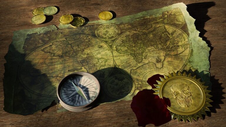
7 Creative Methods for Archiving Maps That Preserve History
Your old maps are more than just paper – they’re pieces of history that deserve proper preservation. Whether you’ve inherited vintage atlases or collected specialty maps over the years, traditional storage methods often fall short of protecting these delicate treasures from time and environmental damage.
Smart archiving techniques can transform how you preserve your cartographic collection while making it more accessible for future generations. From digital scanning innovations to climate-controlled storage solutions, modern preservation methods offer exciting alternatives to simply stuffing maps in drawers or file cabinets.
Disclosure: As an Amazon Associate, this site earns from qualifying purchases. Thank you!
Create Digital Scans With High-Resolution Photography
Modern digital photography offers precise map archiving solutions that capture every detail while preserving originals. High-resolution scanning transforms fragile historical maps into accessible digital formats that maintain cartographic accuracy.
P.S. check out Udemy’s GIS, Mapping & Remote Sensing courses on sale here…
Use Professional Scanning Equipment for Large Format Maps
Professional flatbed scanners handle oversized maps with exceptional detail capture capabilities. Large format scanners like the Epson Expression 12000XL accommodate maps up to 12.2 x 17.2 inches at 2400 dpi resolution. You’ll achieve archival-quality results using TIFF format with 600-1200 dpi settings for most historical maps. Position maps carefully to avoid shadows and ensure complete edge capture during scanning operations.
Get clear, detailed scans of photos and documents with the Epson Perfection V39 II. Its 4800 dpi resolution captures fine details, while one-touch buttons simplify scanning.

Employ Smartphone Apps for Quick Field Documentation
Experience vivid content on the Galaxy A16 5G's 6.7" display and capture stunning photos with its triple-lens camera. Enjoy peace of mind with a durable design, six years of updates, and Super Fast Charging.

Smartphone scanning apps provide immediate map digitization when professional equipment isn’t available. Apps like Adobe Scan and CamScanner automatically detect map boundaries and correct perspective distortion in real-time. You’ll capture GPS coordinates and timestamps simultaneously for complete documentation workflows. Use consistent lighting and steady positioning techniques to maintain scan quality across multiple map sections during field surveys.
Apply Color Correction and Enhancement Techniques
Digital enhancement tools restore faded colors and improve map legibility without altering historical accuracy. Adobe Photoshop’s levels and curves adjustments recover detail from aged paper while maintaining authentic color relationships. You’ll balance contrast enhancement with preservation of original cartographic elements using non-destructive editing layers. Apply sharpening filters selectively to text elements while preserving delicate illustration details throughout your digital archive.
Design Custom Storage Portfolios and Binders
Creating specialized storage systems transforms your map archiving from basic filing to professional preservation that protects cartographic integrity for decades.
Select Acid-Free Materials for Long-Term Preservation
Acid-free portfolio materials prevent chemical deterioration that destroys historical maps over time. Museum-quality archival boards with pH levels between 8.0-9.5 create protective barriers against environmental acids. Polyethylene sleeves offer transparent protection without chemical reactions, while acid-free tissue paper provides cushioning between delicate map layers. Professional suppliers like Gaylord Archival and University Products stock materials meeting Library of Congress preservation standards for long-term cartographic storage.
Display your 5x7 photos and artwork in this 2-pack of stylish portfolio albums. Each album features 24 acid-free sleeves (48 pages) and includes black mounting paper for a professional presentation.

Create Labeled Dividers for Geographic Organization
Geographic divider systems streamline map retrieval while maintaining archival organization standards. Color-coded tabs representing different regions, time periods, or map scales create visual navigation through your collection. Archival-quality manila dividers with printed labels resist fading and cracking over decades of use. Consider organizing by topographic quadrangle, political boundaries, or thematic categories like transportation or geological surveys to match your research workflow.
Implement Climate-Controlled Storage Solutions
Temperature and humidity control prevents map degradation caused by environmental fluctuations that warp paper and fade inks. Maintain storage areas between 65-70°F with 45-55% relative humidity using dehumidifiers and climate monitoring systems. Store portfolios in metal filing cabinets away from direct sunlight and heat sources. Professional map storage rooms use HVAC systems with filtration to remove pollutants that accelerate paper deterioration.
Efficiently remove moisture from large spaces with this Energy Star 2025 certified dehumidifier. It covers up to 4500 sq. ft. and features a smart compressor with an intelligent humidistat for optimal performance and energy savings.

Develop Interactive Digital Map Collections
Interactive digital collections transform static archived maps into dynamic resources that engage users while preserving historical cartographic data.
Build Online Galleries With Searchable Metadata
Online galleries maximize map accessibility through comprehensive metadata systems that enable precise searches across your digital archive. You’ll create searchable databases using fields like geographic region, date range, cartographer, and map scale to help researchers locate specific materials quickly. Popular platforms such as Omeka S and CONTENTdm provide robust metadata frameworks specifically designed for cultural heritage collections. Include standardized Dublin Core elements alongside custom fields for cartographic details like projection type and coordinate systems. Tag maps with keywords describing geographic features, political boundaries, and historical events to enhance discoverability. Implement faceted search functionality that allows users to filter results by multiple criteria simultaneously, making your collection more user-friendly for both casual browsers and serious researchers.
Create Virtual Reality Map Exploration Experiences
Virtual reality environments allow users to explore historical maps in immersive three-dimensional spaces that recreate the original viewing experience. You’ll use VR development platforms like Unity or Unreal Engine to build interactive environments where visitors can “walk through” historical landscapes or examine map details at unprecedented scales. Create 360-degree viewing experiences that let users manipulate map orientation and zoom levels while maintaining archival image quality. Integrate VR headsets like Oculus Rift or HTC Vive to provide fully immersive experiences in museum settings or online platforms. Develop comparative viewing modes that overlay historical maps with contemporary satellite imagery, revealing changes in geography and urban development over time. Include audio narration and contextual information panels within the VR environment to enhance educational value.
Integrate GPS Coordinates and Historical Context
GPS integration connects historical maps to modern coordinate systems while preserving their original geographic context and cartographic accuracy. You’ll georeference archived maps using GIS software like ArcGIS or QGIS to align historical features with current GPS coordinates, enabling overlay comparisons with contemporary mapping data. Embed contextual information including historical events, demographic data, and environmental changes that influenced the original map creation. Create interactive timelines that show how geographic boundaries, settlements, and natural features evolved across different map versions. Include metadata about surveying techniques and instruments used by original cartographers to help users understand accuracy limitations and measurement methods. Develop mobile-friendly interfaces that allow field researchers to access georeferenced historical maps through smartphone apps, combining GPS positioning with archived cartographic resources for on-site historical research.
Transform Maps Into Artistic Display Pieces
After preserving your maps digitally and physically, you can showcase these cartographic treasures as striking wall art that celebrates both geography and design.
Frame Maps Using Museum-Quality Conservation Methods
Mount your maps with acid-free matting and UV-protective glazing to prevent deterioration while creating professional displays. Use archival mounting corners instead of adhesives to secure maps without permanent damage. Choose frames with spacers that maintain air circulation between the glass and map surface. Professional conservation framing costs $200-500 per piece but preserves your maps for decades while enhancing their visual impact as decorative elements.
Create Rotating Gallery Walls for Multiple Maps
Install track lighting systems with adjustable picture hanging rails to easily swap maps based on seasons or themes. Use standardized frame sizes across your collection to enable quick rotations without measurement adjustments. Create themed displays like “Historical Trade Routes” or “Topographic Surveys” that you can change monthly. Digital inventory systems help track which maps are currently displayed versus stored, maximizing your collection’s visibility.
Design Shadow Boxes for Three-Dimensional Presentation
Showcase your treasured memories in this elegant 11x14 black shadow box frame. It features shatter-resistant glass, a soft felt back, and can be easily mounted on the wall or displayed on a tabletop.

Build custom shadow boxes that incorporate map-related artifacts like vintage compasses, surveying tools, or regional specimens alongside your cartographic displays. Layer multiple map sections at varying depths to create visual dimension and storytelling opportunities. Include LED strip lighting within the box perimeter to illuminate details without heat damage. Shadow box presentations work especially well for expedition maps, allowing you to display the complete historical context of mapping adventures.
Establish Collaborative Community Archives
Building community partnerships amplifies your map preservation efforts while creating shared resources that benefit multiple organizations and researchers.
Partner With Local Historical Societies and Libraries
Connect with historical societies and public libraries to pool archival expertise and storage resources. These partnerships provide access to professional cataloging systems and climate-controlled facilities that individual collectors can’t maintain. You’ll gain valuable guidance on metadata standards while contributing to established research collections. Libraries often have digitization equipment and trained staff who can help process your map contributions efficiently.
Organize Crowdsourced Digitization Projects
Launch volunteer digitization initiatives that engage community members in map preservation activities. Recruit local geography students, genealogy enthusiasts, and history buffs to help scan and catalog maps using standardized protocols. You can organize “scan-a-thon” events where volunteers bring personal equipment to digitize family maps and community documents. Provide training sessions on proper handling techniques and metadata entry to ensure consistent quality across all contributed materials.
Create Public Access Points for Research and Education
Establish physical locations where community members can access archived maps for research and educational purposes. Partner with libraries to create dedicated map study areas equipped with large-format viewing tables and magnification tools. You’ll want to implement appointment systems for handling original materials while maintaining open access to digital collections through public computers. Consider hosting monthly “Map Discovery” sessions where researchers can explore archived collections with expert guidance.
Convert Maps Into Functional Reference Tools
Transform your archived maps into practical resources that extend their utility beyond historical preservation. Converting maps into functional tools creates ongoing value while protecting the originals from handling damage.
Create Laminated Field Guides for Outdoor Activities
Identify North American mushrooms with this updated field guide. It features detailed descriptions and illustrations for accurate identification in the field.

Laminate high-resolution scans of topographic and trail maps to create durable field references for hiking, camping, and outdoor education. Print maps at 1:24,000 scale on waterproof paper before lamination to maintain cartographic accuracy in field conditions. Add custom legends and GPS coordinate grids to enhance navigation capabilities. Store laminated guides in protective sleeves with carabiners for easy attachment to backpacks. Create series covering different trail systems or geographic regions for comprehensive outdoor reference collections.
Develop Comparison Charts Showing Geographic Changes
Design side-by-side comparison displays using historical maps alongside current satellite imagery or modern cartographic data. Create timeline charts showing urban development, coastline changes, or forest cover evolution using maps from different decades. Mount comparison sets on foam core boards with clear protective overlays for educational presentations. Include percentage change calculations and measurement scales to quantify geographic transformations. Develop digital versions with slider tools allowing users to transition between time periods interactively.
Design Educational Materials for Teaching Applications
Transform archived maps into curriculum-specific teaching aids by creating worksheet overlays, activity guides, and lesson plan supplements. Develop transparent overlays showing different data layers like population density, elevation contours, or historical events for geography classes. Create puzzle versions of neighborhood maps for elementary students learning spatial concepts. Design measurement activities using map scales and coordinate systems for mathematics integration. Produce themed educational packets combining multiple archived maps with guided exploration questions and research prompts.
Build Comprehensive Metadata Documentation Systems
Comprehensive metadata systems transform archived maps from simple storage items into searchable research tools. Documentation standards ensure your archived maps remain accessible and valuable for researchers, historians, and cartographic professionals.
Record Provenance and Historical Significance Details
Document ownership history and creation circumstances for each archived map to establish authenticity and research value. Record the original cartographer or surveying company, publication date, and commissioning organization when available. Include previous collectors, donation sources, and acquisition methods in your provenance records. Catalog historical context such as the map’s intended purpose, significant events it documents, and its role in local or regional development. Note any unique features like hand-drawn annotations, survey marks, or distinctive cartographic techniques that enhance the map’s historical significance.
Catalog Geographic Coordinates and Scale Information
Create precise geographic reference data using modern coordinate systems to enable spatial searches and GIS integration. Record original projection systems, datum references, and coordinate grids shown on historical maps alongside converted decimal degree coordinates. Document scale ratios and coverage areas including representative fractions, bar scales, and calculated ground distances per map unit. Establish bounding box coordinates for the mapped area and note any scale variations across large-format maps. Include magnetic declination dates and true north references to assist researchers in spatial analysis and georeferencing projects.
Document Physical Condition and Conservation Needs
Assess deterioration patterns and material composition to prioritize conservation efforts and establish handling protocols. Record paper types, printing methods, mounting materials, and binding structures that affect preservation strategies. Catalog damage indicators including tears, fading, staining, insect damage, and previous repair attempts with photographic documentation. Note environmental exposure history, storage conditions, and recommended conservation treatments. Establish condition ratings using standardized scales and create maintenance schedules for regular condition monitoring and preventive care measures.
Conclusion
Your map preservation journey doesn’t end with selecting the right archival method—it’s about creating a sustainable system that serves both current and future researchers. By combining digital preservation with proper physical storage you’ll ensure these historical treasures remain accessible for generations.
The seven methods we’ve explored offer flexible solutions that can adapt to your specific collection needs and budget. Whether you’re starting with basic acid-free storage or implementing advanced digital cataloging systems you’re making a valuable contribution to historical preservation.
Remember that successful map archiving is an ongoing process. Regular condition assessments and metadata updates will keep your collection organized and research-ready while protecting these irreplaceable documents from deterioration.
Frequently Asked Questions
Why are old maps important to preserve?
Old maps are valuable historical artifacts that document geographic, political, and cultural changes over time. They provide insights into past civilizations, land use patterns, and cartographic techniques. Preserving these maps ensures future generations can access and study these irreplaceable records of human history and geographic evolution.
What are the main threats to old map preservation?
The primary threats include chemical deterioration from acidic materials, environmental factors like humidity and temperature fluctuations, physical damage from improper handling, and fading due to light exposure. Traditional storage methods often fail to protect against these risks, making modern preservation techniques essential.
What digital preservation methods work best for old maps?
High-resolution photography and professional scanning equipment are ideal for creating detailed digital archives. For oversized maps, specialized large-format scanners maintain cartographic accuracy. Smartphone scanning apps offer convenient field documentation options. Color correction techniques help restore faded elements while preserving historical integrity.
How should I physically store preserved maps?
Use acid-free materials for custom storage portfolios and binders to prevent chemical deterioration. Implement labeled dividers for efficient organization and retrieval. Climate-controlled storage maintains optimal temperature and humidity levels. Flat storage is preferable to rolling for fragile materials.
Can archived maps be displayed as art pieces?
Yes, archived maps make excellent display pieces when properly framed. Use museum-quality framing methods with UV-protective glass and archival mounting corners. Create rotating gallery walls to showcase different maps periodically. Shadow boxes can enhance visual appeal while protecting the original documents.
How can communities collaborate on map preservation?
Partner with local historical societies and libraries to pool resources and expertise. Organize crowdsourced digitization projects where volunteers help scan and catalog maps. Create public access points in libraries with dedicated map study areas and host “Map Discovery” sessions for community engagement.
What metadata should be documented for archived maps?
Record provenance details including ownership history and creation circumstances. Catalog geographic coordinates and scale information for spatial searches and GIS integration. Document physical condition and conservation needs to prioritize preservation efforts. Include unique features and historical significance for research purposes.
How can preserved maps be used as educational tools?
Create laminated field guides from high-resolution scans for outdoor activities. Develop comparison charts showing geographic changes over time alongside current data. Design worksheet overlays and themed educational packets that transform archived maps into interactive teaching aids for various subjects.