6 Best Mapping Strategies for Geographic Projects
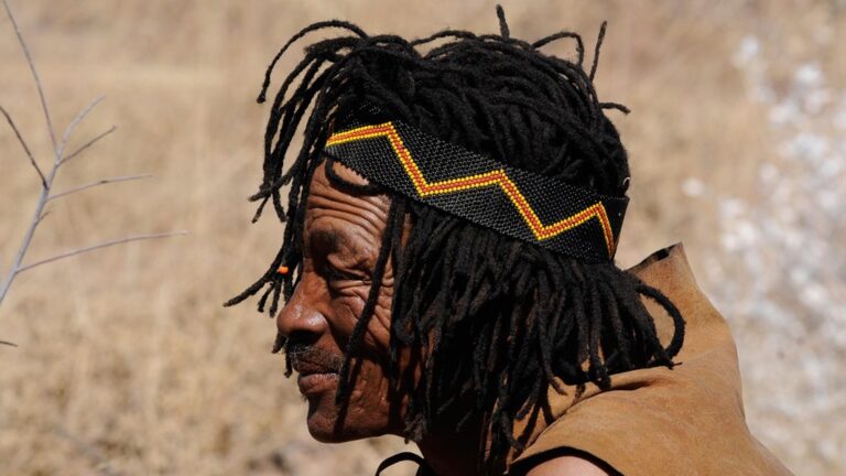
Traditional mapping projects often miss critical details that indigenous communities have preserved for generations through oral histories and cultural practices. You’re likely overlooking valuable insights that could transform your mapping accuracy and cultural sensitivity when you exclude these knowledge systems from your geographic information projects.
Indigenous knowledge brings centuries of environmental observations and spatial understanding that modern technology can’t capture alone. This traditional wisdom offers unique perspectives on land use patterns seasonal changes and geographic relationships that enhance both the technical quality and cultural relevance of your mapping initiatives.
Disclosure: As an Amazon Associate, this site earns from qualifying purchases. Thank you!
Understanding the Value of Indigenous Knowledge in Modern Mapping
Indigenous knowledge systems offer cartographers access to spatial data that spans centuries of environmental observation. You’ll discover these traditional information sources provide critical insights often missing from conventional surveying methods.
P.S. check out Udemy’s GIS, Mapping & Remote Sensing courses on sale here…
Explore and map the wilderness for the Queen in Cartographers! Draw unique terrain shapes and score points based on randomly selected goals each game, but beware of monster ambushes.

Traditional Ecological Knowledge Systems
Traditional ecological knowledge encompasses systematic observations of environmental patterns accumulated over generations. You’ll find these systems contain detailed information about seasonal changes, wildlife migration routes, and resource distribution patterns that modern sensors might miss. Indigenous communities have documented complex relationships between topographic features, water sources, and vegetation cycles through direct field observation. Their knowledge includes precise locations of seasonal camps, hunting grounds, and sacred sites that connect landscape features with cultural practices. You can integrate this information to create more comprehensive base maps that reflect both physical and cultural geography.
Oral Histories and Geographic Memory
Oral histories preserve geographic information through storytelling traditions that span multiple generations. You’ll access detailed accounts of historical landscape changes, including flood patterns, fire cycles, and shifting river channels that predate written records. These narratives often contain specific directional references, distance measurements, and landmark descriptions using traditional navigation systems. Indigenous speakers frequently embed coordinate-like information within stories, describing locations relative to natural features, seasonal phenomena, and celestial events. You can extract this spatial data to verify historical map accuracy and identify changes in geographic features over extended time periods.
Navigate with ease using this 7-inch GPS navigator, featuring real-time voice guidance and pre-loaded 2025 maps. Customize routes based on your vehicle type to avoid restrictions and receive speed & red light warnings.

Cultural Landscape Understanding
Cultural landscapes represent the interconnected relationship between human communities and their physical environment. You’ll discover that indigenous knowledge systems recognize geographic features as integrated cultural-natural units rather than separate physical elements. These frameworks identify invisible boundaries like territorial limits, resource management zones, and ceremonial spaces that don’t appear on topographic surveys. Indigenous mapping concepts often emphasize connectivity between locations through trails, kinship networks, and spiritual relationships that create meaningful spatial patterns. You can incorporate these cultural geography elements to produce maps that accurately represent how communities actually use and understand their territories.
Enhancing Spatial Accuracy Through Local Environmental Expertise
Indigenous communities possess sophisticated spatial knowledge that significantly improves mapping precision beyond conventional surveying methods.
Terrain Recognition and Navigation Skills
Navigate complex topography using indigenous trail systems that reveal optimal pathways through challenging terrain features. Local guides identify subtle elevation changes, drainage patterns, and geological transitions that satellite imagery and standard topographic maps often miss. Their route knowledge incorporates seasonal accessibility, slope stability, and natural landmarks that enhance your base map accuracy. You’ll discover alternative pathways and terrain classifications that improve navigation data for both digital and field applications.
Plan your next adventure with the 2025 National Geographic Road Atlas, covering the United States, Canada, and Mexico. Its durable, folded format (11 x 15 in) makes it ideal for hiking and camping trips.

Seasonal Pattern Documentation
Document environmental cycles through indigenous observations of precipitation patterns, flood zones, and seasonal resource availability across multiple decades. Community members track annual variations in water levels, vegetation growth periods, and weather patterns with remarkable precision. Their seasonal calendars reveal temporal mapping layers that enhance your project’s accuracy for land use planning and environmental monitoring. You’ll capture cyclical changes that satellite data sampling intervals frequently overlook.
Microclimate Identification
Identify localized climate zones using indigenous knowledge of temperature variations, moisture patterns, and wind corridors within specific geographic areas. Local experts recognize frost pockets, drainage areas, and sheltered zones that create distinct microclimatic conditions affecting vegetation and land use. Their detailed understanding of these environmental nuances helps you create more accurate climate classification maps and agricultural suitability assessments. You’ll map climate variations that standard meteorological stations positioned miles apart cannot detect.
Improving Data Quality With Community-Based Observations
Community observations provide consistent, long-term datasets that enhance mapping accuracy beyond what remote sensing alone can achieve.
Long-Term Environmental Monitoring
Indigenous communities maintain multi-generational records of environmental changes through oral traditions and direct observation. You’ll access decades of precipitation patterns, flood cycles, and vegetation shifts that weather stations might miss. These observations help you identify gradual landscape changes like shoreline erosion or forest succession that satellite imagery captures only at specific intervals. Community monitors often detect environmental anomalies years before scientific instruments, providing early warning data for your climate and hazard mapping projects.
Get real-time weather data with the Ambient Weather WS-2902. This WiFi-enabled station measures wind, temperature, humidity, rainfall, UV, and solar radiation, plus it connects to smart home devices and the Ambient Weather Network.

Species Distribution Tracking
Local observers document wildlife populations and migration routes with precision that complements biological surveys. You’ll gain access to seasonal movement patterns, breeding locations, and habitat preferences recorded through traditional hunting and gathering practices. Indigenous trackers identify species presence in areas where formal biodiversity surveys haven’t occurred, filling critical data gaps in your ecological mapping. Their knowledge extends to rare species behavior and population fluctuations that inform conservation planning and habitat modeling efforts.
Resource Availability Patterns
Community knowledge reveals spatial and temporal patterns of natural resource distribution that enhance resource mapping accuracy. You’ll discover seasonal availability of water sources, productive fishing areas, and optimal harvest locations documented through generations of sustainable use. Local experts identify microhabitats and resource concentrations that remote sensing cannot detect, improving your natural resource inventories. Their observations include resource quality variations and sustainable yield thresholds that inform land management and development planning decisions.
Strengthening Cultural Preservation Through Collaborative Mapping
Collaborative mapping becomes a powerful tool for documenting and preserving indigenous cultural heritage while respecting community sovereignty. You’re creating more than geographic records—you’re helping communities maintain their cultural identity through digital preservation.
Sacred Site Documentation
Sacred site mapping requires specialized protocols that honor cultural sensitivity while creating accurate spatial records. You’ll work directly with community elders to document ceremonial locations using GPS coordinates and traditional boundary markers. Traditional knowledge holders guide the documentation process, determining which information can be publicly shared versus privately archived. Indigenous communities control access levels through permission-based mapping systems that protect sensitive areas from unauthorized visitors. Your mapping software should include privacy controls that blur or exclude sacred sites from public datasets while maintaining complete records for community use.
Traditional Territory Boundaries
Traditional Territory Boundaries represent complex jurisdictional systems that predate modern political boundaries by centuries. You’ll discover that indigenous territorial maps include seasonal use areas, hunting grounds, and resource harvesting zones that shift throughout the year. Community knowledge holders identify invisible boundary markers like specific trees, rock formations, and water features that define territorial limits. Your GIS database captures overlapping use rights between different communities, reflecting traditional diplomatic agreements and shared resource management. These boundary maps serve as crucial documentation for land rights negotiations and treaty discussions with government agencies.
Enjoy refreshing water with the Avalon Bottom Loading Water Cooler. It offers hot, cold, and room temperature options, a BioGuard anti-microbial coating, and a child safety lock for peace of mind.

Cultural Heritage Protection
Cultural Heritage Protection mapping identifies vulnerable sites requiring immediate conservation attention and ongoing monitoring protocols. You’ll create comprehensive inventories of archaeological sites, traditional structures, and culturally significant landscapes using both digital photography and spatial coordinates. Community members contribute oral histories that explain the cultural significance of mapped locations, adding contextual layers to your geographic database. Your heritage maps support legal protection efforts by providing documented evidence of cultural site locations and their historical importance. Protected area designations benefit from this collaborative approach, ensuring that conservation boundaries reflect both ecological and cultural values recognized by indigenous communities.
Fostering Community Engagement and Ownership
Integrating indigenous knowledge transforms mapping from an extractive process into a collaborative partnership. You’ll find that meaningful community involvement creates more accurate maps while building lasting relationships.
Participatory Mapping Processes
Community-led workshops place mapping decisions directly in local hands. You’ll organize sessions where indigenous participants identify priority areas, select mapping scales, and determine which cultural features require documentation. Local facilitators guide discussions in native languages while you provide technical mapping support. Community members sketch initial boundaries on paper maps before transferring knowledge to digital platforms. This approach ensures cultural protocols guide every mapping decision while building technical skills within the community.
Local Capacity Building
Training programs develop indigenous cartographers who understand both traditional knowledge and modern GIS technology. You’ll establish mentorship partnerships pairing community members with experienced mappers for hands-on field experience. Local participants learn GPS operation, data collection protocols, and basic GIS software navigation through culturally relevant mapping projects. Community members gain certification in surveying techniques while maintaining authority over their territorial knowledge. These programs create sustainable mapping capabilities that persist long after external projects conclude.
Stakeholder Investment
Shared ownership structures ensure communities maintain control over their mapped territories and cultural information. You’ll develop data-sharing agreements that specify community rights, usage restrictions, and benefit-sharing arrangements for any commercial applications. Local leadership participates in project governance through advisory committees that approve mapping priorities and methodologies. Community members receive copies of all mapping products in formats they can access and update independently. This investment model creates long-term stewardship while respecting indigenous sovereignty over traditional territories.
Building Sustainable Partnerships for Long-Term Success
Establishing enduring relationships between mapping professionals and indigenous communities requires structured frameworks that honor cultural protocols while meeting technical project needs. These partnerships thrive when built on mutual respect and clear communication channels.
Knowledge Sharing Protocols
Develop formal agreements that outline how indigenous knowledge will be shared and protected throughout your mapping project. These protocols should specify which community members have authority to share certain types of spatial information and establish clear boundaries around sacred or sensitive locations.
Create standardized documentation procedures that respect oral tradition formats while meeting GIS data requirements. Your protocols must include community review processes where indigenous knowledge holders verify the accuracy and cultural appropriateness of mapped information before finalization.
Mutual Benefit Agreements
Structure agreements that provide tangible benefits to indigenous communities beyond simple compensation. These arrangements should include capacity building opportunities where community members gain technical mapping skills and access to GIS software and training programs.
Establish shared ownership of mapping outputs where communities retain rights to their traditional knowledge while gaining access to enhanced digital maps for their own land management purposes. Your agreements should specify how communities can use the mapping data for economic development, environmental protection, and cultural preservation initiatives.
Ongoing Collaboration Models
Implement regular consultation schedules that maintain community involvement throughout the project lifecycle rather than limiting engagement to initial data collection phases. These models should include quarterly review meetings where indigenous partners evaluate mapping progress and suggest adjustments to methodology or priorities.
Design adaptive frameworks that allow your partnership to evolve as project needs change and community priorities shift. Your collaboration model should include mechanisms for incorporating new traditional knowledge as it becomes available and updating maps to reflect seasonal or environmental changes identified by community observers.
Conclusion
Integrating indigenous knowledge transforms your mapping projects from technical exercises into meaningful collaborations that honor both scientific precision and cultural wisdom. You’ll discover that these partnerships don’t just improve data accuracy—they create sustainable frameworks for environmental stewardship and community empowerment.
When you embrace indigenous perspectives you’re accessing centuries of systematic environmental observation that conventional methods simply can’t replicate. Your maps become more than geographic representations; they become living documents that reflect the deep connections between communities and their territories.
The future of successful mapping lies in recognizing that the most detailed and reliable geographic information comes from those who’ve lived on the land for generations. By building these partnerships you’re not only creating better maps—you’re contributing to the preservation of invaluable knowledge systems while advancing the field of geographic information science.
Frequently Asked Questions
What is indigenous knowledge in mapping?
Indigenous knowledge in mapping refers to the spatial understanding, environmental observations, and cultural practices that indigenous communities have developed over centuries. This includes detailed knowledge of terrain, seasonal patterns, wildlife migration routes, and cultural landscapes that traditional surveying methods often miss. It encompasses oral histories, traditional ecological knowledge, and sophisticated navigation skills that can significantly enhance mapping accuracy.
How does traditional ecological knowledge improve modern maps?
Traditional ecological knowledge provides systematic environmental observations collected over generations, including seasonal changes, wildlife patterns, and microclimate variations. Indigenous communities can identify subtle terrain features, optimal pathways, and distinct climate zones that conventional surveying might overlook. This knowledge fills critical data gaps and enhances base map accuracy by incorporating both physical geography and cultural understanding of landscapes.
What are cultural landscapes in mapping?
Cultural landscapes represent the interconnected relationship between human communities and their environment. They include invisible boundaries, sacred sites, traditional territories, and meaningful spatial patterns that aren’t captured by conventional maps. These landscapes reflect how communities understand and utilize their territories, incorporating both tangible features and intangible cultural significance that requires specialized documentation protocols.
How do community-based observations enhance mapping data quality?
Community-based observations provide long-term environmental monitoring through oral traditions and direct observation. Local observers track gradual landscape changes, species distribution patterns, and natural resource availability with precision that remote sensing may miss. This continuous monitoring creates comprehensive datasets that improve ecological mapping accuracy and support sustainable land management practices.
What is collaborative mapping with indigenous communities?
Collaborative mapping is a partnership approach that documents indigenous cultural heritage while respecting community sovereignty. It involves community-led workshops, participatory decision-making processes, and shared ownership structures. This method transforms mapping from an extractive activity into a collaborative partnership where indigenous communities maintain control over their cultural information and mapped territories.
Why is capacity building important in indigenous mapping projects?
Capacity building develops indigenous cartographers skilled in both traditional knowledge and modern GIS technology. Training programs ensure sustainable mapping capabilities by empowering community members to lead their own mapping initiatives. This approach creates long-term stewardship, maintains cultural authenticity, and allows communities to adapt mapping techniques to their specific needs and priorities.
How do sustainable partnerships work in mapping projects?
Sustainable partnerships require structured frameworks that honor cultural protocols while meeting technical needs. They include knowledge-sharing agreements, mutual benefit structures, and ongoing collaboration models. These partnerships ensure indigenous communities receive tangible benefits like capacity-building opportunities and maintain involvement throughout the project lifecycle, creating adaptive frameworks that evolve with changing community priorities.